RETIREMENT TRIP #7
Scenic Viewing in Oregon: Our Final Day
We’ve had ten good days so we were due! Today is it!
At Castaway Motel by the Sea, the cliff wasn’t visible when we got
up. Thank goodness Andy had ordered a
picture last night before our fish dinner feast at the angry Norwegian’s Fish
and Chips.
The only part of the country that has seasonal temperatures this
morning is the Pacific Northwest. It was
still dribbling rather profusely at 9:30 a.m. after breakfast, and Humbug
Mountain at 1,756 feet was shrouded in clouds.
Undoubtedly, the front was a harbinger of the coming fall. Weather like this is the Oregon coastal
winter, and from the looks and feel of things today, winter’s coming.
 |
| Not easy to find, Otter Point Beach is deserted early Sunday. |
Huge swells, at least ten-footers, crashed into the beach at Ophir Rest
Area. A few lone tourists stopped to
stare in awe at the might of the sea.
The rain had let up, but a gentle mist dampened everything. “It’s improving,” said Andy hopefully.
The Geisel Family burial site is maintained by the state in memory of
John Geisel and his three young sons—John, Henry and Andrew—who were massacred
by the Indians in 1856.
Otter Point wasn’t advertised, and the one-lane access road was potted
and rough, but the views were spectacular.
We hiked out to the point that jutted far into the sea. Huge basalt rocks rose out of the surf, as
waves broke around them. We had the
place to ourselves.
 |
| Not much remains of the Mary D. Hume after an illustrious career in maritime history. |
“I never would have
found this if you hadn’t pointed out the old road,” said Andy. The sun almost came through. Only blue sky was lacking.
We crossed the Rogue River at the Rogue River Bridge into Gold
Beach. The sun came out just in
time. Here at the base of the bridge was
the wreck of the Mary D. Hume.
In 1876, Mr. R.D. Hume of Astoria, Oregon, moved his commercial fishing
business to the mouth of the Rogue River to capitalize on the large run of King
Salmon, as they came upriver to reproduce.
But in 1880, his small steamer the VARUNA, sank on the Rogue River bar
on a rough and windy day in Gold Beach.
Mr. Hume salvaged the steam engine and started immediate plans to
replace his lost freighter.
He located a 141-foot tall White Cedar tree 13 miles upriver and had it
cut and floated downstream to what is now the Port of Gold Beach. This became the keel for his new vessel, and
tree roots would be ribs.
On January 21, 1881, the vessel was launched as the Mary D. Hume, in
honor of his wife. It served 97 years of
active commercial sea service, the longest for any commercial vessel on the
Pacific Coast. Also unique is the fact
that she retained her original name from the 1881 registry to today.
She hauled wool, canned salmon and other goods from Oregon to San
Francisco as a coastal freighter her first ten years. On December 5, 1889, the Pacific Whaling Company
purchased her for $25,000, so she started a ten-year career in the Bering
Sea. The Mary D. Hume recorded the
largest ever catch of whale Baleen, valued at $400,000 after a 29-month voyage,
and then she made Arctic whaling history with the longest recorded whaling
voyage of six years. After a disastrous
storm in 1899, she was retired to towing service in the Nushagak River in
Alaska.
The American Tug Boat Company purchased her as an ocean tugboat on May
20, 1909. After a brief career in the
Alaskan halibut industry, she returned to service as a tugboat. Final retirement was in the summer of 1978,
when she sailed under her own power to the Port of Gold Beach where she had
been built.
 |
| Standing at the barrier of Route #101, we see stupendous views of the ocean. |
 |
| Cape Sebastian Scenic Corridor preserves ocean scenery. |
Three young seals played in the river, heads bobbing up and down and water
splashing. First I thought it was waves
lapping over a rock; then, birds diving for food, but the movements were too
erratic. What fun they were having!
A few miles farther down the road the Hunter Creek Turnout gave us
beautiful views of the ocean. Holding my
hand, Andy guided me up the cliff side for the shots.
“We’re never going to see Cape Sebastian,” said Andy. The huge, old pine trees at the point were
smothered in fog and only a mile or two back we had beautiful blue sky. Six years ago it was here at Cape Sebastian
in a downpour that we decided to head to Reno instead of staying on the Coast.
That wouldn’t be the case today.
Only the heights were fogged in.
When we got to the beach, the sun poked through again. But we couldn’t see the actual Cape. “I think it was on this beach where we took the
spooky driftwood pictures six years ago,” said Andy.
Unhappy with views from the wayside, Andy stopped along the road.
“Climb over the barrier,” he suggested.
“We’ll have better shots from here.”
He was right. Carefully and
staying well behind the highway barrier, we walked along Route #101 to see Cape
Sebastian Scenic Corridor.
 |
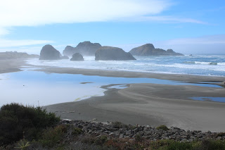
| The beach at Pistol River spread miles in every direction along the water. |
 |
| A long, sandy walk in, the Pistol River Beach is worth the trek. |
We tried the Point again, but it hadn’t cleared.
Pistol River Beach was deserted and beautiful. It was a long, sandy walk through the dunes
to the beach, but it was so worth the trek.
 |
| Waves pound the coast at Pistol River |
 |
| Fog hugs the coast but the land is warm. |
 |
| Boardman's influence as superintendent of parks saves spectacular views for all citizens to enjoy. |
We stopped at the first pullout, Arch Rock Viewpoint. Fog formed a layer midway between the beach
and cliff summit. We walked the trails
and took pictures of the Arch Rock surrounded by ocean. Lots of other visitors did the same on Sunday
afternoon.
Natural Bridges entailed a short walk back into a river overhang. There near the cliff side was a lone rock
with a natural bridge.
 |
| In a secluded cove, water has worn a natural bridge into the rock. |
Other small, two-car pullouts along Route #101 gave us more spectacular
views of the Pacific Ocean and Oregon coastline. There were also some gorgeous, lonely
beaches.
 |
| Every beach has its own unique beauty. |
 |
| Boardman Scenic Area offers wildlife refuges on the rocky heights. |
The fog came and went over Lone Ranch Beach. It cleared as the tide retreated and a north
wind blew in cooler temperatures. We
walked along the beach and looked for agates.
“I never expected to even see the sun the way the morning started,” said
Andy, “so this is a gift.”
 |
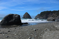
| Driftwood pieces and Oregon agates litter Lone Beach. |
 |
| Waves swirl and churn as the tide turns at Lone Beach. |
Hundreds of rocks popped up in the water along Route #101 as we
approached Brookings. The fog lifted as
well for gorgeous views of a crashing ocean.
 |
| Like others, we stroll along Harris Beach at low tide. |
 |
| Along Route #101, every view is a masterpiece. |
 |
| Colors splash with waves along 101. |
 |
| Even the highway roadside is magnificent. |
Every stop meant a descent to a beach and the climb back up.
We did the same thing at Harris Beach State
Recreation Site, but this time we walked more than an hour along the sand. The tide, going out, left puddles everywhere,
so we picked our way between water, driftwood and huge rocks of black
basalt.
 |
| Late Sunday afternoon Harris Beach is far from crowded. |
It was a beautiful way to spend
an afternoon.
 |
| Driftwood logs make great props for cameras on timer mode. |
 |
| Fog inches in along the water as the sun sinks in the western sky. |
After dinner at the Irish Pub in
Brookings, we headed north on Route #101.
It was low tide now, and a huge cloud bank hung out over the water.
We drove back to House Rock Viewpoint.
It was still in the fog, and rolling masses swept up the hill.
At Cape Ferello we took a couple more pictures in search of gorgeous
views. It had been a photographic day!

No comments:
Post a Comment