Pages

Sunday, November 14, 2010

Exploring the Bay Area


Shyla waited for us outside so we could take her car to Oakland's Lake Merritt, a unique fresh and salt-water lake, the largest such body of water located within an urban area in the U.S. and maybe the world. She had promised us the 3.4-mile walk around the circumference of the lake. This morning we spotted a great blue heron, a brown pelican, snowy egrets, cormorants, geese and ducks. Lake Merritt is the oldest wildlife refuge in North America with tame black-crowned night herons and scaups in abundance.

With bikers, joggers and walkers, some two and three abreast on this bright Sunday morning, we felt comfortable and safe. But graffiti on the retaining walls and the veranda columns and broken glass at the walkway intersections reminded us of recent Oakland riots. San Francisco has serious graffiti problems. The beautiful City by the Bay is littered with garbage and signs of unrest and disunity.
Commanding a sweeping view of the entire San Francisco Bay area, the 170-foot high Oakland Mormon Temple, Church of Jesus Christ of the Latter-day Saints on Lincoln Avenue, allows visitors to walk through manicured gardens and gaze over the city and suburbs. "I came here by accident once," said Shyla. "After that I brought all my visitors to see this magnificent sight." She was right. On a clear day like today, we could see forever. We stood on the Sierra white granite esplanade and identified the sights of San Francisco.
Jack London Square is Oakland's waterfront home to dining. But we had already eaten lunch. "What is the connection to Jack London?" I asked Shyla, who lives one town over. "I assume it is because he lived here." A little reading clarified my guess. Owned by the Port of Oakland, the Square is Jack London's historic watering hole, home to Heinold's First and Last Chance Saloon and Jack London's cabin, relocated from the Klondike. Tourist come-on or not, Jack London Square invited pleasure-seeking visitors to meander. We walked the waterfront, browsed in the shops, and admired the yachts harbored along the docks.

San Francisco Beckons


"I left my heart in San Francisco. High on a hill, she calls to me..."
The words of the song repeated in my mind, as we walked the Embarcadero, watched tourists cram into cable cars, identified twisty Lombard Street and strolled through the Farmers Market, along Pier 39 and Fisherman's Wharf, with thousands of others who had also come to enjoy a Saturday in the city. It truly is captivating. Street performers attracted crowds at every corner: a magician who tore pieces of paper and put them back together again; two spray paint can artists with protective goggles, who created brilliantly colored street scenes; several different mime statues, bodies painted in silver and gold; harmonica, flute and guitar players; even a bongo drummer who never dropped the beat. Everywhere, action. I explained to Shyla and Andy how Maya Angelou wrote about her love for San Francisco in her autobiographical narrative I Know Why the Caged Bird Sings. How could anyone not love the pulse of life in this City by the Bay!
The sun painted a picture perfect evening over San Francisco Bay in Alameda as we walked in the park at Crab Cove near Shyla's apartment just before dinner. "I left my heart...," and the song echoed.

Friday, November 12, 2010

Back to Civilization


Shoreline Highway through Mt. Tamalpais State Park wound in dizzying fashion along the bay and up the cliffs, as we heade south toward San Francisco. "Should I pull out for pictures?" Andy teased.
"Only if I'm to take them while swimming or flying," I said. "Just drive. I can't look."
But I heard him breathe a sigh of relief when he stopped the car at Muir Beach Overlook. From there, the road had guard rails. The cliff face had functioned as a "gopher hole" lookout during World War II. Four cement bunkers at the top of the cliff wall offered military observation points and gun battery protection for shipping lanes and the old fort. Two soldiers hunkered down in each hole. When the commanding officer was challenged about his request for parkas and lined boots for his soldiers in the summer, he answered, "You have to live here to understand."
Father Crespi named the redwoods for their reddish-colored bark. He called them palo colorado. But it was John Muir who did so much to protect them. "In God's wildness lies the hope of the world--the great fresh, unblighted, unredeemed wilderness," he wrote. I read one sign quoting Estwick Evans. "In wilderness is the preservation of the world." If Muir had been at Muir Woods today, he would either have been ecstatic or devastated. Cathedral Grove was wall-to-wall people.

With the help of GPS and a map, I directed Andy into Golden Gate National Recreation Area. "It's a holiday weekend with great weather," he said. "We're going to see a whole lot more people." In spite of crowds, we had great views of San Francisco and the Golden Gate Bridge from the headlands.
"The next big cities will be Tucson and Phoenix, where it will be a lot easier to get around," said Andy, as he gritted his teeth about San Francisco traffic. Even the GPS didn't help much, and balancing a standard shift vehicle like Little Red on San Francisco inclines would rack any nerves.
Shyla showed us true California hospitality with a home-cooked Indian feast at her apartment by the Bay: Alaskan king crab legs with melted butter, chicken and rice biriani, garlic and basil pasta with asparagus and mushrooms, sauteed green beans, marinated wild Alaskan salmon with red peppers. We had enough food for ten visitors... each dish, more intriguing than the one before it.

In the Zone


Today, a national holiday, is so clear we can see the Farallones Island some 30 miles out to sea. "The whales have no privacy," I told Andy as we drove toward Limantour Estero and Limantour Beach. The Limantour slip of land pokes a narrow finger into the bay for a mile, parallel to mainland Marin County.
To our left, we heard waves thunder along the beach, hidden from view by grass-covered dunes.
To our right, the estero, peaceful at first glance, teemed with activity. A covey of quail skittered along the path ahead of us and disappeared under a thicket of coyote bushes. Small flies buzzed en mass around a pickleweed. Maybe a dog had been there. Puddles filled depressions in the clay along the foot-wide trail. Paw prints indicated raccoons. We followed the trail back and forth as it threaded between tall grasses and coyote bush. In the salt marsh pond to our right, hundreds of ducks gathered, gliding slowly in ever-changing formation across the surface. Andy spotted a white egret and a great blue heron in the mud flats. We followed the estuary trail until it disappeared in taller grass near the mouth and the clay path turned to loose sand.
Then Andy picked his way left between plants to the top of the dune. There, 20 feet above the beach, I closed my eyes. Like a child in an electrical storm, I counted seconds as the whoosh grew louder... about 12 counts from one clap to the next as the surf thundered in. White line after white line, the waves broke and churned out from shore. Sand stretched miles, as we looped back a mile toward the main trail.
Pacific golden plovers scurried across the sand; one ducked into a pile of drying seaweed when I aimed the camera. The tide was out, and the three-toed footprints of western sandpipers crisscrossed the beach everywhere. Drying jellyfish, a few with tentacles splayed, and fiddler crab skeletons littered the waterfront.
"This is a stay-forever kind of place," I told Andy as we left. Another couple pulled into the parking lot.
"It's all yours," he said to them. "We left it just for you."
"The sign said that the town of Bolinas didn't want to be found," explained Andy as we bumped down Olema-Bolinas Road, the main street in town. "I read that people keep stealing the highway signs so tourists won't find the town." Time forgot the three-block fishing village of the 1800's, and gas started at $4.09.9 a gallon.
Palomarin Trailhead took us to a totally different kind of beach at the southernmost end of the seashore park. Flowers--gold California poppy, purple milk thistle, non-native lavender flax, red clematis, and tiny yellow and white blossoms that I couldn't identify--lined the trail. The ranger later insisted the blooms were not possible in the fall. A sign said, "Cougar habitat." Half a mile down the hill, the thicket opened on a "pebble" beach... millions of softball-size stones, tumbled smooth by the waves. We found oyster, clam and purple sea urchin shells and watched a lone surfer challenge the crests.
Tomales Bay Trail passed through cow pasture from the highlands of Point Reyes out to the bay. We unchained and re-chained four gates each way and discomfited more than one beef cow.
"I'm intrigued by the San Andreas Fault Walk," I mentioned, as Andy looked for our next hike on the trail guide.
"Okay," he agreed. "It's only a mile, and you can check in the Visitor Center about the flowers."
Olema Marsh Trail, a quarter mile, took us to a dried-out prairie.
Then Andy headed to Mount Vision.
"Even the trees have disappeared up here," he said, as we drove to the peak. The road was closed a mile from the top, probably because of a U.S. government installation. We walked the mile or so uphill on the pavement. Rabbits hopped out from under coyote bush, and a mole poked his head up as we passed.
"Look at the fog way down in the valley!" Andy pointed. "We were out on that point this morning, and it was as clear as could be. That's a good example of weather here... fog comes in when the land is warmer than the water."
Before the sun went down, we watched the fog creep inward on November 11 with temperatures in the 70's. It truly was a holiday treat.

Wednesday, November 10, 2010

The Point of Kings

"There was a time when Califor-
nia roads were the pride of the state," said Andy, as we bounced and swerved around potholes on Sir Francis Drake Boulevard to Lighthouse Point.
At the Point Reyes Lighthouse, operating since 1870, winds picked up to 45 m.p.h. From April through October fog envelopes this point. "Good thing it's November," I told Andy. We could see forever.
Driving toward Chimney Rock, we watched dairy cows graze on one side of the road and deer, some with eight points, move skeptically up the hill.
Chimney Rock Trail, a two-mile walk, looped around the steep rocky cliffs of Drake's Bay on one side and the open Pacific on the other.
"This is one of the most beautiful and untouched places I have ever been," said Andy.
I agreed. Untouched... windswept... spectacular, raw beauty, with foot-wide trail sections that clung to the edge of the cliff and skirted the lip of the rounded cliff tops. I sucked in my fear of edges. "Andy?" I whimpered. "Please? I can't do this."
"Oh, come on. You won't fall off here. The trail is flat," he said, reaching back for my hand.
"And a foot from the steep edge, straight down, with nothing to grab," I moaned. It was almost one of those sit-down-and-cry paralysis moments at dangerously beautiful edges that take my breath away.
Elephant Seal Trail, only about 25 feet above the water, seamed Sir Francis Bay to over look an elephant seal colony breeding beach. At least 50 animals lazed in the sun. An ice plant bloomed along the trail. A short walk, all uphill, gave us a beautiful view of Drake's Beach, the protected area where Sir Francis Drake, one of England's most famous sailors, careened his ship, the Golden Hind, to make repairs for some five weeks during his voyage around the world. Drake was the first man to make such a trip in his own ship.
As we drove to the next stop along the National Seashore, we passed a herd of elk in Tule Elk Reserve. The male, a proud 16-point buck, gathered his harem on the inside of the farmer's barbed wire fence. We chuckled about a few young ones, confused and afraid to jump, as they poked their noses between the wires, debating what to do but anxious to leave our presence.
"Are you trying to exercise me?" I asked as we walked up another quarter mile to the Life Saving Station cemetery. Graves of people from the late 1800's who died at sea rested between eucalyptus and cypress at the hilltop.
Not far away, a dirt road followed the estuary to an oyster farm. Four or five scruffy men at picnic tables nodded, as Andy and I walked past mounds of broken, drying oyster shells. A young lady stepped from the ramshackle store, carrying two large net bags of fresh oysters, but a sign nearby read, "Oysters for bait only! Could contain poison. Not for human consumption. Do not feed to pets." The girl went back inside the store, and we watched a seagull land on open crates to peck determinedly for lunch.
"I imagine she is buying oysters for a restaurant," said Andy, "but that bird already located fine dining."
Abbott's Lagoon, a two-mile walk, provided views of pelicans, egrets and a blue heron in the marsh. Instead of going the extra half-mile to the beach, we climbed an adjoining hill for the panoramic view.
The next stop, Kehoe Beach Trail, was a 1.2-mile trek along Kehoe Marsh, up and down across several sand dunes and out to Kehoe Beach. Signs warned surfers about white sharks and waders and hikers about dangerously high bacterial count in the water.
"I told you today we would be outside more than in," said Andy, as we walked around the old Pierce Ranch. In the later 1800's, Pierce was reputed to have run the best dairy in the San Francisco Bay area, and his butter was prized far and wide.
As the sun sank lower and shadows crept between the hills, we picked our way down the steep McClures Trail to the beach. Here, according to the sign, researchers would count great white shark until January of 2011. All alone, we watched the gulls stand patiently at the edge of the foam, as waves and backlash washed the shore. The tide was receding; the day, ending; and we had a steep climb back home to Little Red.

Tuesday, November 9, 2010

On the Rocks

Although we faced the Pacific at Gualala Country Inn this morning, we watched a colorful sunrise as pink changed to shades of lavender and sky blue all around us. "It's going to be a beautiful day after all," said Andy.
Kruse Rhododendron Park, poorly marked off of California #1, could have been a lovely hike among redwoods. We took the short loop, but Andy really wanted to do a longer stretch. A sound from one thicket, half grunt-half growl, made me glad we weren't going farther.
"Could that be a bear?" I asked Andy.
"No, I don't think so," he replied reassuringly. "More likely a bobcat or mountain lion."
"Oh, funny," I answered skeptically. There WAS an animal, probably a raccoon.
"I would have walked farther," he said, "but the map never suggested how far the trail extended."
Instead, he pulled into Stump Beach and headed for the water. An hour later we were still on Bluff Trail, partly tall grass bent by a few passersby on their way out to the point and partly blazed by Andy ahead of me.
"Hands down, the Oregon and California coasts are stupendous," said Andy, looking out to sea from the point, "and I'm really proud of you for chancing a trail so close to the edge of the cliff."
"Yeh," I answered, "it was either follow or get left behind."
"I've never left you yet, but there are times I've thought about it!" he said.
"Funny!"
Another hour lapsed at Stillwater Cove Regional Park. "Give me your hand," Andy yelled from on top of the jut of rock overhanging the sea wall. You have to come out here and get a picture. It's rock. It isn't going to fall off."
"No, I can't do it," I said, reaching out my hand anyway.
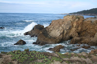
He was right. Stillwater Cove was anything but still. Waves crashed against rock cliff with powerful magnificence.
Blind Beach State Park would take hours to explore. We watched a red shouldered hawk glide above Kortum Trail and a deer graze on the hillside near Goat Rock. A one-lane road across the cliff face led to a man-made groin connecting the sea wall and a very large sea stack. Across the groin, waves crashed furiously. Signs everywhere warned of sleeper waves, riptides and dangerous currents. And then a few raindrops chased us back to Little Red.
We had lunch at Schoolhouse Beach pullout in Bodega Bay, site of the filming of Alfred Hitchcock's thriller The Birds. As we munched our granola bars, a seagull landed next to Andy's door. Rain dripping from its beak, it squawked at us. No sooner had it made some noise than a couple others landed by my side of the car. They watched us eat. We were ready for a remake of the horror classic.
At Coleman Beach a surfer adjusted his wet suit, stretched, grabbed his board and headed down over the edge of an area marked "Closed. Do Not Enter." We saw him paddle out into the surf and then disappear back toward the beach beneath us.
"Maybe it's too rough," said Andy. "In all the time we've been out here, I've never seen any semblance of calm. It's also starting to drizzle."
"I doubt a little water would bother a surfer," I said.
A little farther south, the vegetation changed. Tall sea grass stalks with feathery tops, like tan ostrich plumes, bent in the wind, and bushes laden with bright yellow flowers covered the hillsides. We learned later the bushes were probably "broom," an invasive exotic from France that the locals are trying to eradicate. At some pullouts succulents covered the ground. Around the gulches cypress and eucalyptus trees shaped by the wind leaned away from the water because of the onshore breezes. With a slightly milder climate, Inverness and Point Reyes would be our base for a couple days before we headed to the big city.

Monday, November 8, 2010

Beach Bums

We have been on the road eight weeks as of today -- almost 10,000 miles -- and it doesn't seem that long at all. Every day is interesting, unique and beautiful.
At every wayside, pullout and vista from Fort Bragg to Mendo-
cino, we stopped for cliff walks and pictures. When the wind picked up and the tide came in, waves crashed against sea stacks and roared as the spray broke. Feathery clouds accented the surf as gulls glided by on the updrafts. By noon we had completed all of ten miles of coastline.
At View Trail near Navarro Head we parked for another short hike. A man, probably in his 50's, polished a red 1985 station wagon. The seats were covered with leopard fabric and white fur. "I live on a commune near here," he told us, as he applied polish to the chrome. "I'm a grower."
We never took the hike, not on an isolated beach with computer, camera and luggage in the car.
Wind gusted at Point Arena Lighthouse, originally built in 1870, but destroyed by the 1906 earthquake. Rock layers jutting up from the ocean stood perpendicular to the water.
"Is that a fault line?" asked Andy.
"I'd say so," I told him.
Just before sunset we followed a cliff trail at Hearn Gulch across a grassy field to where it dipped down a rocky path toward the beach. The descent of more than a hundred feet took us down a steep rock embankment with only a rope to hold for support, but after leaping over the creek, we found the beach a beautiful reward. Waves crashed and rolled against sea stacks hidden in a horseshoe cove of towering black rock. The solitude was awe-inspiring. We played chase with the incoming tide, took pictures with the sun glowing behind the rock outcroppings, and checked out the beach for shells. Where in the world have eight weeks gone?