Pages

Sunday, September 13, 2015

RETIREMENT TRIP #6
      MONUMENTS OF NATURE    
                  September 2015             
In the morning sun, Navajo Country is beautiful.  Outside of Chinle to the northwest as we drove toward Kinyata, we passed expanses of yellow snakeweed and black-eyed Susans.  Several small ponds gave evidence of recent rain.
“Are those dairy cows?” asked Andy, when we passed a small grouping of animals near Chilchinbito.
Near Kinyata, Arizona,
Church Rock rises sharply as a landmark.
Mesas of sandstone north of
Chinle accent the skyline.
I couldn’t tell from the distance, but the village had a new housing development of 30 or 40 beginner-family ranch homes—all with bright red, blue and green roofs—that still looked maintained and clean.
The sun burned off any remnants of morning haze by 10 a.m., as we neared Kinyata.
Closer and closer to El Capitan we stopped
for pictures of the monolith. 
Church Rock stood out on Sunday morning against a magnificent backdrop of sandstone formations.  A nearby sign said, “Blowing dust area,” but there was no evidence of it on this calm, hot morning.
“That’s El Capitan peak,” said Andy, as we approached the monolith that rose dominantly many feet from the desert floor.  Cars sped past as Andy maneuvered pullouts closer and closer to the rock spire.  “It’s definitely a morning picture,” he added, as I zoomed in with each progressive stop.
Formations along Route #163
resemble those of Monument Valley.
Local vendors of Native American handicrafts were just setting up, as we drove north on Route #163 toward Monument Valley.
“We’re not going into the valley,” said Andy, “but you can still see many of the interesting land formations.”
We crossed over the state line into Utah at 10:45 a.m.  Immediately the road changed.
Monument Valley-type formations
dominate the landscape.
“It’s easy to tell which state allocated more highway money for Route #163,” said Andy, as we bumped along.  The scenery was still gorgeous.
Horses range free on the Navajo
Reservation but skittishly move
away from the camera.
 We stopped often at unpaved single-car pullouts to snap shots of the sandstone formations.  A few wisps of cloud highlighted the higher points and mesas.  A paved side road, labeled the Douglas Mesa Road, that was not on either the Arizona or the Utah map took us several miles across the Navajo Reservation plateau before the pavement turned to dirt.
From Douglas Mesa Road we could
gaze in awe at the back side of the
Monument Valley formations.
A large group of horses grazed near the road in open range. They didn’t like being photographed and skittishly moved away.
But the stop gave us some beautiful pictures of the back side of the Monument Valley formations, sights most tourists don’t bother to take in.  It was late Sunday morning, and the roadside vendors had not opened yet.  Few people were around.  A sign read, “Revival.”  I didn’t need any; this was God’s country.
At every turn the formations looked more imposing
and more impressive.
It’s precarious,” I said, as we drove past Mexican Hat, the sandstone slab balanced on top of a sandstone formation. “It’s more precarious than I remember it.”
Andy agreed.  “Another Man of the Mountain bites the dust,” he said, laughing.  “The cap rock can withstand regular rain out here, because they get so little, but just give it some wind, and it’s done for.”
If there is ever a next trip here for us,
this Mexican won't have a hat.

From near the top of the Moki Dugway
the world looks small and far away.
“This is a cool road,” said Andy, turning onto


 Moki Dugway, 2.2 miles of steep switchbacks at a ten percent grade up the mountainside.
It didn’t take me long to remember we had done this several times years before.
“Impressive road,” he said again.
I didn’t look at the edge.
“It’s steep, but it’s graded,” he added.
 The switchbacks were dizzying.
“I just want to see how this vehicle handles in second gear,” he added.  The steering wheel shook as he pressed down on the gas pedal.
Andy reminded me how the Dugway, Utah Route #261, was built.  “They started at the top and just shoveled everything over the side in switchbacks all the way down,” he explained.
I looked on the map for some indication of elevation, but I couldn’t find any.  It was really high.
Clouds built as we made our way to Blanding, Utah.  “Thirty-percent chance of rain,” said Andy.
This small reservoir in Blanding shows little evidence of a
water shortage that plagues the area.
After checking into the motel in Blanding, we headed back out to explore.  The local reservoir seemed pretty full for late summer, and two young boys fished from the earthen dam.  But later when we passed Recapture Reservoir, we realized how badly in need of rain Blanding actually was.
“The grass is already well established on the sides,” said Andy, “so it’s been down for quite a while.”
We looked around Monticello for Abajo Mountain drive.  It took us into the mountains to the top of Manti-LaSal National Forest in the Abajo Mountains. We didn’t need air conditioning for the first time in days.  Mile after mile had signs warning about deer crossings. “297crashes this year” flashed one highway notification.  We noticed two dead animals near the roadside.
Part way up the mountain near Buckboard Campground, the aspen were starting to turn.  We could see tinges of yellow here and there. Some of the trees were dying though.  Maybe they have the same problem as we do this year with lack of rain.
The road to the peak was closed beyond Micio Lake, but it was a pleasant spot to stop and watch the geese swimming in the distance and a lovely way to end a day of exploring.
RETIREMENT TRIP #6
     MAKING IT TO THE WHITE HOUSE    
             September 2015              
Just a speck in the early
morning, Mummy Cave
hides in the shadows.
The tiny lunchbox-size Toyota Yaris has certain advantages.  When we calculated yesterday's mileage and bought gas, we realized this compact vehicle is getting 42.5 miles per gallon.  Even though prices are somewhat higher on the Navajo Reservation, that's a real savings in travel costs.
"You're a good Indian," said a middle-aged Navajo man to Andy this morning as we headed to Burger King for a highly unusual fast food breakfast.  We had already tried the motel cafeteria that served only oatmeal and biscuits and gravy for Saturday morning breakfast.
"You're a good Indian," he repeated, as Andy held the door for me.  Again uncharacteristically, I was talking to Tara on the cell phone.  "Your woman follows you.  She follows behind."
We all laughed, and he nodded his head politely when I wrinkled my nose!
The sun is already high as we hike down into the canyon.
And so we set out in good time to check out the North Rim Overlooks, higher in elevation with ruins more visible in the morning light.  Other tourists from Australia and Germany had similar ideas.
Antelope House Overlook off North Rim Drive allowed us to see Ledge ruins and Antelope House ruins far across the canyon.
From Massacre Cave Overlook we picked out Yucca Cave ruins.  History tells of a Navajo fight with the Spanish here in the 1700's.  Legend records a struggle between a Navajo woman and a Spanish soldier.  The cliff name "Two Fell Here" explains their demise when she took him over the edge, refusing to let go in the life and death struggle.
Andy waits patiently for
Sue to catch up.
A speck from the overlook, White House
ruins is actually a whole village.
Mummy Cave or House Under the Rock, called Tseuaa Kini by the Navajo, was so named because an archaeological expedition found two well-preserved mummies here.  This cave, hidden in shadows at 10:30 a.m., is the longest occupied cave in Canyon de Chelly.  Anasazi lived here 1,000 years ago.
At 11 a.m. we returned to White House Overlook parking area for our hike down into the canyon. With hats for protection, plenty of water to drink, and slathered with suntan lotion SPF 70, we headed down the switchbacks.
Protected by location and
now by fencing, the White
House ruins hold cultural
clues to the past.
 

The ruins on the ground and in the cleft
of the rock ledge hold mysteries
of Anasazi life in the canyon.
Signs at every overlook had warned to lock all valuables out of sight in the cars.  The area must be notorious for crime.  We were well prepared for that too; we left everything back at the motel or carried it in our packs.  And so we set out on the 1.25 mile trek down the cliff side into Canyon de Chelly.
The White House that gives this ruins its
name is partly visible under the cliff
overhang behind the forward rooms. 
Bathed in sunlight, the canyon floor was not as we remembered it from 1975. Andy  has a phenomenal memory, and he was surprised to see so much vegetation, the manmade dyke and the deep gullies created by the Chinle Wash.
The lush valley floor offers refuge
and peace from the world outside.
A couple Native Americans politely greeted us and offered their handicrafts; a jeep tour stopped, allowed passengers out for pictures and then left; and eight or ten other tourists joined our ruins-viewing party at the bottom: a half hour of quiet and tranquility, gentle breezes, swaying grasses and hints of another world.
The Anasazi village is
dwarfed by the immense
sandstone wall and its
black varnish.
Our voices and those of the past bounced off the canyon walls and echoed softly and repeatedly.
As we climb higher up the cliff face
to leave the past behind, the canyon
takes on a different perspective. 
Then came the hard part: the 1.25-mile climb back up to the top.  We took it slowly, stopped for shade and were back at Midget Red in the parking lot by 1:30 p.m. 
A welcome rest stop awaits as others
trek down past us.


Climbing back up the
trail demands endurance.
"I want to get one more look at Spider Rock," said Andy, heading back to the Spider Rock Overlook.
Legend says the white cap on Spider Rock
is evidence of the Spider Woman's web.
A tour bus unloaded passengers just ahead of us.  It was a good few minutes to check pictures and read about how Navajo mothers threatened misbehaving children with stories about the Spider Woman who lived at the top of Spider Rock.  She would cast down a thread, catch those who didn't mind their parents and eat them.
Few Navajos live outside Chinle, and
the badlands topography suggests why.
When we did walk out to the viewpoint, there were few tourists there and no Spider Woman.
In the late afternoon we made a driving loop from Chinle through reservation territory.  Some land seemed fertile and green, but other areas, badlands of clay, had no value or potential.  No wonder the Navajo Nation struggles. Andy said, "It looks like the moon."

Saturday, September 12, 2015

RETIREMENT TRIP #6
     ON THE RESERVATION
                      September 2015                     
Today lives in infamy, but I wonder how many people in this part of the country feel impacted by events of 14 years ago.
Shadows spread across the Little Painted Desert in the early
morning light of September 11th.
As we drive across the wide grasslands of northern Arizona in the Navajo Indian Reservation, the constructed towers of New York City seem years and worlds away.  Here all we see as far as the horizon stretches is flat plains of sage brush.
“It’s not even grass for animals,” said Andy, turning into the Indian reservation’s disintegrating asphalt road for Little Painted Desert.  Useless sage grew abundantly.
Everywhere yellow flowers dot the
landscape, setting off the canyon rim.
With accents of yellow from the flowering plants like snakeweed along the rim, the Little Painted Desert was a canvas of color in the mid-morning light.  My watch read only 9 a.m., and temperatures hovered in the pleasant low 80’s. But in the Navajo Reservation it was actually 10 a.m. because of Daylight Savings Time.  A cloudless sky and bright sun promised another hot day in Arizona.
We stepped out of the car at three different points along the short stretch of broken road that followed the rim.   Beer bottles and cans gave evidence that many had enjoyed the view.
“This view is perfect for morning pictures,” said Andy, “and it would be so easy to clean up the area and keep it that way.”
But our East Coast perspective--and perhaps our age--colors our attitude.
In the distance Castle Butte rises as a
local landmark.
Castle Butte at 6,491 feet above sea level presented an imposing landmark along Route #87 as we headed north.  “It’s pretty rugged all of a sudden,” said Andy.
The landscape was markedly green for Arizona desert and Navajo Reservation, evidence of recent rain.
I spotted a coyote spring for a breakfast catch in the grasslands near a collection of houses called Teas Toh.  He looked a lot healthier than the Connecticut variety.
Wagons of the past remain outside
Hubbell Trading Post as a memory
of days gone by.

Inside, Hubbell Trading Post looks
much like it did years ago.
As we drove across the Hopi-Navajo Reservation, we noticed patches of corn stalks.  It was something we had never seen here before.  “I’m guessing it’s grown for use as corn meal,” said Andy.  Readings about ancient peoples had already taught us that the Anasazi people of 800 years ago had four varieties of corn, presumably used for different purposes.
Hubbell Trading Post has welcomed
visitors for 110 years.
J.L. Hubbell opened the Hubbell Trading Post in 1876.  Today it is the oldest continuously operated trading post in Navajo Territory.  Hubbell used tin currency in this trade with the Native Americans, because most of them didn’t have gold, silver or copper coins.  At first they were suspicious, but the jingle of tin soon caught on, and Hubbell established a thriving business.  Known for his honesty in business dealings and for his hospitality to travelers, Hubbell provided wise counsel to his friends the Navajos.  Born John Lorenzo Hubbell in 1853, in Pajarito, New Mexico, he was the son of a Connecticut Yankee who had gone west as a soldier and married into a family of Spanish descent.
"Don Lorenzo" to the whites, he was called "Old Mexican" or "Double Glasses" by the Navajos.  He consistently promoted excellence in craftsmanship and was the foremost Navajo trader of his time beyond question.
The trading post was a place of social life, as well as one of business.  Here Navajos came to meet friends and relatives as well as sell their hand-woven rugs and turquoise and silver jewelry.  The store was a center for news, gossip and endless talk.
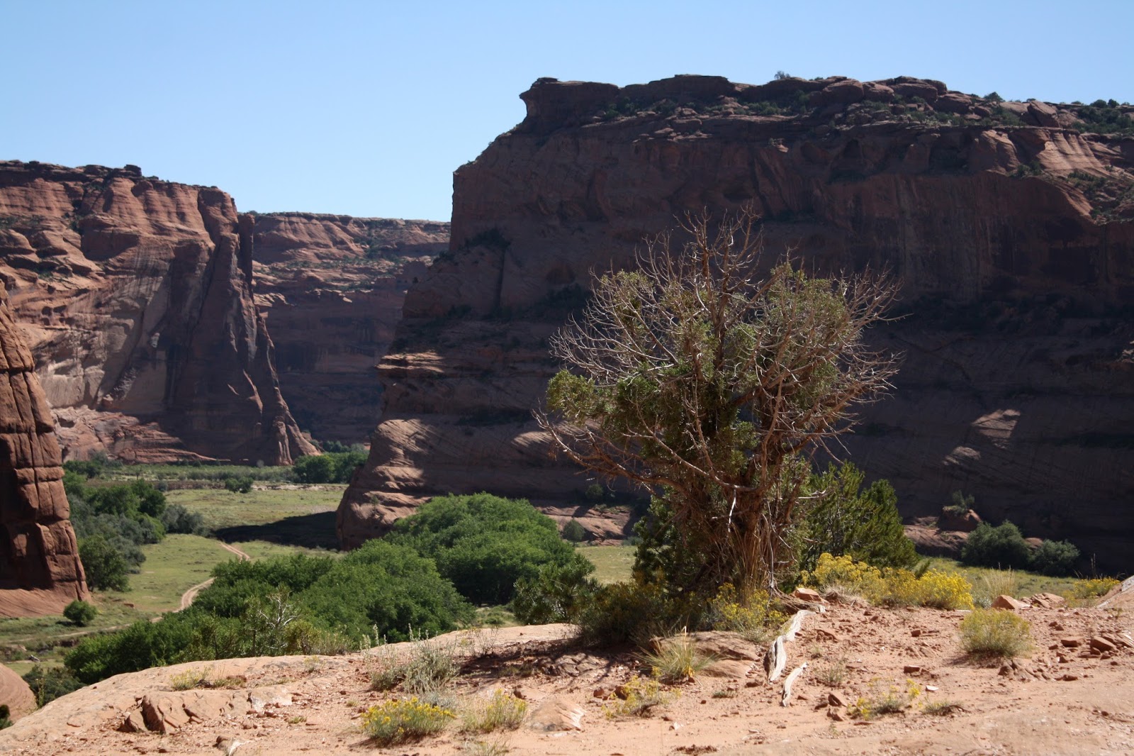
The Hogan and shelter at Canyon de Chelly Visitor Center provided a feel for Native American life in early Navajo times.
Junction Overlook of Canyon de Chelly
offers panoramic views of the valley floor.
The South Rim pullouts at Canyon de Chelly are best with an afternoon sun.  There Native American girls sold handcrafted jewelry and pottery at Tunnel Overlook and Junction Overlook.  At Tunnel we bought three stone paintings by Anthony.  His sister sold them to us and said the family lived in the valley about ten miles down the road.  Her brother had been painting since age eleven.
Tsegi Overlook was closed off with a large gathering of Native Americans.  We wondered what was attracting all the attention, but we weren’t invited.
Andy poses for a moment in the
bright sun of White House Overlook.
The ancient White House across the valley floor holds
secrets of the Anasazi past.
 
The ruins at White House Overlook seemed so small from the rim, but the river was dry.
“Do you remember our last visit here?” asked Andy.
How could I forget! Drew was a babe in arms, probably under a year old.  Andy carried him in the backpack and sunk up to his ankles in the river.  We crossed then though and viewed the White House ruins all by ourselves.  We couldn’t go in, but we forded the flowing Chinle Wash for views as close as we could get.
Hidden in the shadows of afternoon sun, Sliding House ruins
holds its secrets from ages past.
Sliding House ruins were in the shadows when we walked out to the overlook at 3:30 p.m., and here too the Chinle Wash was completely dry.
“Chinle Wash comes and goes in the sand,” explained an elderly man from Phoenix.  “There’s water in it up at Spider Rock.”
At Face Rock Overlook we bought two more stone paintings from Christine.  They had been done by her son Tyson.  He had autographed the backs with his name and Dine, the word for Navajo.  Christine explained that Tyson was saving for a computer game.  She showed us a picture of him when he was five years old.
At Spider Rock Overlook, the double monolith rises
more than 800 feet from the valley floor.
The interpretive sign at Spider Rock Overlook explained that the Spider Rock woman was very important in Navajo mythology, because she taught the Navajo people how to weave.  A lady from Toronto at the overlook raved about the jeep tour into the canyon and told us how the driver actually lived in the canyon.  He told stories about his life—how five or six vehicles had gotten caught in the quick sand of the Chinle Wash and disappeared forever.  Then I remembered hearing about that before Andy tried to cross the unpredictable wash in 1975.
Stories of being left at the top of Spider
Rock far below scared young
Navajo children into behaving.
As Sue and Andy pose in the afternoon sun, tomorrow's
challenges of climbing down into Canyon de Chelly await.
Turkey vultures dipped and circled overhead.  “I wonder if they are looking for quick sand victims,” I mused.  One circled so low we could see his yellow beak and naked red head.
On the return pass we stopped at Tsegi Overlook, which had been blocked earlier in the afternoon.  A couple farms lined the Chinle Wash down below, and the canyon looked lush.
“I wonder why it was closed and so many Native Americans had gathered here before,” pondered Andy out loud. “Maybe someone got stuck down below in the mud and sand.”
Whatever it was, it certainly attracted attention.
The overlook was calm and peaceful at 5 p.m.  Apparently everyone headed into town for Friday night.

Thursday, September 10, 2015

RETIREMENT TRIP #6
   NATURE'S PAINTINGS
                             September 2015                                  


In the early morning sun, the desert at Pintado Point
looks rich and alive.
The morning dawned fiery red across the eastern sky. "We must be right on the edge of a weather front," said Andy.
But back in the Petrified Forest National Park by 8 a.m., we cruised along under gorgeous mid-70- degree blue skies. Clouds painted swaths of cotton-white accent puffs. At Pintado Point an artist daubed oils on canvas. He said, "I don't know where it's going, but I can't resist the opportunity," when I admired his creation.
Flowers surrounded the stone-lined pullout at Nizhoni Point. The blooms attracted huge wasps. One stopped long enough for a close-up. And the flowers added color to an already colorful landscape.
A wasp alights on a fall blossom
at Nizhoni Point.
Andy poses before the remains of vehicular travel on Route 66.
Whipple Point gave us another magnificent panorama of color as the morning sun painted shadows.
Andy read the interpretive sign as I photographed from Lacey Point pull-out.  He explained that the pull-out was named in the early 1900's for Senator Lacey of Iowa, who was instrumental in formulating the Antiquities Act and getting it through Congress. President Theodore Roosevelt signed the Antiquities Act, and leaders ever since have used it to protect lands all over the country. Lacey Point honors the invaluable contribution of one conservation-conscious Senator. Since "land of scientific importance" covers a broad range, the Antiquities Act has been broadly applied.
Sue sits comfortably atop the
grillwork of an old Route 66 vehicle.
"Do you remember this?" asked Andy, as we pulled into the Route 66 remembrance pull-out. When we were here five years ago, the weather was abominable--whipping wind, lashing rain and bitter cold. The area honored the memory of Route 66, the American highway, that ran through here before the age of Interstates like Route #40.
Remains of the indigenous village of Rio Puerco showed the culture of the ancestral kachina settlers.
Petroglyphs provide an ancient
newspaper in stone.
One petroglyph visible from the observation point marked the summer solstice. The spiral was in direct line with the sun in the morning at 9 a.m. on June 21. We saw it in shadow at 9:15 a.m. on September 10, but the spiral was clearly visible in the shadow of the rock.
Nearby we could see the evidence of the recent rain. The dry wash flowed gently with muddy water, but the rain triggered desert bloom everywhere.
At Newspaper Rock the interpretive sign explained that petroglyphs are images chipped on a rock surface. Pictures are created by removing the natural black patina to expose the light-colored rock underneath. Telescopes allowed us to focus on hundreds of patterns and figures left behind by the ancient pueblo peoples.
The Tepees rise like giant tents
from the mud flats.
Petrified logs dot the landscape of the ancient sea bed
that today is the Petrified Forest National Park.
At the Tepees I read that the dry mud formations had once been part of a huge river system that carved the landscape.  The Chinde system scoured the land and left behind deep gorges and mud domes.
A huge raven waits for a handout
at the Blue Mesa pull-out.
Blue Mesa Overlook, already hot by 10 a.m., gave us the first glimpses of petrified logs. It was easy to see how weathering had slowly uncovered the ancient trunks, and as they were unearthed, they tumbled down the slopes to the valley floor. A raven watched us photograph, undoubtedly wishing for a meal.
Blue Mesa Trail, a mile loop down into the badlands, offered a strenuous mid-morning workout.
A steep trail leads us into the
heart of the badlands at Blue Mesa.
"You collapsed on this trail in 2004," Andy reminded me, "but that was immediately after your surgery before the mule ride into the Grand Canyon." 
No collapsing today, but it was definitely hot.

Petrified logs collect in all the run-offs beneath Blue Mesa.


The trail provided unusual perspectives of the steep slopes and petrified rubble that had tumbled from the Blue Mesa layer near the top.  Close up we saw pebbles of so many different sizes cemented together in the conglomerate. The sign explained that was evidence of a fast-moving stream that carried the stones at such speed they couldn't be sorted.  Then they were all suddenly dumped at once and roughly compacted.  It was an interesting lesson for me in how geologists read and interpret history.
All petrified, the rubble of
the ages collects
at the bottom of the gulley.
Agate Bridge, a giant petrified log, was shored up with concrete in 1917. The concrete looked more weathered than the exposed log above it. We followed another short trail out to the far edge of the mesa rim.  About 11 a.m. the temperatures had already reached the 90's.
With petrification, the living cells are
replaced by crystals
that turn to jasper and agate.
In 1906, John Muir recorded information about Jasper Forest. By 1917, tourists recognized this spot as having one of the largest collections of petrified wood anywhere in the world. Today we have to be content with collecting the visual images. Thank goodness the remnants far below us are protected.  Gorgeous chunks and slabs of petrified wood are just too tempting!
"And whose bright idea was it to do this?" I asked, trudging along after Andy at almost noon.  He had chosen a mile-long newly established trail into the wilderness.  We parked next to Dry Wash Bridge as directed and followed the main wash under the bridge into the badlands.  That was the easy part.
Martha's Butte marks the extent of our misadventure along
Dry Wash into the badlands.
Damp patches indicated recent rain, but our only sign of trail was a couple cairns and some footprints in the sand.  Admitting this was beautiful country, I turned around several times to admire the scenery and check out the return perspective.  The sun beat down, and it was HOT!  This was an easy place to get disoriented and seriously lost.  I thought about stopping, but when he asked if I had had enough, the butte seemed close.  The blurb said a significant petroglyph could be seen there.  Beyond was a large petrified tree, according to the information pamphlet.  Just as we identified the tree, Andy slipped on the crumbled basalt.  We gave up the search, applied necessary medical care and headed back in the general direction of civilization. It was most certainly bushwhacking.
Giant Logs Trail circled the Rainbow Forest Museum and Visitor Center.  Elderly tourists congregated in the shade of the portico right outside the museum or walked out to see the nearest giant petrified log.  We followed every path in and out between the huge tumbled trunks and chunks.
At Giant Logs viewpoint, we meander through the largest
collection of petrified wood in one place in the world.
"What I thought was most interesting about the video," said Andy, after we had watched the short informative show, "was that this area was equivalent to Panama latitudinally today when the world was one giant continent 225 million years ago."
I like looking at the colors.
"It's amazing to me how an area can be so beautiful and so cruelly desolate at the same time," said Andy, as we walked the three-quarter mile trail at Crystal Forest. It was the busiest stop of the whole day, but most people only walked to the first sheltered overlook about 300 feet from the parking area.  From there on we had a forest of fallen trees crystalized with agate and jasper and other semi-precious stones mostly to ourselves.  We sat for a few minutes to take in the expanse of land and sky--a scene to inhale and remember.
RETIREMENT TRIP #6
   ON THE ROAD AGAIN
                                September 2015                                          
A year or two ago the Willie Nelson song, "On the Road Again" haunted my thoughts as Andy and I headed for parts unknown. In my Little Red Saturn we had cruised west and south. This trip Little Red waits patiently in the garage at home.  But ironically we are still driving a little red car on Retirement Trip #6--a bright red Toyota Yaris, since the rental company had no Ford Focus as promised.
Over the phone Drew said, "Sounds like a lunchbox." He's absolutely right, but it drives. Maybe we'll call it Midget Red.
So it's "on the road again" as we head away from Phoenix northward toward Holbrook. And what normally would be parched desert plateaus and steep dried out hillsides along Route #87 instead are now slopes lush with vegetation--another irony since Connecticut landscape begs for rain.
Without stopping, we snapped pictures
from the Yaris window along Route 87.
A few raindrops dampened the windshield as we drove northeast on Route #260. At home we had not had a drop of moisture for 21 days.
It's amazing how the land changes with elevation. With the turn onto Route #377, a few miles outside of Heber, all the pines and junipers disappeared. Quite suddenly a flat panorama of grasses opened before us, dotted by bush-like cedars. A few miles later, the trees disappeared completely.
An interesting sky suggested we
might get rain later in the day.
"It's a lot drier here," said Andy. He was right. A herd of cows grazed among the clumps of sage brush and in the 
distance the tops of windmills from a wind farm spun gracefully. For sure, this is big sky country.
The two Tiponi Point pull-outs offered panoramic views of the Painted Desert.
Painted formations lined the desert horizon as we entered
the Petrified Forest National Park in the late afternoon.
"Do you remember this area from five years ago?" asked Andy, as we followed the low adobe wall around the parking area.
"Sure do," I answered, shaking my head.
Then bitterly cold, the wind had swept across the parking area in icy gusts. A damp drizzle penetrated everything.  The next night the blizzard hit where we were in Gallup. It was certainly a different world this visit with Mormon tea in full bloom and Utah juniper loaded with berries.
Utah junipers accent the rim and struggle for life in the
harsh desert landscape.
Tawa Point featured a half-mile trail to Kachina Point and the Painted Desert Inn, a historic adobe lodge from the 1920's.  Refurbished, the building is used as a museum to display local art.  A spotted lizard scurried under a clump of sage as we passed, and a turkey vulture circled overhead.
High above the badlands of Chinde Point we watched shadows creep across the formations far below us.
A recent rain triggers plant growth along the rim.
Chinde, part of a Navajo word for "ghost left behind after a person dies," reminds onlookers of the "spirits" buried far below. Here embedded in the preserved layers of rock, are the remains of thousands of animals and plants from the Triassic Period. Paleontologists continue to make fossil discoveries here that provide clearer understanding of life 227 to 205 million years ago.
Fossil bones of an early dinosaur named Gertie (Chindesaurus bryansmulli) were discovered near Chinde Point in 1984. Gertie was thought to be the most primitive dinosaur in the world found up to that time. The remains were reclassified in 2011 after careful analysis of the anatomy, and then Gertie was classified as a therapod, a family that includes birds and Tyrannosaurus rex.  But even today scientists are unearthing "ghosts" of the past.
By the time we walk back along the rim,
the sun bakes the landscape. 
And so Retirement Trip #6 has begun, and we two are ON THE ROAD AGAIN.
Some way to celebrate a birthday, I'd say!
Up at 3:30 a.m. we caught an early flight to Phoenix, but an unexplained 45-minute delay taking off really put a cramp in our O'Hare connection. Disembarking at the far end of Terminal F and boarding at the far end of Terminal C didn't help much either, but we made it and thankfully so did our luggage.
And so our next adventure begins.