Pages

Tuesday, October 4, 2016

RETIREMENT TRIP #7
Nidoto nai yoni -- Let It Not Happen Again
                                                                    This morning the area around Boise had a 30% chance of rain.  The storm could bring snow to Stanley in the mountains.  We could see overcast to the east, but it was just a patch—a 30% patch.  Regardless, winter is coming.
We drove southeast on Interstate #84.  Andy zipped along at 70 m.p.h. in our tiny Ford Fiesta.  Everyone passed him.  Then, we saw the speed limit sign of 80.  “So that’s why everyone was passing me,” he chuckled, and sped up to 75.  “But trucks are only allowed to go 70,” he added.
Just then a Forest Service pick-up went by.  “Wait a minute,” laughed Andy.  “Even the trucks are passing me!”
“Yeah, but that’s a passenger truck,” I told him to soothe his ruffled ego.  “He’s allowed to go 80.”
Just as I said it, a semi whizzed past.
“Man,” said Andy, shaking his head.  “You need to fly out here to get ticketed.  He’s probably doing 78, just fast enough over the limit to avoid getting pulled over.”
The Snake River cuts through cliffs near Buhl, Idaho.
At the exit for Buhl, the windmills churned.  A brisk breeze kept them turning.  “I heard a prediction for 60 m.p.h. gusts today, somewhere out here,” said Andy.  “If that’s true, they’ll have to shut down the windmills.  I think the most they can take is 35 m.p.h.    After that the blades can’t handle it.”
Between the close of the Civil War and the end of World War I, the sheep industry played a major role in southern Idaho history.  Drawn to the abundance of forage on vast unregulated public ranges, sheep transients came from Oregon, California, Nevada and Utah.  Numbers grew enormously after the railroad arrived in 1882.  By 1914, more than 300,000 sheep were being trailed through Ketchum.
A life-size bronze statue of a Basque sheep herder, his sheep
and his dog stands in Hagerman, Idaho.
By the late 1920’s, the Golden Age of sheep ranching, there were nearly three million breeding ewes and rams in Idaho.  It declined after World War II because of the unavailability of sheep herders, a disinterest in eating lamb as a meat, and the creation of synthetic fabrics to replace wool.
Most sheep herders were Basque, and Hagerman Valley was the prime winter location.  To pay tribute to the Basque contribution in developing Idaho sheep ranching, Danny Edwards of Twin Falls created this sculpture at his Twin Falls studio in 2012. 
In Hagerman, Andy found a statue of an Indian.  “That’s really cool,” he said, stopping for a picture.  A few blocks beyond was the Hagerman Visitor Center with a ten-minute movie about the combined Fossil Beds/Minidoka National Monument.  We watched the movie and looked at fossils of the Hagerman Horse and juvenile Mastodon elephants.  Many of the displays were by local school children who had toured the museum rooms.
Hagerman Fossil Beds National Monument is most famous for the Hagerman Horse, which is also the state fossil.  No other fossil beds preserve such arid land and aquatic species from the time period called the Pliocene Epoch.  The evidence allows scientists to study past climates and ancient ecosystems.   More than 200 species of plants and animals have been found at hundreds of sites in the park.   Complete and partial skeletons of this zebra-like ancestor of today’s horse have come from these fossil beds.  Paleontologists from the Smithsonian Institute in Washington, D.C., made the first scientific excavations in 1929.  During the 1930’s the Smithsonian scientists excavated 120 horse skulls and 20 complete skeletons from an area now called the Horse Quarry.
Bluffs that contain Hagerman Fossil Beds rise 600 feet above the Snake River.  They reveal the environment at the end of the Pliocene Epoch.
Wagon ruts from the Oregon Trail are still visible
below the rim.
The Oregon Overlook offered views of the valley below.  “The sign said that the main road actually follows 3.5 miles of the Oregon Trail,” said Andy.  We walked out along the rim.  A second trail took us to views of the ruts from Conestoga wagons.  Timing was everything then since pioneers still had 700 miles of territory to cover to reach their destination in Oregon—the Willamette Valley.  Most had already been traveling for five months, 1,200 miles.   They covered about ten miles a day, and this wasn’t easy terrain.  Intense summer heat, dust, wind and lack of water made crossing the Snake River Plain an ordeal.
In 1862, the Idaho gold rush increased traffic on the Oregon Trail.  In 1882, the Oregon Short Line railroad arrived north of the valley, and farming settlement increased here.  Today’s farmers grow corn and potatoes as the major crops.
Along the rim, the wind lashed at our faces.  “It has to be sustained at 40 m.p.h.,” guessed Andy.  He didn’t exaggerate.  It was brutal to even walk the cinder trail, and 54 degrees was COLD!
Andy pretends to be a paleontologist as he studies the
pretend "dig site" near the cliff edge.
American Indians now known as the Shoshone-Bannocks and the Shoshone-Paiutes have lived in the Hagerman Valley for 12,000 years.  They caught and dried salmon, steelhead trout, whitefish and sturgeon.  They dug camas lily and other roots and harvested seeds, fruits and other plants.  They hunted small animals and deer, elk and mountain sheep.
At the Snake River Overlook we could see fossil strata across the river.  Here layers of sand and silt were deposited during floods of the Pliocene Era as the Snake River emptied into ancient Lake Idaho.  Flood water carried the bodies of animals, plants, and pollen that were eventually preserved in the sandstone.
Melon gravel litters the fields around Hagerman Valley.
Here, at the Overlook just below the rim, the wind wasn’t quite as brutal.  We stopped for snack lunch, hoping the sun might break through.
Down by the river we stopped at an irrigation control dam.  A warning sign said levels could change rapidly, but it was way too cold to think about approaching the water.  A couple hundred mallards swam on the river near the dam.  They didn’t seem to mind the chill at all.
Typical of this area are boulder fields of lava rocks.  Most of these were deposited in one particularly devastating flood of the Snake River about 15,000 years ago.  The Bonneville Flood lasted up to eight weeks, but it was so extreme it carved the high bluffs, exposing the layers and fossils.  It also deposited the fields of melon gravel—the lava boulders the size of watermelons and as big as cars—from today’s river level up to gravel bars that are 225 feet higher than today’s river.
The road took us past Jerome with a huge cheese factory and lots of feeding lots for dairy cows. I didn’t see any barns, so I wondered if the cows stayed outside all winter.

Andy said the largest yogurt factory in the world was in Twin Falls.  Some of the milk was probably being sent to Chobani in Twin Falls.   Fields of potatoes appeared on both sides of the road.  And then fields of sugar beets.  This is a farming region.
One reconstructed guard house marks
the entrance to Minidoka War Relocation
Center, locally known as Hunt Camp.
With some searching along country roads, we found the Minidoka National Historic Site.  More than 13,000 people were imprisoned at Minidoka War Relocation Center, known locally as Hunt Camp, between August of 1942 and the end of World War II in 1945.  It started on February 19, 1942, when President Franklin D. Roosevelt signed Executive Order 9066, depriving more than 110,000 people of their freedom.  All were of Japanese Nikkei ancestry, two-thirds were American citizens and half were children.
Shikata ga nai, the Japanese said.  It can’t be helped.  A certain Presidential candidate should come here and learn.  It CAN be helped.
Japanese incarcerees at Minidoka live in tarpaper barracks,
left, that start out as wooden apartments, right.
Andy and I walked the 1.6 miles of cinder paths.  We were the only visitors, and the 50 m.p.h. winds were withering.  I covered one ear with a gloved hand and tilted my head to protect the other ear.  We had gusts close to hurricane force.  Those poor, poor people of Minidoka!  October is the month of wind here.
We read the signs.  For the first six months from August 1942 to February 1943, everyone had to use open pit toilets until the sewer treatment plant was finished.  The 33,000-acre site had 600 buildings, but most of them were crowded onto 946 acres.  More than 13,000 incarcerees came through the gates, with a peak population of 9,397, the seventh largest city in Idaho on March 1, 1943.
All that remains of the original welcome station at Minidoka
casts an ominous shadow at the entrance.
Barracks were simple tarpaper and wood shelters with six “apartments,” each housing two to eight people.  Meals were held in the Mess Hall to break down family bonding.  Five miles of barbed wire and eight guard towers went up three months after Minidoka opened, but so resented was t he fence that it soon came down and the guard houses weren’t staffed.  Minidoka was the “quiet” camp. 
Incarcerees organized churches, recreational activities and a consumer cooperative.  They planted gardens to bring beauty and familiar food back into their lives.
They helped their Idaho neighbors too.  Thousands of volunteers from Hunt Camp helped cultivate and harvest the sugar beet crop for Amalgamated Sugar Company, and in 1943 the Minidoka firefighters helped subdue a wildfire 60 miles away. 

The Snake River winds through carved canyons along
 a 16-mile scenic gorge.
Idaho residents came to better understand these people who had been imprisoned by prejudice.  Many had sons and father s fighting in the war.  The Congressional Medal of Honor was awarded to 19,000 Japanese American soldiers.
Nidoto nai yoni.  Let it not happen again.  The Civil Liberties Act of 1888 provided a Presidential apology from President Gerald Ford when he formally terminated Roosevelt’s EO 9066.  Reparation payments to 82,000 former incarcerees were made.  But only those still alive received payment.  Today Japanese Americans around the country commemorate February 19—the day FDR first signed EO 9066 – as a “national day of remembrance.”
Hansen Bridge towers
over the canyon.
It CAN be helped.  Nidoto nai yoni.
Lookouts on both sides of the Snake River at Hansen Bridge gave us lovely scenic views of the water.  Even more impressive was the bridge over the 16-mile-long gorge.  Hansen Bridge was completed in 1966, to replace a suspension bridge that had been constructed in 1919.  The original bridge carried wagons across in two lanes.   It cost $100,000 in 1919.  Before 1919, the only way across the 16-mile gorge was by rowboat.
Life in this farming country
depends on the Snake River.
In the dry season, the Snake River still flows.
Another Snake River crossing at Murtaugh Launch Site brought us closer to the water on a lower bridge.  Here, even in the driest of the dry season, water spewed from the cliffside lava.  Maybe it was just irrigated fields draining down to the river, but the farms here look lush and thriving.
This was beautiful country.

Monday, October 3, 2016

RETIREMENT TRIP #7
Back to Boise and Beyond
                                                                       Derek Walcott, Novel Prize in Literature winner in 1992, wrote, “We read, we travel, we become.”  I had been reading to Andy as we traveled the country. I know reading and traveling expand perspectives for both of us.  I wonder if that is the substance of my need to write.
Ice coated the top of the little black Ford Fiesta this morning when Andy loaded the luggage.  The bank across the street read 36 degrees when we left the motel some time later.  On the Oregon
Irrigation pivots spew water that freezes on contact in the
early morning chill, the first frost of the season.
Outback there isn’t much to hold the heat at night.  This morning the cloudless sky warmed quickly.
“Next gas 120 miles,” said a sign outside of Crane on Route #78.  “That means each rancher must have his own supply,” I said.
“Absolutely,” agreed Andy, “or none of his farm machinery would be operable.”
Just then we passed some pivot irrigation systems with long white lines under them.  I pointed it out to Andy, wondering if the white was some sort of fertilizer in the water.
“No,” he answered, slowing down the car.  “Look, it’s ice!  They had to go way below freezing last night.  It’s ice.  They were in the 20’s here.  The sun’s been out for more than two hours.”  Frost covered the ground under the pivots and icicles hung from the metal rods and wheels.
Few people live in this rugged,
remote part of Oregon.
In Rome, Oregon, close to the Idaho border, the Owyhee River flowed comfortably.  But almost no one lives here.
“This would be a good place to see the Milky Way,” Andy mentioned… again.  He always picked the most inopportune times to look at stars.
Rugged volcanic hills line the border
between Oregon and Idaho
Here, the ranches sprawled for miles across the volcanic land.  “Eat at your own peril,” Andy told the cows as we drove past.
“You got that,” I echoed.  “The more you eat, the sooner you die!”  A cattle truck passed us going the other way.  It was empty.
The tiny old town of Jordan Valley on the Idaho border, preserved one wall of the Jordan Hotel, built in 1880.  It looked odd towering over dilapidated trailers and modest frame homes.  It's just about all that is left from days gone by.  Before the discovery of gold along the banks of Jordan Creek on May 18, 1868, this arid region was the exclusive domain of American Indians, a few hardy explorers and Hudson Bay Company's fur trappers.  The prospect of gold quickly changed this attitude, and eastern Oregon became a destination for hundreds of miners.
One wall of the old hotel towers over homes in
downtown Jordan Creek.
Merchants with heavily-laden pack animals quickly took advantage of the opportunity and so too did ranchers, wood cutters, blacksmiths, stone masons, carpenters, gamblers and a host of others from all walks of life.
 The sudden population increase alarmed local Native Americans, who harassed the newcomers to drive them away.  It brought more. The tragic conflict lasted for five years until the Treaty of 1868.
By the 1870's mining took second place, but the livestock industry to provide food for miners and mules and horses for transportation replaced it.  This all laid the groundwork for Malheur County's industry today--agriculture. The one wall of the old hotel is all that remains to remind visitors of this colorful history.
Views from the overlook show
the rugged terrain of Oregon.

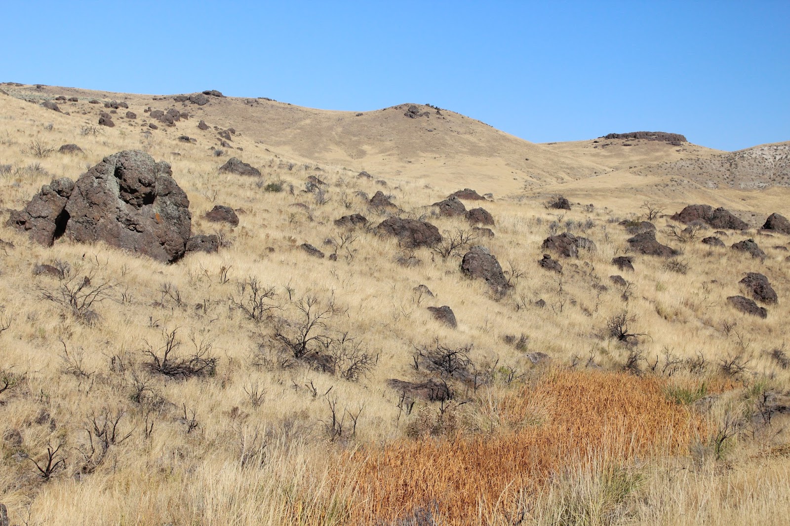
Ten miles north along the border, the road turned east, and then there was Idaho.  Dry grass covered the mountainous slopes as far as we could see.  Steeply rolling, it made good range land, but except for the wire fence, there were no signs of habitation for miles.
Cliffs rise on both sides of the
highway pass.
Basalt boulders rested precariously on the hillsides where they had tumbled.  “Watch for rocks,” warned the appropriate sign.  This was rugged territory.
Deep in this valley, a successful
ranch extends for miles.

Owyhee County just over the border was actually named after an outdated spelling of the word Hawaii.  The pass, a 6% grade downhill for three miles, cut through lava cliffs on both sides of the road.
We stopped at the rest pullout, climbed to a lookout and watched piggy-back hay trucks and cattle-hauling semis climb the steep grade.
The Anne Frank Human Rights Memorial recognizes the
rights of all individuals, regardless of race, color, creed... 
One vehicle near us rested his brakes before the steep descent.  It was a long way downhill.
In downtown Boise the Idaho Anne Frank Human Rights Memorial paid tribute to Holocaust victim Anne Frank, who died at the hands of the Nazis in 1945, just as World War II ended.  Famous quotes carved in sandstone reminded onlookers of the value of humanity and the price of liberty and freedom.  It was impressive, with fountains, ponds and gardens.
A bronze statue of Anne
Frank highlights the
Human Rights Memorial.
Beautiful rose gardens surrounded the Idaho Capitol Building in downtown Boise.  Parking was free on Sunday, so we parked and circled the block on foot.  The rotunda was open for close-up views of the interior arches and colonnades.
Beautifully landscaped, the Anne Frank
Human Rights Memorial is a tribute
to people everywhere.
“I think the building was patterned after the U.S. Capitol,” said Andy.  “It’s a replica but about a third the size.”
A photographer positioned six groomsmen and the groom, all in black tuxedos with rose-colored vests, on the cement front steps.  They squinted in the bright sun, but temperatures were pleasant 70’s.
Right in front of the main staircase was a replica of the Liberty Bell—no protection, no signs, no stops.  Andy rang it.  The clang reverberated a block away.
Gardens in front of the Idaho State Capitol
Building still bloom in early October.
“It didn’t say I couldn’t do it,” he laughed.  Moments later, others followed his example.  They were adults too.
Anne Morrison Memorial Park is their crown jewel.  It was swarming with Canada geese.  In another section older guys competed in a soccer tournament.  Cars lined the fields.  Moms sat on blankets on the sidelines, watching the game and rambunctious toddlers.
Boise was a lovely city.  “If you’re on welfare in Idaho, you’re not getting a big check,” said Andy, “so the city has money to spend on other things like parks.”
Platt Park outside the Boise Depot overlooks the entire city.  Built by Union Pacific railroad in 1927, the gardens have winding walkways, benches, a koi pond and a miniature volcano rock, lined with beautiful roses.  Here, a mother posed her two young children, all dressed up in their Sunday finest.  Two other women photographed a teenage girl.
“Senior picture?” I asked.
“Yes,” they all grinned.
Sue peeks behind the Liberty Bell
replica at the Idaho State Capitol.
Down below is Idaho State University.  We parked outside the Boise Depot and took the last elevator up to the Bell Tower.  “Only one bell still works,” explained the guide.  “It sounds at 5 p.m., noon and 8 a.m.  You can hear it from the campus.”  The family on the elevator with us agreed.  Their daughter was a freshman at ISU.

The panorama of Boise unfolds from
the top of Boise Depot's Platt Park.
From the top we had a panoramic view of Boise with lots of trees and the colors of fall creeping in.  The Boise Depot itself is a beautiful historic Spanish-style building, completely restored in 1993 at a cost of 3.5 million dollars.  It is owned by the city and rented for special events.  Built in 19025, for use as a Union Pacific railroad depot, the building was designed by New York architects and was heralded as “the most beautiful structure of its kind in the West.”
Setting the camera on timer, we manage a picture at Boise's
Platt Park, albeit a little crooked!
Outside on the railroad tracks was a huge black locomotive.  Authentic and right in place, it looked as if any moment it would belch steam and arrive right on schedule at the station.  And with weddings in the Grand Hall with its 44-foot ceiling, the train was the perfect way for a newly married couple to ride off into the sunset.

Sunday, October 2, 2016

RETIREMENT TRIP #7
The Oregon Outback: Ranch Country
                                                       There isn’t much between Bend and Burns.  Five miles east of Bend, everything disappears except sage brush, rubber rabbitbrush and whatever other weeds are growing.  No ranches, no houses.  When the road went up to 4,630 feet at a truck rest stop, a sign pointed north to Camp Creek, Horse Ridge and Saddle Butte.  So Western!  It reminded me of author Bret Harte and all his short stories of the pioneers.
Three horses grazed near the Stage Coach Truck Stop, but otherwise we didn’t even see cows.  Route #20 stretched straight through open range.
“This certainly wasn’t his lucky day,” said Andy, as we passed a subcompact car going the other way.  The driver had been pulled over by a state cop or sheriff who stood next to the little vehicle by the driver’s window.  “He must have been flying to get pulled over here.”
Rich crops of alfalfa hay spread as far as the eye can see. 
Ahead of us for the next ten miles we watched the road:  several “no passing zones” on bends or small rises, only a couple dirt road turnoffs where a cop could sit in waiting and a speed limit of 65.
“If it wasn’t passing in a no-passing zone, which seems unlikely given the traffic, he had to be doing more than 75 in that tiny vehicle,” said Andy. 
“I guess he was in a hurry!” I chuckled.
“Yup,” Andy agreed.
We both grinned.  The sun was warm.  Life was good.  We weren’t in a hurry.
Later, at the top of a rise, a portable highway sign flashed, “Warning: Smoke Ahead.”   Andy slowed down, but we never saw any fire, and only a slight haze suggested smoke.
With water more accessible near Burns,
the ranches seem more profitable.
 
We were in Burns, Oregon before noon.  We couldn’t find a Starbucks, and there was no place to sit at the Signature Café inside Safeway, so we bought two donuts and went to McDonalds for coffee.  That hit the spot.  Locals all had on jackets.  One bank read 51 degrees; another said 53 degrees.   You wouldn’t know it from the brilliant sunshine, but flags were stretched at full mast in the brisk wind.   It was cold.
A trail climbs to Buena Vista Overlook
in Malheur National Wildlife Refuge.
From the top of the Overlook at Buena Vista, the marshland of
Malheur National Wildlife Refuge spread for miles.
Heading south about 30 miles to Malheur National Wildlife Refuge, we passed through sprawling ranches of alfalfa hay.  Here and there cows grazed in fenced fields.  A volcanic butte separated the rich Burns farmland from a drier, much more arid valley.
Descending the trail from Buena Vista, we can see cultivated
land in the distance where ranchers plant alfalfa.
“This is the place that the Bundy followers occupied,” said Andy, as we drove past the Malheur National Wildlife Refuge entry sign.  “Do you remember that group under the leadership of Bundy that occupied buildings in a stand-off against Federal officials?  They were demanding that the government turn land back to the ranchers, relinquishing control.  I think this was the son of the Bundy in Nevada whose animals were confiscated for not paying grazing fees on Federal land.  One person was killed in the confrontation, but when the Feds moved into the Nevada home area, they found the land had been absolutely destroyed.  The father came up here to “rescue” his son, and they were both arrested.  The Feds got them on occupying a Federal facility and interfering with a Federal official who was doing his job.  The trial in Portland was supposed to start a few weeks ago.”
I could see how someone would get “lost” here.  Andy said he figured the FBI blockaded a lot of these roads.  It all started when two ranchers got 12 years in jail for starting fires in their fields.  The fire spread into the Wildlife Refuge.  Bundy had come to protest the sentence, but the ranchers really didn’t want his “help.”  At least, that’s what Andy remembered of the whole incident.
At Buena Vista Overlook we walked the quarter-mile trail to the top instead of driving the dirt road.  It offered lovely views of the buttes and the wetlands below.  Cliff swallows swooped around us, but it was too late in the season for most other birds. 
We followed Diamond Lane Auto Trail around Buena Vista Ponds, a gravel road through the wildlife marshland.
We stopped to walk in a few paces by the spot where the ponds might have been, but a wooden sign read, “Official Use Only.”  No purpose in tempting fate in Bundy country!
Malheur is called a protected oasis in Oregon’s high desert, a Mecca for birdwatchers and wildlife enthusiasts.  With more than 320 bird species and 60 mammal species, it is famous for its tremendous diversity and spectacular concentrations of wildlife.  It is one of the crown jewels of the National Wildlife Refuge System.  No wonder the Federal government went after the Bundys when they barricaded themselves in the refuge headquarters!
The poplar trees in Diamond are
dated at 100 years old.
President Theodore Roosevelt first set aside land here in 1908 as a preserve and breeding ground for birds when some species were being slaughtered for plumes.  Now the Refuge covers more than 187,000 acres of wildlife habitat.
The town of Diamond, nestled in the heart of the Refuge at the base of a poplar grove, has a population of five.  Can you even imagine living here?Large numbers of Mule Deer move in during October when the rutting season starts.  The ones we saw were still more interested in eating.

Andy turned in at Diamond Craters.  “I’m only going a little way,” he said.  “We did this road ten years ago, and it was terrible.”  We drove to the first overlook and walked out on the cinder craters.  The lava cinders, black and red, crunched under our feet.
“It’s like a moonscape,” I thought out loud.
Diamond Craters are actually six cinder domes that probably formed about 17,000 years ago.  They appear more current and un-eroded because of the arid climate and lack of vegetation.  The first flows, now about six miles across in the northern and southern edges, were pahoehoe lava.
Before the initial flow completely cooled, additional magma rose up underneath that lava flow in six places to form six domes:
1.       West Dome with two craters and Malheur Maar, formed where magma encountered ground water, which flashed to steam to form explosion craters.

At Diamond Craters a butterfly or moth
lands on a flowering rubber rabbitbrush.

2.    2. Central Dome where volcanic ash erupted from many vents so that the top of the dome dropped into a caldera or circular depression.
3.      3. South Dome where magma high in gas erupted out as cinder cones.
4.      4. North Dome which is covered with volcanic ash from the Central Dome vents.
5.      5. Northeast Dome which is a well-developed cone littered with volcanic bombs
6.      6. Graven Dome, a long channel-like depression, because lava flowed out the flank when the dome was forming.
It was a fascinating lesson in geology.
Cinder cones rise in six domes at Diamond Craters.
Our next stop was Round Barn.  Here Peter French built his unique Round Barn in 1880 to break and exercise horses in the winter in the later 1800’s.  We drove in carefully to avoid dust from the gravel road, but we also walked around carefully after reading the sign that warned rattlesnakes are frequent visitors.  Thankfully, there were no rattlesnakes today.
French, the boss of “P” ranch, a vast spread in the Donner and Blitzen Valley, raised nearly 300 head of horses and mule colts a year.  Most were kept to work on the ranch. 
French designed the Round Barn in circular fashion to keep horses running at a smooth and even pace.
Vaqueros inside the Round Barn of Peter French
could keep horses moving at a constant pace.
Unique in design, the Round Barn survives since 1880 in
Donner and Blitzen Valley.
Built on high ground for better drainage, the Round Barn encloses a 60-foot stone corral.  The conical roof is supported by a 30-foot juniper center post and 13 other posts.
At the age of 23, Peter French set off from California with 1,200 head of cattle, 20 horses, several supply wagons, a cook and half a dozen cowhands.  He eventually settled in Donner and Blitzen Valley to establish a ranching operation that grew to 200,000 acres.  He was one of Oregon’s first “Cattle Kings.”
His reign ended in December of 1897 when he was shot and killed in a land dispute with a local homesteader.  The Round Barn is the only one of three that survived.
Nearby a family-owned gift shop and snack bar was operated by David Jenkins and his dog Spike.  We greeted Spike, who accepted me with a kiss, shopped in the classy store and sat outside snacking on honey roasted peanuts and a shared tiny bottle of Chardonnay.  What a way to spend an afternoon!
Pronghorn grazed a mile or so around the bend.  The pond near them was nearly dry, but Oregon is going into the rainy season.
“It’s not nearly as cold as it used to be,” David had told us in the gift shop.  “Years ago we could expect 30 below in the winter, but not anymore.  It was in the 80’s here yesterday.”
At 4:30 p.m. it was a pleasant 61 degrees in Burns.  The car was actually hot in the sun.

Saturday, October 1, 2016

RETIREMENT TRIP #7
Interesting Adventures in Oregon
                                                                    It was cold this morning when we got up in Christmas Valley.   Not cool, but cold.  Andy went to the local market for coffee and.
A young man said, “You’re a lot tougher than I am.”  He had on a winter coat.
Andy, dressed in tee shirt and jeans, answered, “No, I’m just dumb.”  Even he agreed it was cold.
By the time we left the motel, the temperature had warmed to 50 degrees.   We would be driving for a while, so shirt sleeves would still suffice.
Historic wooden buildings, remnants of Homesteaders in
the 1900's, are preserved near Fort Rock State Park.
Fort Rock Valley Historical Society Homestead Museum, founded in 1984, was closed.  “Come see us in May,” said the sign.  Across the road from Fort Rock State Park, the Homestead Museum preserved some of the wooden buildings of an old Oregon town of the 1800’s.  The electrified fence protected the old buildings from would-be vandals, but we could still take pictures and read a little of the history.
The Enlarged Homestead Act of 1909 fueled a land rush that had begun in 1862.  It qualified individuals to claim 320 acres by building a residence and cultivating 40 acres.
The old General Store even has its original gasoline pump.
Thousands headed west.  More than 1.3 million claims were filed in the U.S. before 1900, but less than half proved successful.   The original law had allowed heads of households, widows and all single people over 21 years old to purchase 160 acres at $1.25 an acre or by paying a $15 filing fee after five years of residence and cultivation.
Farming came with the Homesteaders in the early 1900’s. Many first-time Homesteaders in this region arrived after 1909. Life on the land was not easy.  Dryland farming was a laborious and expensive venture, and many would-be-sod-busters simply left when their backs gave out or their money ran out.  The advent of World War I saw many drafted into service, while others left for “good jobs” in the city.
In the distance Fort Rock stands high
above the flat plain where the town
 from olden days is on display.
Deep plowing and sowing drought-resistant crops became the norm.  The development of deep well irrigation technology in the 1960’s made agriculture profitable.  Today, locally grown alfalfa is highly prized and shipped as far as Japan.
The sun and clouds cast shadows on Fort Rock across the road.  It was a great view of the entire lava tuff, a view we hadn’t seen from inside the state park yesterday. 
At Hole-in-the-Ground, another enormous feature in Oregon’s Outback, the floor of a crater sinks 490 feet below the surrounding ground level and the rim rises 110 to 210 feet above the surroundings.
From where we stand on the rim of Hole-in-the-Ground crater,
the distance across is about a mile.
A mile across the crater, a trail traced an arching path up to the rim.  We walked about half way down in the powdery, ashy dirt.  It had been 4.4 miles in, driving on a rutted gravel road without signs, so we had almost turned back.
As we stepped back onto the rim, a jeep or truck crawled down what we thought was only a trail on the other side.
“That’s just amazing,” said Andy.  “Look at how slow he’s going!  That road must be awful.”
Interested, we watched for a long time as the far-off explorer, just a tiny dot even with the zoom lens, walked around the belly of the crater and let his vehicle cool.
“What we thought was just a trail around the rim is actually a dirt road,” said Andy.  Our little car would never make it, and we certainly weren’t going to try.  But watching was fun.
Hole-in-the-Ground is between 13,500 and 18,000 years old.  It was once under water but quite near the shore of Fort Rock Basin’s ancient lake.  At first scientists suggested it was a meteorite impact crater, but study showed Hole-in-the-Ground was volcanic, caused when Basaltic magma intruded near the surface groundwater, turning the water to steam.  The steam blew out overlaying rock and soil.  As the material slid back down the sides, it closed the vent.  But the explosions repeated again and again with blocks as large as 26 feet being flung as far as 2.3 miles.  It’s quite a sight and delightfully silent!
Paulina Falls in Deschutes National Forest gushes over
soft igneous rock that crumbles and gives way.
We pulled out onto Route #97, lined with traffic and logging trucks.
“We could have stayed at that motel,” said Andy, pointing to a sprawling Best Western.
“I’m glad you chose the tiny Desert Inn in Christmas Valley.   It was clean and adequate,” I said.
“I like to see how others live,” he explained.  “I try to experience different lifestyles to understand.  It also makes me very grateful for what I have.”
I understood completely.
Ahead of us rose the Cascades, black silhouetted peaks against a cloud-filled sky.  Snow lingered in patches.  Soon there would be more.  The weather was changing and cumulus clouds were moving in.
A visitor from Atlanta captures Andy and Sue
together at Paulina Falls.
In Deschutes National Forest the Forest Service was selective thinning to minimize the chance of fire.  Piles everywhere waited for burning once the winter snow covered the ground.  “They could get snow out of those clouds,” said Andy, looking at the sky.  “They are heavy enough and high enough in the mountains.”  He was thinking about our already cold morning in the Outback.
From the overlook in Deschutes National Forest, we could see the Three Sisters and other snow- crowned peaks.

Undergrowth at Paulina Falls is tinged
with color as autumn temperatures
plummet at night.
East Lake was cloud covered, but there were still rowboats on the shore.  A few cabins named Goose, Honker and Gull were occupied, probably for the weekend, and a group of adults, dressed for winter, picnicked at a table near the lake.
Paulina Falls had two major viewpoints.
Andy, Sue and our new friends
from Atlanta hike down
to the base of Paulina Falls.

We walked the 800 or so feet to the upper view and then tried without success to find a river crossing.  The quarter-mile switchback trail to the lower falls looped back and forth to the basalt jumble near the base.  Some visitors from Atlanta offered to exchange photographic opportunities.  It was nice to get a quality picture of both Andy and me at a beautiful location without using the timer.  But we held our collective breaths every time the sun disappeared.  A couple sprinkles near the falls from a big grey cloud warned us of what could be.

Newberry Crater, a sleeping volcano, is one of few in the world
to spew obsidian as a lava during an eruption.
Paulina Falls is like a hydraulic jackhammer, pounding away at the softer rock beneath.  But since the volcano that feeds the falls erupts about every thousand years, the solid rock that the falls wears away is periodically replenished.  Geologists think the falls was 200 feet downstream about 2,000 years ago.  Today water tumbles over the falls at a rate of about 20 cubic feet per second.
At the base of Paulina Peak, 7,984 feet in elevation, we took the Obsidian Flow Trail into the crater.
Obsidian Dome is otherworldly.
Newberry Crater, a 500-foot climb of stairs ad trail in the center of the crater to the top of the spewed Obsidian Dome, was actually above the tops of the Ponderosa pines.  Wind whipped in waves, but intermittently the sun broke through.  The trail, a half-mile around the dome, climbed to the top and circled the inner dome of lava and obsidian.  “You wouldn’t want to fall here,” said Andy.  It would literally be falling on glass.

Climbing the trail is
actually walking on glass.
Obsidian, actually formed from molten silica, is just superheated sand with a drop of iron oxide.  Sand is what is used to make glass.
Ancient peoples treasured obsidian and used it as money, but it doesn’t occur in many places of the world.
Here, the explosion that produced the Obsidian occurred about 1,300 years ago.  Where people lived near obsidian, their lives and cultures were transformed.  They used the “glassy” volcanic rock to manufacture tools, weapons, jewelry, sculpture and ceremonial objects.
Life is tough on the rocks
of Obsidian Dome.

To ancient Central American people, the importance of obsidian for their economies was similar to that of steel for the economies of modern industrial nations.  I found the informative sign fascinating.
We stopped once more at the overlook at 3:00 p.m. because the sun was out with blue sky.  The view showed Lookout Mountain, Mount Bachelor and the Three Sisters far in the distance.  It’s beautiful country.
From inside the crater on the Obsidian Dome we can
see the top of the old volcano rim.
Andy turned into La Pine State Park in the hopes he could rinse off the back window at a campground dump site.  We found the Don McGregor Viewpoint with views of a big bend in the Deschutes River.  The color was just creeping into the undergrowth across the river for perfect pictures.  The area was dedicated to a man who had given much to Oregon parks.
The Don McGregor Viewpoint memorializes a man who
cared for and loved the natural world.
At Big Tree in La Pine State Park, Oregon’s largest Ponderosa pine is protected.  A circle of wooden fencing keeps visitors from further compacting the soil immediately around the roots of the 500-year old giant.  The age is an estimate, but the height is measured at 162 feet.
Oregon does an incredible job of establishing and maintaining its state parks.  Other states could learn a lot!