Pages

Thursday, November 3, 2011

HISTORICAL HOMECOMING--Trip 2

In Tara's New York country neighbor-hood, the scene was one of winter beauty. But in town after town from Grahamsville, New York, to the Hudson River, the storm took its toll. Stop and go lights at intersections hung black and unlit. Last night's 12 inches of snow played havoc with the power. Gas stations, silent and empty, had taped the pumps with yellow CAUTION signs. No electricity, so no power. Hence, no gasoline. We wondered what we would find closer to the water.
Every curve on Interstate #84 brought traffic slow-downs with cars spun out and trucks in the ditches. The radio reported one and a half million customers still out of power, as the snow took down leaf-covered branches.
"Damage is incredible. Unprecedented power outages. Unprecedented destruction," said the newscaster.
We headed home. "The earlier the snow, the less we typically get," said Andy. "If that's true, this will be an easy winter."
But we knew cleaning up October wouldn't be so easy.
"Historic," said Governor Daniel Malloy about outages in Connecticut. "Roads and lawns are littered with branches. More than 840,000 customers are out of electricity in the state. We've never had so many out from a fall storm."
United Illuminating and Connecticut Light and Power (CL&P) warned it might take more than a week to restore power. "There's damage every couple of feet in Litchfield," added a company representative.
West Milford, New Jersey, near Port Jervis got 19 inches. "We were just there," said Andy. And by Sunday evening we learned that more than 32 inches of snow had piled up in a few Massachusetts towns. But Connecticut took it the worst overall with more than 840,000 customers out of power and leaf-covered trees down everywhere.
Four days later, CL&P reported that more than 420,000 in Connecticut were still without power. That was nearly as many as the count when Hurricane Irene devastated the state earlier in the year. In the towns of Seymour and Oxford, 100 percent of the customers claimed no power on Thursday, nearly five full days after the Saturday night barrage.
But we lucked out. We came home to the aftermath of the worst October snow storm in the state's history, and, even though we lost six trees, our lights only flickered once.

NOR'EASTER TEASER--Trip 2

Winter arrived. Even though the calendar said the official season was two months away, winter came today with a blast of icy chill. At noon, temperatures dropped from 37 degrees to a bone-chilling 25 degrees, and snow fell. It started with a fine misty layer that filled the air with tiny white crystals. Thirty minutes later, the flakes covered the grass and bushes.
"I figure a generous inch," said Tara, looking at the weeping cherry tree near her front door about 2 p.m.
By 6 p.m. the plow had been by twice, three inches of icicles plunged from the edge of her roof, a blanket of white draped across the truck hood and roof, a couple inches of heavy powder balanced on the telephone wire and all the bushes wore white cloaks. The lights flickered once, and I gathered up a few already burned candles and jacked up the heat. It was going to be a long night.
The world outside every window was a pristine white winter wonderland, with five inches blanketing the ground and more huge flakes coming down in gentle sheets as night settled in.

ROCKY ROADS--Trip 2

Hickory Run State Park in Pennsylvania preserves a glacial boulder field 400 feet wide by 1,800 feet long and estimated to be at least 12 feet deep in most areas. As the glaciers from the last Ice Age retreated some 15,000 to 20,000 years ago, they dumped rocks of all sizes and shapes here in eastern Pennsylvania in the Pocono Mountains.
On this crisp, cold October morning, the more reddish rocks retained a fine glaze of ice. We stepped gingerly, odd for clambering over boulders.
"Be careful," warned Andy.
He didn't need to tell me. Some of the huge rocks wobbled under foot. A light dusting of snow covered others closer to the ground. I picked my way warily, securing my footing and trying to avoid ankle-twisting crevices. I felt ridiculously clumsy, but no one else visited the boulder field to watch my antics. We were alone on a massive highway of rocks, stretching as far as we could see.
"Just think," said Andy, as we turned onto Interstate #80, "this is all going to be covered by snow tomorrow. Right now, it's in good shape." Dry and clear, the highway stretched before us with little traffic. Snow on leafless beeches and birches had melted, leaving the air fresh and clean as we headed northeast. Wisps of cirrus clouds swept in high swirls across the highway in a mostly blue sky.
What a contrast to yesterday and tomorrow!
Hialeah Picnic Area in the Delaware Water Gap combined all the colors of fall in one glorious display: the wild beauty of tree-covered hills accented by the dried stalks of cultivated corn fields. "This was one of the nicest stretches of Appalachian Trail," said Andy. "The trail is right over there." He pointed across the Delaware River. "You'd never expect this in New Jersey."
Canada geese browsed at Smithfield Beach. Andy chased them into flight so I could snap pictures. They took off, honked angrily in response, banked and headed for the safety of the river.
Bushkill Access, a boat launch area closed for the winter, provided beautiful views of the Delaware River.
Pocono Environmental Education Center (PEEC) had five marked trails. We chose the 1.5-mile Two Ponds Trail with its diverse habitats around Pickerel Pond and Front Pond.
The 1.5 miles circled from the Visitor Center through shrub wetlands with muddy soils. The cold temperatures precluded any snakes, but I watched anyway. We could still hear frogs in the nearby pond. At the edge of the open field, red cedars and dogwood thrived. The trail continued to emergent wetlands with wild grape vines and skunk cabbage. A dragon fly lit on a Virginia creeper vine as I read the Two Ponds Trail Guide. "This area supports beaver," I told Andy. We could see gnawed stumps. "It says a beaver can chew through a tree six inches in diameter in five minutes. Maybe you need one of those in conjunction with your chain saw."
He didn't think it was funny.
Past an old logging road, we noticed blackened bark on the lower trunks of many larger trees, evidence of the 1979 forest fire, started accidentally by a hunter. Closer to the Visitor Center, as the trail circled back, I photographed the colorful understory of shrubs, topped by delicate white pine. The trail turned into a mixed oak forest with shag bark hickory before it crossed Alicia's Creek for the return quarter mile. By the time we got back, stratus clouds whitened the southern sky, and the third graders, in a classroom learning center with the park ranger earlier, had retired to the cafeteria.
The toll collector at the bridge at Dingeman's Ferry employed an unusual and undoubtedly profitable technique. "It's only a quarter," said Andy.
I pulled out a bill. The toll collector took it, flagged us across and turned to collect from a car going the other way.
"Did you see what he did?" asked Andy. "He's collecting both directions at the same time!"
We followed a narrow gravel road several miles to Buttermilk Falls and climbed to the top. Fallen logs set into the hillside provided steps, but some were more than two feet apart instead of just one. "That was some climb," said Andy, when we got back to the car.
Several times we followed roads in the park that dead ended with "ROAD CLOSED" signs. "Something happened here that caused severe damage," said Andy. "It must be washout, since if it were just downed trees, they could clear it up quickly."
"Rocky road," I said. "Not sweet."
And he agreed.
All along our route just outside the park, small trucks stopped in the pullouts near the woods, a sure sign of hunters at this time of year. But we didn't hear shot gun pops, so it must be bow season. No signs of kills. No animals, besides squirrels, in sight.
By the time we left Delaware Water Gap and headed north, the weather changed. White sky hinted of the promised Nor'easter for tomorrow, and the breeze picked up, sending in a few grey clouds and colder temperatures. When we reached Grahamsville, New York, a blustery wind chilled the air to 39 degrees. Brrrrrrrrrrrr! Drew and Tara had both warned us about snow to come, as much as ten inches by afternoon tomorrow. Here, it feels like winter.

Thursday, October 27, 2011

WINTER WHITE--Trip 2

The color would have undoubtedly been spectacular along Interstate 80 in Pennsylvania if we could actually have seen it. Hardwoods still held their leaves, creating a mottled patchwork of yellows and browns that covered the hillsides. But today clouds muted the landscape--big dreary masses, thick sheets of grey, wispy fingers of mist reaching downward--and all of it brought a raw drizzle to dull the world. Even the top of a cell tower near Corsica caught a murky glob of grayish white as it drifted overhead and disappeared in the mist.
Predictions warned of a Nor'easter up the coast for the weekend, a hurricane churned in the Gulf, and snow buried parts of 14-degree Colorado under an all-time early eight inches last night. Here, a few degrees colder and the rain could freeze, but forecasters said sunny, warm and beautiful tomorrow. That's hard to believe. For now, dreary prevailed. The farther east we drove, the harder it rained and the more the temperature dropped.
"It's cold here," said Andy, stepping out at a Pilot station to gas up in Mackeyville, Pennsylvania, "and you don't need to wash the windows."
Sheets of rain spewed across the adjoining roadway and sprayed in white gusts from passing semis. Drops hit the puddles and bounced up in multiple spatters. Fog moved in over the rooftops, blanketing taller trees in ghostly draperies.
White clouds of fog covered the hills around Hazelton. We couldn't see 75 feet from the roadside. "It's even thicker here," said Andy. "Pea soup!"
"No," I corrected. "Clam chowder!"
The temperature in Blakeslee, Pennsylvania, read 45 degrees, but the motel clerk said to expect 29 degrees by morning. "At least the rain has stopped," said Andy, after he checked in. But he spoke too quickly. No sooner had he unloaded the suitcases than the grey skies opened again.
By dinnertime heavy white flakes filled the air. "I can't imagine it will stick," said Andy, "even if the predictions are for a cold morning tomorrow. It's too early to snow. This is still October."
But stick it did, in spite of the warm ground. By 7:00 p.m. White Haven, our Pennsylvania world, truly was white.

Wednesday, October 26, 2011

WALKING THE LINE--Trip 2

"I don't think we will see the sun today," said Andy, as we headed east from Perrysburg, Ohio. The 8:00 a.m. skies, totally overcast, dribbled lightly as we left the Toledo area.
At Brandywine Falls, 108 steps led down to overlooks of a bridal veil waterfall. A thriving town based on water power existed here in the first half of the 19th century. The town died as Akron and Cleveland grew along the rail lines. Only some foundations and the 60-foot waterfall remain.
The falls formed after the last Ice Age as Berea sandstone protected underlying softer deep red Bedford shale. The base of the waterfall exposed rocks that had formed 300-400 million years ago.
The Frazee House, built in 1826 on Canal Road and preserved in the Cuyahoga Valley National Park as one of the older homes in the valley, exemplifies the essence of Federalist-style architecture. Stephen Frazee bought 600 acres of Connecticut Region land and left the East to be a gentleman farmer and landowner in what became the state of Ohio.
The Ohio and Erie Canal on the Cuyahoga River, completed in 1827, linked Cleveland to Akron by a water transportation system. By 1832, the Canal connected to the Ohio River and offered cheap and easy access for marketable goods. A total of 44 locks along the Cuyahoga River raised and lowered boats 395 feet to and from Lake Erie. The Federal government has preserved 20 miles of the Canal with adjoining historical points of interest along the Towpath where mules pulled canal boats. What a different world we live in today!
The lock at Hell's Half-Acre probably attracted tired boatsmen who wanted beer at the tavern. The big white house served as tavern, home and supposedly the lockmaster's headquarters, but no records indicated a lockmaster ever lived or worked here. Regardless, the colorful name stuck.
Sixty-two steps led to Bridal Veil Falls. We strolled along the wooded path and boardwalk, following the stream downhill. A memorial stone read, "Ancient saying--You can't tell how far a frog can jump by looking at it." I thought, what a great quote for a college essay.
Tinker Creek Gorge Overlook inspired gasps of awe, but oh how much more beautiful the colors would appear with blue sky and sunshine.
Workers in the 1820's cut sandstone blocks to build Lock #29, an aqueduct that carried canal boats right over the Cuyahoga River. Enterprising businessmen constructed a grist mill on the riverbank in 1832 to utilize water power to grind the corn and efficiently load the flour right onto the boats to transport it to market. Charles Thomas and Chandler Moody bought the mill in 1885. They renamed it, expanded it and kept a thriving business going until 1931, when it burned to the ground.
Peninsula Depot, built in 1879 in Peninsula Village, was restored to its 1925 appearance when the Ohio and Erie Canalway Towpath and later the railroad carried goods and passengers along the Cuyahoga River. Today it serves the Cuyahoga Valley Scenic Railroad seasonally for tourists. In this low-key, quiet countryside, it's hard to believe that life teemed less than a hundred years ago. Everett Covered Bridge on Everett Road is the only remaining covered bridge in the county. In 1800, Ohio boasted 2,000 such bridges, the most of any state in the country at that time.
A school group of third graders stopped for a break near the bridge. "Find a separate spot and do your writing," ordered the teacher. "You may eat your fishy crackers, but you may not talk to each other. You have ten minutes to write."
"I can follow those rules," I told Andy, and I put pen to paper. That was without fishy crackers.
At Beaver Marsh we walked a mile along the old Ohio and Erie Canal Towpath, stepping where boatmen and their mules trod in the 1800's. Beavers took over when the canals were abandoned, and eventually the beaver dams swamped an old auto salvage lot to create a massive pond and marsh. We would never have known that the area was ever "civilized."
Nearby, Lock #26, decayed and green with algae, preserved the reminders of days gone by. Here, a massive flood in 1828 stalled the canal boats. The only thing left to eat for canal travelers was corn meal for pancakes, earning this lock the nickname Pancake Lock.
Two pair of mallards nibbled on algae greens on the canal surface. "Bottoms up," I joked as in unison they dipped their heads under the water.
"They mate for life," Andy reminded me.
A large turtle posed on a sunken log. "Look," I pointed, but only some ripples marked the spot where he disappeared in the bog. A large goose preened itself in the marsh, and farther on a blue heron stood silently at the river's edge. But no beavers swam out to greet us.
The park is as varied as the landscape and history. Since it encompasses 33,000 acres along the Cuyahoga River Valley between Akron and Cleveland, it includes forests, meadows, streams, lakes, waterfalls, rock outcroppings, farm fields, historic villages and canal resources. Every turn provided spectacular photographic opportunities. But it would never have been preserved if it had not been for the efforts of John F. Seiberling, the grandson of the founder of Goodyear Tire and Rubber Company and the Akron Metropolitan Park District. Starting in the 1920's, Seiberling promoted the idea of a comprehensive park, supported by the Federal government.
He wrote, "We will never see the land as our ancestors did. But we can understand what made it beautiful and why they lived and died to preserve it. And in preserving it for future generations, we will preserve something of ourselves... There is no more worthwhile cause."
In 1996, Congressman Ralph Regula sponsored legislation that expanded the park vision. Through his work, the national park has become physically connected to local parks and 40 communities along the old Ohio and Erie Canal.
Remnants of the Conrad Botzum Farmstead reminded visitors of life along the Towpath in the 1800's, but Botzum was luckier than most with a ready transportation system for his produce.
At 4:45 p.m., without a ray of sunlight on a totally overcast October day, Blue Hen Falls blazed with color. We descended the steep trail across a foot bridge amidst a fiery understory of orange, yellow and red.
"The tree tops are bare," said Andy. But the camera lens saw only the brilliance of autumn foliage.
"I'd say we lucked out today," I told Andy.
"You got that right," he agreed. "Not a drop of rain all day once we left Perrysburg, but water, water everywhere."

Tuesday, October 25, 2011

INDIANA AND OHIO HIGH--Trip 2

Cowles Bog Trail sounded like an impossibility when we listened to the weather forecast last night. "Clouds moving in with rain by early afternoon or before" precluded any chance of walking 4.1 miles through bog and across sand dunes. But by the time we checked out of the motel at 8:00 a.m., the sun had burned off any morning dew and a brisk breeze cleared the skies.
"They are saying 70 degrees by early afternoon, but it's in the low 40's now," said Andy, as we loaded the car and headed 12 miles back to the Indiana Dunes National Lakeshore.
Cowles Bog Trail, named after Dr. Henry Cowles, who conducted initial studies of plant ecology here, circled the bog for 4.1 miles, according to the trail map, but designated parking .2 mile away added another .4 mile to the loop.
We set out along the oak savannah path with wetlands to one side. The trail, leaf covered, skirted green pools with downed trees and marsh grasses. "We have to come back this way," said Andy, when we reached the first junction, a mile in from the parking lot.
The consistent rumbling increased. "That can't be trains," I told him, "because the rumbling doesn't stop. But locomotives sound all those toots and whistles, and the crunching crashes have to be diesel engines picking up rail cars."
Andy agreed. "But the steel companies create that rumbling," he said. "It's the roar of the furnaces. I guess when people live here, they don't even notice it any more, because it is ceaseless."
The trail edged gently uphill another half mile toward the lake; then it climbed the dunes. Up, up, up we trudged, using the tree roots as steps in the sandy soil. Then down, down, down the other side. "But oh what a dirty trick this is!" Andy said. Another dune, higher than the first, separated us from Bailly Beach and Lake Michigan. Up, up, up, again. This time the down proved more daunting with larger roots entangled a foot out of the ground. But at the base stretched a bunch grass plain, the sand beach and beyond it the endless water of Lake Michigan, touching a blue horizon.
Two tenths mile down the beach, we scanned for a trail back. Easy to spot, it climbed an un-vegetated portion of dune, straight up. "You'll burn off your breakfast muffin now," said Andy.
"No kidding!" I gasped. Focusing on my feet, I trudged up the loose sand.
"Try to follow my footsteps," Andy called back. He breathed deeply too.
Right, left, right, I stepped, but with each foot forward, I slid down nine inches, as the loose, dry crystals gave under the weight of my heels. "I'm using your footsteps," I puffed back, "but your stride is longer than mine."
I caught my breath at the top, pausing to take in the view of Lake Michigan, waveless and calm, the power plant puffing clouds of pure white steam, the steel mill glistening in the morning sun, the oaks and maples, still shedding leaves of brown and yellow and red. Andy said he wasn't out of breath at all, but he waited for me anyway.
"It's all downhill now," said Andy, and he was pretty much correct. A few rises, a couple boardwalks and leaf-covered paths through wooded acres took us back around Cowles Bog. I shed my jacket, and we sat on the boardwalk, emptying the sand from our sneakers. It had been a pleasant way to spend a morning.
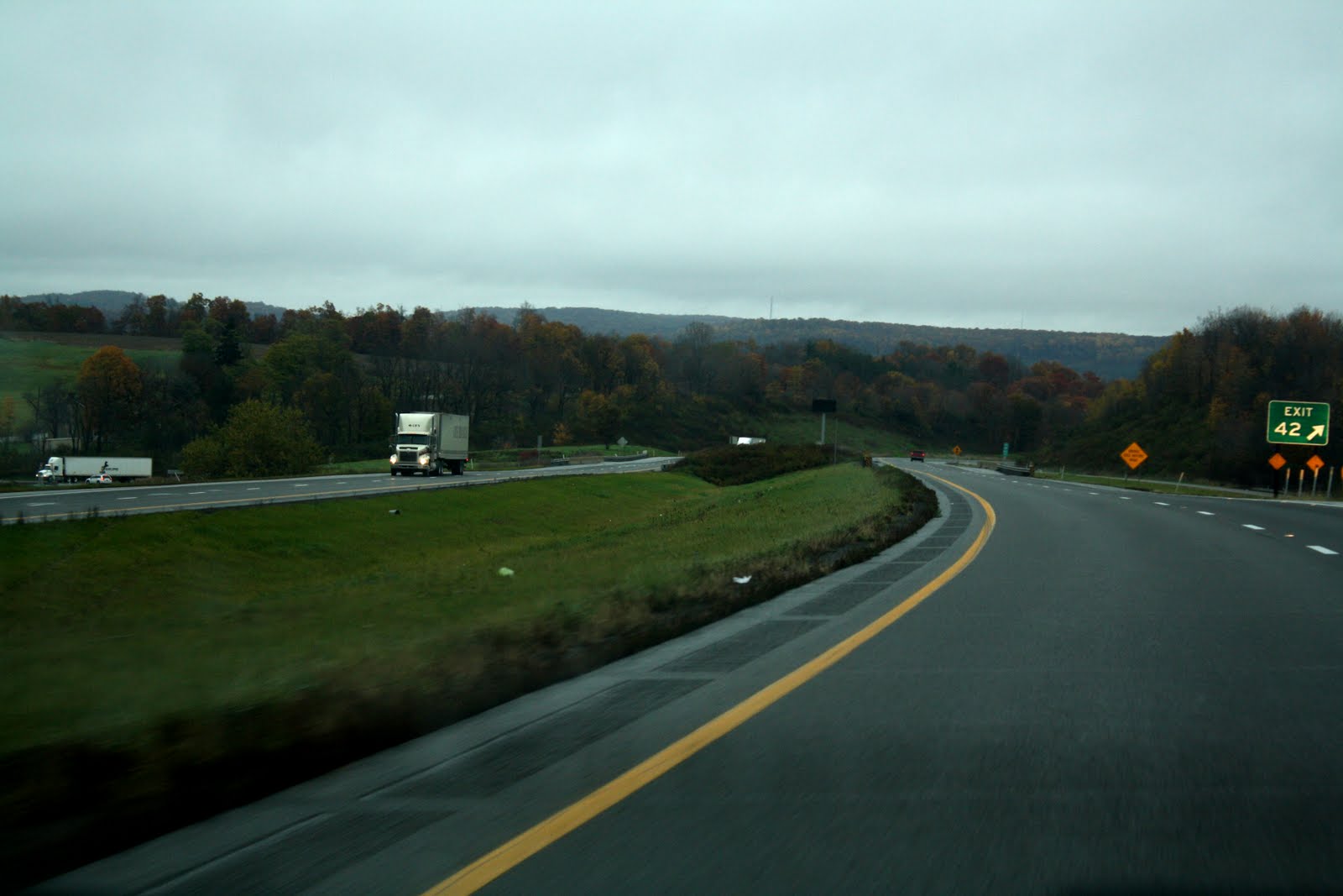
There were more trucks than cars on Interstate 80/90. That probably makes sense since it stretches from New York to San Francisco. UPS and Fed-Ex piggy-backs passed us both directions, all the three-trailer-pull variety. Truckloads of automobiles hauled both directions, as well, carrying bright blue Mazdas, black Ford trucks, silver Chryslers, and red Toyotas. I read names like Western Express, Patriot Transport Inc., USXL Worldwide, Covenant Transport, Pegasus Transport Inc. and M.S. Carriers. From the looks of the Interstate, it was hard to believe there was any slow down in production or any recession in the economy. The monster trucks just zipped along at 65 m.p.h., dominating the highway and outnumbering the passenger cars.
The Fallen Timbers Monument on the Maumee River paid tribute to the Indians and colonial militia who battled here over territory in the early 1790's.
"The Indians got screwed again," said Andy, as we walked around the bronze statue.
He was right. After failed military campaigns in 1790 and 1791 to crush the Indians who resented the white man's encroachment and settlement in the Ohio Territory, President George Washington turned to Anthony Wayne. Wayne assembled troops in Cincinnati, disciplined them for months as an army, and marched on 2,000 Indians in 1794. He found them here in what is now Maumee at a grove of trees downed by a tornado. Defeated not far away at the gates of Fort Miamis, the Indians signed the Treaty of Greene Ville, surrendering most of Ohio to the United States. Peaceful settlement of the frontier followed for 15 years. We walked around the statue, enjoying the unseasonable warm and knowing that the forecasted rain would soon be overhead.
The army broke ground to build Fort Meigs in February of 1813. Operated by the Ohio Historical Society, the earthen breastworks and log stockade with corner two-story parapets defended the Maumee River against the British and their Indian allies. The fort stood at the center of American military operations in the Northwest Territory and was intended to serve as a temporary supply depot and staging area for an invasion of Canada. Named for the Governor of Ohio, the garrison housed 2,000 U.S. regulars and militia from Ohio, Kentucky, Pennsylvania and Virginia.
The British laid siege on May 1, 1813, but after a four-day bombardment when Kentucky militia reinforced the fort, the British gave up, lifted the siege and returned to Canada. The Indians who had accompanied them were bitterly disappointed by the British failure to take the fort. They had hoped a British victory would drive out the American settlers and discourage any more newcomers.
In July the British besieged Fort Meigs again to appease their Indian allies, but American forces saw through the initial mock battle to lure them out of the garrison. The second siege failed, as well.
By December 1814, with the signing of the Treaty of Ghent, the war ended. Abandoned, Fort Meigs burned to the ground. The Ohio Historical Society restored it in 1974. Even though the museum was closed, the grounds remained open for visitors. We walked around the inside and outside of the Fort, admired the sunset and marveled at the history resurrected and preserved.