Pages

Wednesday, September 30, 2015

RETIREMENT TRIP #6
     THE GHOST LIVES    
                      September 2015                 
Andy packed the car as I checked out of the Dow Villa Hotel this morning.
“Did you enjoy your stay here?” asked Amanda, at the registration desk.
“Yes,” I grinned.  “I tried to have a little chat with John Wayne, but he didn’t have too much to say.  It only felt like he was around.”
“Are you the lady who was sitting at the table?  The one with the burgundy cloth?” she asked.
“Yes.   For hours both nights,” I told her.  I had typed in blog stories, loaded and adjusted photographs, edited essays for private students and checked AOL email and Facebook.  Andy sat with me checking emails and reading the paper.  “I sat at the table next to the old desk,” I told her.
In Red Rock Canyon State Park the iron oxide makes
cliffs look like bleeding rocks.
“Then he probably was around,” Amanda added.
I’m sure I looked very surprised.
“You were sitting at his poker table,” she explained.  “It used to be in the basement here.  I’m told that he and the guys would go down the basement at night to play poker around that table.”
WOW! Imagine that. I’m friends with John Wayne’s ghost!
Weathering causes unusual formations
in Red Rock Canyon.
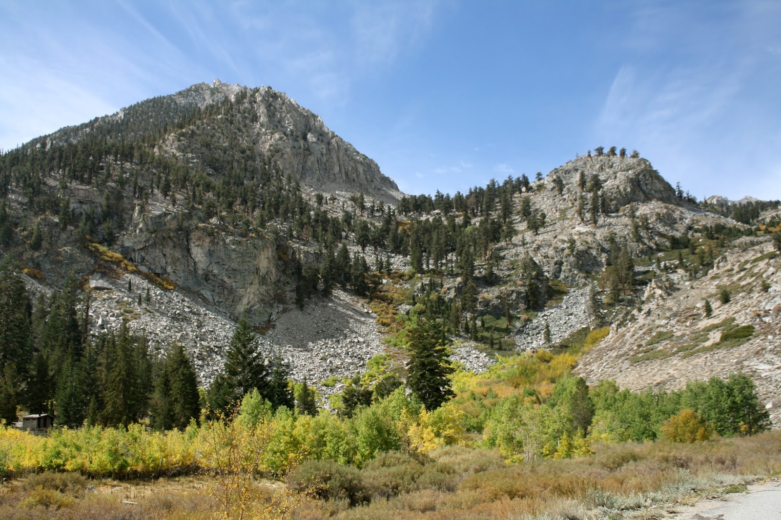
Our first stop today was Red Rock Canyon State Park in Ridgecrest, California.
“There are two little hikes here,” said Andy.  The formations were all badlands clay, but Ridgecrest gets so little rain.
The meeting of two geological plates produces uplifting here.
The Hagen Canyon Nature Trail was named for Robert Hagen, who originally owned the land and a store and a rudimentary inn here.  He sponsored walks into the canyon where two fault lines meet, one uplifting the other into angled slabs.  We followed the trail a mile in where it circled around the washes.  The red in the rocks is iron.  When it rains, the iron oxidizes and washes down, making the rock look like it’s bleeding.  At 10:30 a.m. the sun beat down, and it felt really hot.
A half mile up the canyon, the uplifting
is readily apparent.
But the trail offered beautiful perspectives of the badlands cliffs.  Lined with lava and basalt, the trail was easy to follow, but lots of side trails didn’t match the main posted map.  It was still a lovely walk early in the morning.
“This is Mohave Desert,” said Andy. “We have left the Great Basin.”
The car read 78 degrees, but it felt a lot hotter than that.
Randsburg is a mining town with people still living in the tiny one-or-two-room houses.  The welcome sign said, “Randsburg, a living ghost town.”
Driving down Butte Street was like going back about a hundred years in time.  Everything in town was closed except the grocery store, but most indicated “open on weekends.”
Johannesburg, population 172, was a mile away but on the main road.  Johannesburg actually had more livable trailers, but it wasn’t as quaint.  Here, the road in town had been re-tarred recently.  We advanced gingerly.
The third mining town, Red Mountain, didn’t even have paved roads.  But a modern Kern County fire truck drove back in among the tumbled shacks and rubble.
Spoils from mines dotted all the hillsides.
“And they just leave everything,” said Andy.
Businesses in Randsburg look like the set of a movie
in the Old West instead of real life.
Mines had been here for many years, based on the mountains of spoils.
“The criminal part is that all this is contaminated,” said Andy.  “It probably leaches out sulfur and who knows what else, but if anyone tries to come after the owners to clean it up, they just claim bankruptcy.”
From below Red Mountain, we followed Butte Street as it wound back into the hills of spoils.  It was the only paved road around, and it led right back to Randsburg.  There, far behind the town, was a huge strip mine.
“There has to be something of value here,” said Andy.  “They are cutting that whole hill down.  That’s why you got good cell service.  The tower isn’t for the people.  It’s for the mining company.”
Closed on Wednesday, shops in Randsburg announce
they are open on weekends.
Everything along the road was fenced with “danger” signs.  To me, living here was incomprehensible, but they did have great cell service.
On the south side of the mining towns it truly looked like desert.
“I think the Mojave is the harshest desert in the country,” said Andy.  “Great Basin is colder, but all you have here is creosote.”
I agreed.  It was mile after mile of creosote bushes.  We knew that nothing can grow around creosote, because the roots of the creosote poison the surrounding ground to eliminate competition for water.  Smart move, but it sure makes for an ugly landscape.  There was some sagebrush, but that didn’t help much.
After doing laundry and checking into the motel, we set out along Interstate #15 to explore the area.
“I’m doing the speed limit—70—and everyone is passing me,” complained Andy.
A pick-up truck whizzed by.  “Just let them go,” I suggested.  “We’re not in a hurry.”  Only the semis went slower, but for them the limit was 55.
We took a couple of exits off of I-15 to check out the landscape.  They were both absolutely disgusting with litter and garbage. There were broken bottles everywhere.  If California is such a wonderful place, this state has some serious problems with values.  I’ve seen few highways as disgusting.
People live and work in the mining town of Randsburg.
We turned off at Newberry Springs. It looked from the map like a whole “suburban” community with all kinds of streets.  Instead, we found dirt paths with street signs.  I guess it’s called urban planning.  The residents were pistachio farmers.  We followed paved streets all the way south to U.S. #40.
“A tour bus?” said Andy.  “What’s that doing here?”
Then we realized that U.S. #40 replaced the old Route 66.  Everything along this stretch was abandoned.
But the tour must have been a trip down Memory Lane to remember days gone by before the time of the super highway and the interstate.  At 23 miles from Barstow, time and the interstate had passed them by.
And U.S. #40 was also a mess with mile after mile of broken glass everywhere. 
“You’d need an army to clean this mess,” said Andy, when I suggested Adopt-a-Highway miles.
And he was absolutely right.
RETIREMENT TRIP #6
  ALABAMA HILLS AND JOHN WAYNE'S GHOST 
September 2015  
Driving in the Alabama Hills gives us a spectacular glimpse
at Mount Whitney in the far distance.
Cirrus clouds swirled in wisps overhead at 8:00 a.m., but the sun came out over Mount Whitney as we turned into the Alabama Hills.  The second highest peak in all of North America, highest peak in the contiguous 48 states, glistened in the sun.  It looked like a giant pipe organ lit from above.
Alabama Hills provide the site for more
than 400 movies, most of them Westerns.
Mobius Arch
perfectly frames the peak of distant Mount Whitney.
Andy parked at the trailhead, off an extremely rutted dirt road and all the cutoffs that crisscrossed the old movie locations. Mobius Arch Trail took us a mile into the jumbled rock formations where Roy Rogers and John Wayne filmed the old Westerns.  With the arch as a frame we watched Mount Whitney poke in and out of the high clouds.
Two road graders were smoothing the road when we hiked back to the car.  We waved a thanks and they nodded.  Temperatures were in the comfortable 70’s.
“We have time. Let’s go up the portal,” said Andy, turning onto Whitney Portal Road before I even answered.
“So now is that part of your To Do list?” I asked jokingly. “Climb Mount Whitney?”
Alabama Hills contrast to the foothills
of the Sierra Nevada Mountains.
Jumbles of rocks offer interesting
formations at the Alabama Hills.
“No,” he answered in all seriousness.  “I don’t really have a bucket list.”
We headed up the portal, 8,631 feet.
“Just think about those poor people who do that Iron Man-type run from Death Valley.  This is the end of it—at the top of the portal.  There’s a village up here, but the run is in the summer—a hundred miles.”
Well banked but with no side protection, Whitney Portal Road
allows for no errors in judgment. 
The road, paved all the way, addressed the climb with few switchbacks.  Signs read “active bear area” everywhere we looked.  Andy had read that the little store at the end of the road in Whitney Portal was THE place to come for pancake breakfast.  But we had had Danish and coffee, and it was already 10 a.m.
I grabbed my jacket to climb up to the waterfall.  It was 57 degrees, but there were easily a hundred cars in the Hiker Lot.  Every year more than 10,000 people make the strenuous 22-mile hike to the summit.
Coming down we could see miles and miles in both directions.
“Look at that!” said Andy.  “There’s nothing in it.  It’s just like Death Valley.”  He was absolutely right.  There wasn’t a sign of settlement.  All the people were up at the portal.
We balance on rocks in the center of a
waterfall at the top of Whitney Portal.
A coyote crossed the road in front of us, but I wasn’t quick enough to get his picture.  He kept moving—focused on breakfast.
Whitney Portal Road was built in 1936 by the Civilian Conservation Corps (CCC), part of Roosevelt’s “New Deal.”  It served as a setting in 1941 for Humphrey Bogart’s classic High Sierra and in Lucille Ball and Desi Arnaz’s film The Long Trailer.  Then Luci surreptitiously fills a travel trailer with her rock collection until it’s too heavy to ascend the grade.
We made it up and down with ease.
“This is the road the Iron Man-type runners use to go from Death Valley to Whitney Portal,” said Andy, turning into the old Owens Lakebed.  The old lake had been sucked totally dry by the city of Los Angeles.  More recently something had to be done to keep the ground damp or it turned to blowing white powdery dust that penetrated everything.
Two charcoal kilns remind visitors of past activity in the area
when miners needed charcoal to process ore.
A historical marker at Cerro Gordo marked the turnoff into the mountains where the Cerro Gordo deposit was discovered by Mexicans in 1865.  The mine eventually produced $17,000,000.00 and for a time was the richest deposit in the U.S.  We remembered going up the dirt road 30 years ago when a woman at the information booth had said it was drivable.  Then our rented car overheated on the steepest turn. Andy ordered us out and away as he carefully maneuvered the vehicle in neutral backwards to a level spot.  Once it cooled, he turned it around.  We never did reach the mine, and we weren’t about to try it in a Toyota Yaris.
A little farther on we crossed the 110-square mile dry Owens Lakebed.  It’s hard to imagine that this dead valley was once a beautiful lake.  But it’s the water and mineral wealth of this place that created the Pueblo of Los Angeles.
We went through Olancha, an 1870 supply depot for Owens Valley settlers.  That was before Los Angeles bled it dry.  Now Olancha has a population of 39.  But just outside of town was a huge plant for Crystal Geyser Spring Water.
A defunct factory, perhaps one that processed salt,
stands idle on the shores of dry Owens Lake.
After all wood near the Cerro Gordo mine had already been cut down, charcoal was prepared in these kilns across the valley and shipped by steamboat across Owens Lake where timber trucks hauled it up to the mine and processing plant.
From Route #395 we could see the dry Owens Lake and a defunct salt mining plant factory near the dry lakebed.
At the intersection Andy turned onto Lubkin Canyon Road.
“This is our last drive into the mountains for today,” he said.
Horseshoe Meadow Road climbs steeply into the mountains only
ten miles from Whitney Portal but with very different scenery.
We were bumping along a one-lane paved trail toward Horseshoe Meadow.  Then the road climbed in steep switchbacks.  Huge lodgepole pines and mountain hemlocks dominated the top.  Signs warned, “Active bear area.”  Unlike Whitney Portal, Cottonwood Pass opened on a spacious flat meadow dotted by trees.
The trail to Horseshoe Meadows passes
through a high, flat forest at more than
9,000 feet in elevation.
The ground, powder dry dust, rose in poufy clouds with each step, as we set out for Horseshoe Meadow.  Totally unlike Whitney Portal, only ten miles away, here the trees spread out with little competition from ground cover.  Those dead ones on the ground showed decay.  There’s much more moisture here than in the Bristlecone Forest.
We hiked in a mile, following a trail that was roughly lined with stones and tree limbs.  A half hour in when the trail reached the rock rubble of the canyon, we turned back, unsure of which direction the branch trails headed.
Standing on the narrow road to Horseshoe Meadows,
the view over the edge is breathtaking and frightening.
Coming down we stopped at the take-off pad for hang gliders.  Now that’s seriously taking your life in your hands.
“If you don’t catch the updraft and get out, you have nothing but rock spires beneath,” said Andy, as we stood on the pad and felt the updraft.   “You have to make it all the way down to the valley.”
The broad pullout 18.3 miles up the canyon is called Walt’s Point.  It was a long way down!
In the back corner of the Dow Villa
Hotel lobby, John Wayne still lives. 
The hills to the east of Lone Pine are huge mounds of packed dirt and rock.   They don’t have the rugged jaggedness of the Sierras, but in the setting sun the greens and reds stood out.  They cast beautiful shadows.  We only went as far as the pavement lasted.
“I’m not getting my clean car dirty,” said Andy.  We had washed it at the coin-op a few hours before.
So tonight as I diligently work, sitting in the lobby of the Dow Villa Hotel where John Wayne stayed when he filmed his Westerns, I wonder about the famous actor and what he would have been doing here.  Surrounded by his pictures and film festival posters, I feel his atmosphere... maybe his ghost... permeate the air.  The hotel amenities? Well, it's a quaint place.  But John Wayne, wherever you are, I'm thinking of you!

Tuesday, September 29, 2015

RETIREMENT TRIP #6
        PRACTICING SHAKITI NA GAI       
             September 2015         
Glacier Lodge Road follows Big Pine Creek into the mountains.
 Last night was the lunar eclipse and a blood moon. Not another like it until 2033.  That’s 18 years away, so we could miss it!  Here in the desert where the sight should have been stupendous, we couldn’t see a thing.  There was a blanket of clouds covering the sky.  Of all places where night viewing should have been spectacular, we had none.
The clouds hadn’t left this morning, so it wasn’t just a teaser.  But it didn’t rain either.  At least not so far.
The Sierras rise majestically along Route #395.
Just exploring early this morning, we followed Glacier Lodge Road high up into the mountains.  It followed Big Pine Creek, flowing down from ice melt.  The road wound through an avalanche area that warned, “No Stopping and No Pedestrians.”  All the upper campgrounds in the area had already closed, but campers still occupied spots in the lower campground, even on a Monday in late September.
Hikers, setting off from the North Fork parking area, all wore long pants and heavy jackets.  Our car said 55 degrees.  Dressed in shorts for lower elevations, we hopped out only briefly to snap a few pictures.  Someone slept in a camper nearby, but all the horses from the Pack Train corral had been loaded on trailers and removed.
Onion Valley Road climbs high into
the backcountry.
South of Big Pine on Route #395, a pullout explained that the first road here in 1920 was actually an eight-foot wide concrete sidewalk.  Even before it was completed the residents felt it was inadequate.  I took a picture of the pay scale posted on the interpretive sign.  The foreman made pretty good money.  It just shows his education really paid off!
A butterfly lands on a wildflower
near the cliff edge.
In the background the mountains rose majestically.  We could see the steep drops where avalanches had left their mark.
Down in the valley the land was dry and strewn with volcanic black basalt.  It was also 80 degrees at 10:30 a.m.
Although Independence, population 669, was centered in the middle of a dry valley, the mountains on both sides rose sharply to impressive peaks.
“I guess they burn wood here,” said Andy, when we passed trailers and small homes with wood piles.
The county Court House and the Inyo County prison and a juvenile detention facility make this small town an important place.
Onion Valley Road winds and twists through rugged terrain. 
We took Onion Valley Road into the mountains since we had plenty of daylight ahead.  A creek, heavily lined with pine trees, indicated the presence of a good supply of water.
“That’s a good picture,’” said Andy, pulling over to an unprotected edge.
He was right, but I held my breath.  “The green makes a lovely contrast to all the rock.”
As I focused the picture, a butterfly, no more than half an inch across with wings spread, landed on the plant at my feet.  How delicate and fragile a creature in this land of harsh vastness!  Quickly I changed settings and snapped away.
The closer we drive to the campground, the more trees pop up.
Onion Valley Road kept going and climbing—actually above some of the adjoining peaks.  It continued to switchback along the creek bed deep into the canyon.  Suddenly it opened onto a meadow at 9,200 feet: Sequoia Kings Canyon Pack Train corral.  At least 25 cars filled the parking lot.  The California Big Horn Sheep Zoological Area and Muir Wilderness adjoined.  Nearby the Pacific Crest Trail cut through the mountains.  This was a major wilderness area and now we had blue sky to go with it.
Near the Onion Valley
Campground a stream gushes
down the mountainside.
We walked past the stream that pooled near the parking area and then strolled along the one-way drive through the campground.  Every slot was reserved, even the walk-in areas, and many were taken through October 6.  No wonder!  These were gorgeous campsites with pump water every few sites and clean outhouses.  “This is a major connection point for hikers,” said Andy, “and in the sun it’s actually hot.”
The car read 70 degrees, but it felt warmer than that.
An interpretive sign read, “Don’t underestimate the intelligence of an animal that can ride a motorcycle.”  Beneath it, bear-proof lockers stood ready for hiking and camping provisions.
At the Onion Valley Campground entrance at the Inyo National Forest facility, the sign-in fee said, “$18.00 per site, $5.00 per extra vehicle and $15.00 per three bundles of firewood.”  I guess camping fees have kept pace with motel costs.
At Manzanar 36 block houses like this one house more than
10,000 displaced Japanese-Americans during World War II.
Mary Austin lived here in Independence from 1868 to her death in 1934.  Then Independence had promise.  Now, since Los Angeles has purchased most of the water rights, many of the stores are vacant.
The simplistic interior of the block
house in 1942 shows the difficult
conditions that families faced.
Andy pulled into Manzanar.  Years ago I would have had no knowledge of this place.  In suburban Chicago in the 1960’s we didn’t learn about U.S. treatment of others during World War II.  We were the good guys; we practiced democracy.
I know differently now.  Manzanar and camps like it are America’s black eye.  
During three years of isolation,
the detainees create gardens
like this in the harsh climate.
We watched the 22-minute film in the Visitor Center and spent the rest of two hours driving the Auto Road.  A barracks from initial occupation in 1942 and another from 1945 illustrated daily life at Manzanar. The detention camp for more than 10,000 innocent Japanese-Americans was a travesty.  Many years ago when we had been here, there was almost nothing to remind us of what had been done in wartime in the name of “justice” and “safety.”  Now a moving memorial recorded the history and the truth.
Draped with paper cranes, the cemetery monument pays
tribute to the 150 innocent souls who died here.
Several of the blocks had stone-lined gardens that the Japanese detainees had constructed to make life more bearable.
The garden for barracks #34 included rocks that resembled a turtle and a crane, the symbols of longevity and vitality.
Six burials remain here at Manzanar of the 150 people who died here at the relocation center.  Nine others were removed by relatives after the war; most others were cremated.
One guard tower, rebuilt to illustrate the towers at each corner of the barbed-wire city, illustrates the major horror of Manzanar: imprisonment.
The entry sign stands starkly against
the gorgeous backdrop of mountains.
As former President Ronald Regan said, “We made a mistake.”  To help rectify the costly error, a sum of $20,000 was given to each of the 60,000 detainees who were still alive.  Initially 120,000 had been removed from their homes on the West Coast and imprisoned in ten internment camps across the country from California to Arkansas.
A guard station like this one at each corner of the complex
reminds visitors that life here was truly imprisonment.
We stopped at the Inter-Agency Visitor Center in Lone Pine.  At least 50 people looked at displays, browsed in the gift shop, and asked questions of the Forest Service employees.  Andy wanted information on the Alabama Hills; I checked the map for Garden Grove.
“We have a picture of Drew sitting on a split-rail fence here.  It’s in the scrapbook,” said Andy.  The split rail fence no longer exists and the picture must be from at least 30 years ago.
The Alabama Hills is the setting for
more than 400 movies.

After we had checked into the hotel in Lone Pine, we headed back out to explore the Alabama Hills, the site of more than 400 movies.
The granite here underwent chemical weathering after being uplifted 100 million years ago.
The area got its name when prospectors sympathetic to the Confederate cause named their mining claims after the Confederate warship that wreaked havoc during the Civil War.  The name stuck.
Here in this harsh environment many of the old Westerns
were filmed with stars like John Wyne.
Beginning in 1920, Hollywood filmmakers took an interest in the Alabama Hills.  Movie stars, such as tom Mix, Hop-along Cassidy, Gene Autry and The Long Ranger, all shot it out here with the outlaws. More recently Star Trek Generations, Gladiator, Iron Man and Django Unchained were filmed in the Alabama Hills.
Beauty surrounds visitors in this
land of harsh reality. Shakiti na gai.
Each October the community of Long Pine hosts the Lone Pine Film Festival and famous people return to the community as guest speakers and film aficionados.
What a place to stay! I sat at John Wayne’s desk in the Dow Villa Hotel and typed my story.
"Shakiti na gai," I thought to myself.  I had learned that at Manzanar.  It was the attitude of many detained Japanese, a stoic acceptance of fate.  Hemingway would have been proud of them.
I went back to my story.  "Shakiti na gai."  Right now, fate was kind.
RETIREMENT TRIP #6
     IN THE LAND OF THE ANCIENTS    
        September 2015       

At Vista Point pullout, we can see tiny patches of snow
on peaks in the distance. 
“It’s going to be 95 in the valley again today,” said Andy.
“But we won’t be there,” I answered, checking to make sure my jacket was in the back of the car.  I knew I would probably need it if we were headed back up into the mountains at the 13,000-foot level.
“These Bristlecone pines are only at about 10,000 feet,” said Andy.
“Cool enough.”
“I think this grove is the oldest known trees on earth,” he continued.  “It’s the site of the Methuselah tree, and they don’t tell you which one it is either.”
Sierra View is on top of the world.
“That’s a shame, but it also makes sense,” I answered.  I can’t fathom how people could be so callous that they could do damage to anything so rare and priceless.  But then again I know there are thoughtless individuals who would carve initials to leave their mark.
Andy rests at the foot of a Bristlecone Pine.
It was a 24-mile drive to the Schulman Grove.  We passed three road bikers on the narrow, winding road in.  Andy slowed for each one so there was no chance we’d meet another car coming the other way on the bends. All three had small bottles of water, but what strength it takes to ride thousands of feet continuously up in elevation!  They must have started up by 6 a.m. to make it so far by 9:30 a.m.
“Imagine their lung power!” said Andy.
I guess this is training for La Tour de France.
Growing in the nutrient-poor dolomite soil, Bristlecones
have little competition with other plants.
At the Sierra View Vista Point pullout we walked the scenic trail out to the point.  Hazy in the morning sun, the peaks in the distance towered 13,000 to 14,000 feet.  Mount Whitney was about 30 miles to the south.
“That’s why Death Valley, the driest spot in North America, is so very dry,” said Andy.  “There are four major ranges before the clouds can get to that valley.  It still has the highest recorded temperature on earth of 134 degrees at Furnace Creek.”
Bristlecones cling
precariously to the
sides of the mountains.
                                      
                          We drove on leisurely to Schulman Grove. It was 64 degrees.  I didn’t really need my jacket.
At the Visitor Center, high in the mountains, Interpretive Guide Jackie chatted with us about travel and her own love for the Sierras.  She readily accepted a few dollars in change that Andy had collected and helped us pick out a unique souvenir monarch butterfly pin.  Above all, traveling lets us meet wonderful people like Jackie.
The 4.5-mile Methuselah Walk, a journey through the oldest known living forest, took us three hours and 25 minutes.  It climbed and descended 800 feet and reached higher than the 10,200-foot elevation.

With shallow roots that may extend out
fifty feet, Bristlecones absorb all
available moisture.
Here, sun beats down, wind sculpts rock and snow can blanket the ground for months at a time.  Change is slow and footprints last for years.
The Bristlecone, growing in one of the most inhospitable climates on earth, holds the secrets of longevity.
As we walked, we read about the ancient marvels.
Most Bristlecone Pine cones are purple, due to the presence of a pigment called anthcyanin.  Pollen from cones pollinates the small bristly purple seed cones, which close and begin to grow before winter.  The seed cone grows, matures the next fall, opens to release tiny white-winged seeds to the wind.  Reproduction isn’t easy.
Bristlecone pines grow better on northern slopes where snow melts less rapidly and water evaporates more slowly.  A seed may sprout and get its start in the alkaline dolomite soil and grow only about an inch a year.  Because few other plants can tolerate the alkalinity, the tree has little competition, but the soil is nutrient-poor.  Each tree sends out shallow, lateral roots for stability, water and nutrients.  Bristlecones have no deep tap roots.  The resinous nature of the wood protects them from fungus and insects.
Living on top of the world, Bristlecones bear inhospitable
conditions but have little competition from other plants.
New growth rings are added yearly, but they are so small it might take a century to add an inch of thickness.  That inch could contain up to 300 growth rings.  It is said that the Bristlecone rings can be dated back to 6,700 B.C., which is more than 8,715 years of tree-ring history.
The trail, not much more than a foot wide in some places, cut into the steep slope and skirted the edge of high ridges of the sub-alpine life zone.  Bristlecones and Limber pines grow on the north-facing slopes, where dolomite soil predominates.
Bristlecones, with needles attached
in whorls of five, keep
their needles for 30 to 40 years.

Somewhere in this grove is the 4,600-
year old Methuselah Tree.


                                   Sage and mountain mahogany grow in darker, richer soils on the drier south-facing slopes.  As the climate warms, pinion pines are moving in.
Because Bristlecones keep their needles for 30 to 40 years, little residue litters the forest floor.  This prevents the spread of fires.
Somewhere in the Methuselah Grove is the tree located in 1957 by Dr. Edmund Schulman to be more than 4,000 years old.  We know today it is more than 4,600 years and is still alive and producing viable seeds.
Greater adversity seems to grow stronger trees, even century after century.
The twisted forms look like sculptures
in the high desert.
The sensitive nature of the tree gives scientists records of the past.  Climates, droughts, severe frost, fires, volcanic eruptions can all be recorded in these ancient pieces of wood.
We passed a cut branch from a fallen Bristlecone.  A small gouge showed the year Christ was born.  The tree was dated as living 1,000 B.C. to 650 A.D.  I touched it gently, awestruck by the magnitude.  Not only had it lived so far out of my realm of imagination but it had not rotted in 1,400 years.
In the high desert old age
is impressive.
 
As Andy and I sat together on one of the benches donated by the Manasett Rotary Club of New York, I breathed in the nippy mountain air and closed my eyes as the hot sun bathed my face.  I wanted to come back here in times of stress.  I wanted to hear the call of the sapsucker and the whistle of the nuthatch and the scurrying feet of the golden mantled Ground Squirrel as it searched for seeds before the first snowfall.  But most of all I wanted to breathe in the peace of this environment of stunted, ancient trees—3,000 to 4,000 years old and still growing--not in spite of adversity but because of it.  It is a place I didn’t want to leave.
Bristlecones thrive
where nothing else
can stay alive.
We checked out Deep Springs.  It turned out to be a ranch, but the entrance said Deep Springs College.  The cluster of trees looked out of place in the dry valley, next to the salt flats and dried out bed of Deep Springs Lake.  That would be a lonely place to go to school.
Back down in the valley, radio telescopes from Cal Tech
look for life in other places.


Another turn to a dirt road took us to the Cal Tech radio telescopes.  We walked in to the one that wasn’t gated to take a picture.
“We’re actually crossing the desert on foot,” I told Andy.  “We’re pioneers.”