Pages

Sunday, January 30, 2011

Taking Chances with the Weather

Mississippi has gone full tilt into casinos. That should provide jobs, even if many positions are minimum wage. There are 11 casinos in the Gulfport-Biloxi area alone, according to one pamphlet.
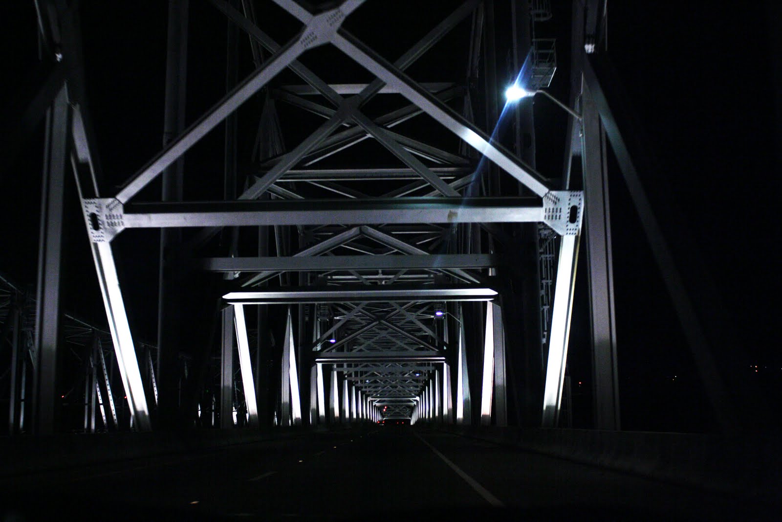
"We're going to Gulfport today," said Andy. "That's a town that was annihilated by Hurricane Katrina." Route #84 carried no traffic early Sunday morning; only an occasional crow pecked away at an opossum carcass. "This is probably as good a day as we will get weather wise." A few drops spattered the windshield and heavy grey clouds threatened more to come.
In Waveland, Mississippi, on the Gulf of Mexico, we had the oil changed at a Walmart Super Center.
"We were operating out of a tent after Katrina," said a Walmart clerk. She and I talked about all the snow up north. "When we get even an inch of snow, everything closes," she said. "It just grinds to a halt. The last time we had snow, well, let's see, I guess that was right before Katrina."
Here, time is measured by the Hurricane--before or after Katrina. It was understandable.
We drove through Pass Christian on the water. Lot after lot was empty, vacant, devoid of the gorgeous homes and of debris remnants, as well. "They cleared it all up," said Andy. For Sale signs on the outskirts of town suggested some people chose to take insurance money and leave, or maybe some who left before the storm just didn't return. Lots of new high-rise complexes lined Route #90. "I think the tidal surge was 22 feet," said Andy. "Those new buildings would still flood. Most are raised ten feet, and the lots are probably six or eight feet above sea level, but look how many are still for sale." From the looks of the balconies and overhangs, many high-rise apartment units were empty.
The white sand beach of Pass Christian and Long Beach and Gulfport ribboned along the grey water. "The beach looks wonderful, considering the oil spill," said Andy. Patches of new sea grass on raised sand mounds dotted the shore. For miles, the beach stretched in silence. Not a soul walked the sand on this overcast winter day, even though pansies bloomed in the median and palm trees swayed gently by the roadside.
A white egret hunted for dinner at low tide in the murky waters of Davis Bayou at Gulf Islands National Seashore. It tipped its head to listen, stepped forward, one long leg and then the other, and with a quick thrust of beak in water, speared a tiny fish. At an alligator pond near Starks Bayou, a turtle rested precariously on a fallen log. We walked three short trails, avoiding a few raindrops, shooing away no-see-ums that circled our heads, watching for alligators.
"It's warm enough," said an elderly gentleman from Atlanta, as we chatted on the boardwalk. "It's 61 degrees, but alligators like the sun, and they won't get any of that today."
We read a nature display nearby. "Andy, look," I got his attention. "This area was under 15-20 feet of water when Katrina struck on August 29, 2005." The display explained that nature heals herself. "In the bayou the rise and fall of daily tides bring nutrients to and from the salt marsh, making it one of the most productive natural environments on earth." I read the interpretive trail guide. "It would seem man needs to take some lessons from nature," I said. "We destroyed so much with all our thoughtless building, and nature knows how to heal herself."
We drove along the shore in Biloxi. "The casinos are back," said Andy, "but many of the homes have not been rebuilt." Lot after lot was vacant with For Sale and For Lease signs everywhere.
"The difference is that Mississippi politicians got money to clear the debris immediately," said Andy. "At least the clearing is giving things a chance to grow again. In New Orleans, there are still whole neighborhoods left in ruin. And there are so many more plots of land available than the current market can bear."
"But maybe they'll get it right this time," I suggested. "Maybe they'll create more stringent building codes and build away from the sand beach like they have in Gulfport and create parks closer to the water as buffers like they did in Biloxi. It's no wonder people are impatient," I said. "In five and a half years the bayou has healed, but so much more has not."

"Tracing" History

"Now that's what I call a he-man," joked Andy, as we loaded Little Red in Vicksburg. Our motel neighbor, a good looking man in his thirties, stood outside his door, a cigarette in one hand and a Bud Lite in the other. "That's his second," said Andy. An empty bottle rested on the sill next to him. "But he's considerate. He doesn't smoke in the room."
"If that's a he-man," I told Andy, "I'm certainly glad you're not one!"
The Natchez Trace was already outdated by the time of the Civil War, but in the early 1800's, this road through the Mississippi wilderness opened the frontier for settlement.
Used by mail carriers, itinerant preachers and traders, as well, it started in Nashville and extended south to Natchez. We leisurely drove the 50 miles, relishing the gorgeous weather and stopping at all the pullouts.
Five plagues killed Rocky Springs, a thriving town of 2,616 people in 1860: erosion due to subsistence farming and cotton plantations; the Civil War, when slaves ran away and horses and mules were stolen; a yellow fever epidemic, that killed off more than 40 people; the Boll Weevil, that destroyed the cotton crop in the early 1930's; and finally, the dying of the natural spring.
Nothing is left except two safes, two dry cisterns and the Methodist church that ended services in 2010.
Owens Creek, nearly dry as well, showed green spring growth and a few hardy bugs on January 29.
Evidence in Magnum Mound, an ancient burial ground, suggested that prehistoric people took the lives of servants when a chief died and sacrificed the family members out of deference and respect when an elder passed away.
Grindstone Ford, where the Natchez Trace crossed a creek, was a cemetery with eight or ten tombstones from the 1800's. Although abandoned in the woods, the sites were identified by name. As I looked at Jane, who died in 1823, I thought of the 12,000 unidentified soldiers interred at Vicksburg. I guess it didn't matter either way, identified or not.

At Sunken Trace, the road had eroded ten or twelve feet below ground level. It must have been dangerous and scary to walk this section through Choctaw Indian territory.
We stopped for trail bars at Mud Island Creek picnic area and walked the Procession Forest Nature Trail at Bullen Creek. Clouds rolled in, forerunners of rain, and the 74 degree temperatures cooled.
Restored to the way it looked in 1820, Mount Locust, a plantation home with 1,200 acres of cotton, corn and hay, served as one of the inns along the Old Natchez Trace. A four-room, two-story annex called Sleepy Hollow, that was erected behind the plantation home of William Ferguson, his wife Paulina, and later her second husband James Chamberlain, housed foot travelers on the Trace from Natchez north for 25 cents a night. The fee included dinner, which usually consisted of corn meal mush.
Volunteer Guide Lynda showed us the modest farm house and explained that the inn often accommodated as many as 25 weary travelers, who floated their goods to Natchez on wooden rafts, sold the lumber for whatever they could get and walked back north on the Natchez Trace.
"This is really comfortable," said Andy. "I could live here."
"No, I don't think so," I told him. "The cook house is gone. You wouldn't get much to eat, even if there was only corn meal mush most of the time."
"Follow that path to the slave cemetery," said Guide Lynda, pointing from the back doorway, "and that one to the family plot, where most of the family members are buried." She told us that one traveler who died at the inn was included in the family graveyard. Only one small stone marker, barely visible above the fallen oak leaves, remained in the slave cemetery. Outside the family plot a patch of daffodils in full bloom nodded gracefully in the sunlight patchwork of oaks and locusts.
"Just think," I said, "short sleeves and daffodils in January!"
Our next stop, Emerald Mound, is the second largest ceremonial mound in the U.S. built in the Mississippian Period, 1730-1200 B.C., by the ancient ancestors of the Natchez Indians. The 35-foot high dirt mound covers eight acres, 770 feet x 435 feet, but two small mounds sit atop the primary mound for a total height of about 60 feet. Named for a plantation on the site in the 1850's, Emerald Mound was first seen by white men when explorer Hernando de Soto passed through North America. All the nearby villages and ceremonial centers were abandoned in the 1600's, perhaps partly because of diseases introduced by de Soto and his men, as well as the intrusion of Europeans and internal village strife. We climbed the mound, probably the setting for elaborate civic processions, ceremonial dances and solemn religious rituals. Andy topped the 50 steps first.
"Okay," I called out. "Do your thing, Emerald Mound King!"
Near the southern end of the Natchez Trace, we walked a short path to one brick wall in the woods, all that is left of Elizabeth Female Academy. Founded by Elizabeth Roach in 1819, the Mississippi school was the first college in America to confer degrees on women and the first female school of higher learning in the U.S. There certainly wasn't much left of it.
Scaffolding enveloped Melrose, considered by many to be the finest home in all the Natchez region. The Greek Revival-style plantation house offered tours for a fee, in spite of renovation work. We walked the grounds of the plantation instead: the dairy, carriage house and slave quarters, with displays about life in bondage. Melrose plantation master John McMurran owned 75 slaves between 1841 and 1861. They prepared the family's meals, served food, drove the cart, tended the gardens and yard, cared for livestock, worked the cotton fields and maintained the buildings and grounds of the 132-acre estate.
A display explained that researchers found it difficult to obtain honest feelings about slavery from former slaves. Even as late as 1930, people who had been slaves feared reprisal against their families if they said too much. I read the commentary. No one who lived as a slave could be alive today to be interviewed. Thank goodness things have changed and people have moved beyond such inane questions as How does it feel to be a slave?
We drove back over the Mississippi River Bridge and walked the Promenade along the river in Vidalia, Louisiana. Clouds moved in, tinged pink and blue from the setting sun, and suddenly the spring warmth disappeared.
"It's not going to be nice tomorrow, is it?" I asked.
"No," said Andy, "and I read that severe weather is on the way. It's not tornado season yet, but thunder storms are predicted."
Headed back across the bridge, we entered a brilliant pathway of light across the great black waters of Old Man River. The bridge rumbled as we rolled east.

Friday, January 28, 2011

Remembered

On the way south from Dumas, Arkansas, we drove by Lake Chicot. Set far back from the road, rambling brick homes lined the lake shore, their spacious front lawns stretching a couple hundred feet to the road.
"This is a retirement area," said Andy.
I could understand why. Across the road on the other side lay miles of flat farmland, rich black earth tinged green with clover to be plowed under or beige with the chucking from corn stalks or brown and white with the remains of cotton.
"The lake is crescent shaped," I noticed, looking at the map.
"That's because the river changed course," said Andy. "See all the twists and turns between Arkansas and Mississippi? The river can't make up its mind, but the state boundaries don't change. You just might find yourself living on a different side of the river after a big rain, but you'll still be in the same state."
"That is, if your house doesn't wash away first," I added.
In Eudora several older men raked their garden plots. "They can plant in about a month," said Andy. Temperatures today were predicted to reach 68 degrees, 72 degrees for tomorrow before the cold snap dips into the 40's again, and even warmer south of here.
As we crossed back into Louisiana on Route #17, the odometer on Little Red turned over 100,000 miles. "I never thought I'd see that on this car," said Andy. "It certainly doesn't look 16-plus years old.
Signs advertised boiled peanuts and sweet yams in towns like Oak Grove and Forest. "I guess we know what is being grown here," I said.
"Yes, and soy beans," said Andy.
"And the trailers are raised off the ground, so it must flood frequently," I added.
"Well, look at the water in the culverts," said Andy. "It doesn't take much to flood, and the brick houses are all on slabs. I think they do it more to keep out the snakes though."
Poverty Point State Historic Site, affiliated with the federal government, was named for the plantation located here in 1850. But cultural and historical significance extends back to 10,000 B.C., when this region attracted hunter-gatherers who settled in northeastern Louisiana and to 2000-500 B.C., when they established a permanent community of about 2,000 people.
"We applied for World Heritage Certification," explained the ranger, "and we think there is a good chance."
The incredible earthworks of Poverty Point overlooking the Mississippi flood plain include mounds and ridges, built by an unknown people around 1600 B.C. They moved enough dirt to build a structure the size of the largest pyramid in Egypt. They did it all with baskets and bare hands. In addition, one mound, 72 feet high, retains the effigy of a bird in flight with a 656-foot wing span. The mound, with a flat 20 x 30-foot platform along the tail, is considered an ancient temple, since bird effigies and carvings were found in the village area that surrounded the temple mound in six concentric semi-circular arcs or ridges. The temple mound, considered the largest in the western hemisphere at the time of its construction in 1400 B.C., had a volume of 90,000 tons of dirt, all carried in baskets.
Studies by the American Museum of Natural History and later by Tulane University uncovered planned building and leveling of other mounds by these ancient peoples, dated around 3,600 years ago, and requiring at least five million hours of labor to construct. It was a great communal engineering feat. The plaza included evidence of circular buildings up to 202 feet in diameter buried under the farmland.
The Poverty Point inhabitants participated in extensive trade, as well, with others from Appalachia to the Midwest to the Great Lakes 1,499 miles away, and they developed art that included stone beads and carved figurines, most with broken heads. They ingeniously molded earthen balls for boiling liquids and for baking. Stone was not available to make cooking implements.
"Someday this park could be incredible," said Andy. "The potential is all there, but they have a long way to go." The mounds were just being cleared, and a group of supporters met behind the closed door of the museum.
My desire to do archaeological digging and discover rarities burned again. Even Crater of Diamonds didn't kill the longing for a find.
We crossed the Mississippi River and stopped at the Welcome Center, complete with an elegant parlor and coffee and cookies for guests. The sign said, "Welcome to Mississippi, Home of America's Music."
But music was not what Andy had in mind for the rest of the day.

We checked in at the gate of Vicksburg National Military Park and spent the next four hours taking the Battlefield Tour.
For 16 miles the blue Union markers and the red Confederate markers showed visitors the military positions and fortifications for one of the most significant battles of the Civil War, a battle that determined control of the Mississippi River and divided the Confederacy in two. The Union victory of Ulysses S. Grant here marked one of the great Northern objectives of the war and prompted President Abraham Lincoln to say, "The Father of Waters again goes unvexed to the sea."

Andy and I were amazed at the close proximity of the Union and Confederate lines as we drove to 15 major stops, walked around the major state monuments, and drove by hundreds of stone markers.
A battery of 22 cannons, most on display, had hammered the Confederate Great Redoubt for months in the late spring of 1863. Grant knew that direct attacks failed, and even tunneling under the fortifications and planting explosives didn't dislodge the Confederates from the high ground. So with the river blockaded by gun boats, he turned to bombardment to starve them out.
Particularly impressive, the white marble Illinois Monument, with its 48 steps and gold leaf eagle, stood high on a Union redoubt next to the Shirley House. Union troops called the Shirley farm "the white house," the only structure in the park that survived the war.

The Wisconsin Monument, 100 years old this year, proudly displayed Old Abe at the top, a six-foot granite eagle that is the symbol of the Screaming Eagles Airborne. We were saddened that this beautiful monument, a tribute to those who served from the north, had been vandalized with graffiti. Removed and cleaned, the evidence of thoughtlessness, or worse of hate, was still visible.
The more we walked, the more the temperatures climbed. Andy, in shirt sleeves, left his sweatshirt in the car. Others jogged in shorts. "Look," said Andy, "those trees are actually budding, and the grass in the sunny areas has already greened."
An obelisk paid tribute to the Union Navy, sailors who blockaded the harbor from February of 1862 through November of 1864.
Nearby we found a museum and the remains of the U.S.S. Cairo, one of the seven ironclad gun ships on the Mississippi River and the only one to survive. The Cairo, brought down in 12 minutes, was the first ship in history to be sunk by an enemy mine. No men were lost, but the Confederates had learned the vulnerability of the ironclad "unsinkables." Walking across the deck area and seeing the original timbers raised from 100 years in the mud of the Mississippi brought history to life for us.
We walked around the newer Tennessee Monument and the Texas Monument with the live yuccas and the Iowa Monument with its bronzes on the high ground of the Mississippi Palisades. The park, a remembrance of a terrible war, is a place of beauty and peace.
We left feeling overwhelmed by the magnitude and awed by the sacrifice and the horrendous loss. "At least they didn't forget what men did on both sides," said Andy. "At least here they are remembered."

Thursday, January 27, 2011

Delta, A Symbol for Change

We didn't bother with the GPS this morning. The route on back country roads took us more directly to Dumas, and the GPS always chooses Interstates. So I navigated: U.S. #30 to #7 to #8 to #79 to #35 to #114 to #83 to #54. I followed the map, watched the road, and read the last pages of Travels with Charley, John Steinbeck's account of his journey around the United States in the early 1960's, out loud to Andy as we drove. I guess I didn't do any of the three very well. He let me know. "Is this my turn?" "What route do I need next?" "How far to the next highway?" He interjected questions intermittently. Miles zipped by, mostly expanses of pine forests broken by occasional farms, then newer growth of yellow pine and a couple chicken farms.
"There is very little to do here," said Andy. "If you don't belong to a church, you have nothing. It's more rural than I anticipated, so I would guess that sports in high school are really important. That, and church activities. This is the Bible belt."
Farther east the chicken farms grew in size--six, seven, eight-barn coops a block long. "Where are the processing plants?" mused Andy. "Tara told me last night that Arkansas is the second largest chicken producer in the country, but I haven't seen a slaughter house or an egg processing plant." He took it back when we saw a large windowless factory in Star City.


The closer we drove toward the Mississippi River, the more the land leveled. Farms spread wider and deeper, with small neat brick houses and trailers on footings off the ground. Occasionally a brick mansion stood out next to a junk yard or shack surrounded by garbage bags and buckets and tires. One house had six old trucks without tires and an overstuffed sofa in the front yard, and then more plowed fields, tinged green with clover to be turned under the wet earth. "It's too rich for hay. I would guess corn or soy beans," said Andy, as we drove past black dirt as far as the eye could see on both sides. 
A steam shovel dug deeper drainage by the side of Route #212, and in one field, thousands of geese feasted on the remains of a corn crop. Canada geese and snow geese took off en masse when I opened the car door, darkening the sky, blocking the sun and totally changing the focus on the camera as they circled before my lens.

Twenty miles from the Mississippi River, it was easy to see why this could be called delta--low, flat land easily flooded by the river. Water levels looked high. Cypress trees, totally surrounded by water, grew on the sides of the levy. More geese filled the fields along Route #169 on the way to Arkansas Post National Memorial. Even a farmer stood next to the road with his camera.
"There's the bayou," said Andy, "and that's the Arkansas River." It has always amazed me how he recognizes geographic features and remembers places. And this was one we had never seen firsthand.
Arkansas Post National Memorial is part of U.S. history that I didn't learn or don't remember, and yet occurrences there significantly affected the country. Through five changes of ownership, the site of two 18th century trading and military posts and a 19th century town, the fort opened the Mississippi Valley to trapping and trade and protected Little Rock.
We browsed in the museum. "I'm going to upload the history quiz this weekend if you want to take it. I have two versions," said Ranger Joe, when I tried the museum "test yourself" display.
"Sure, but I think I'd prefer to look at the outdoor displays and read about the history first," I told him. We agreed he'd leave the quiz at the front desk, along with an answer key.
We walked the expansive grounds to learn about the history of the region.
The written history of Arkansas Post begins in 1682, when a land grant to Henri de Tonti allowed a trading post on the Arkansas River near a Quapaw Indian village. Eventually the French established a military post there to protect river convoys of furs and create a staging point for Mississippi River trade between New France and the Gulf of Mexico. The Spanish renamed the military post Fort Carlos III, when it was ceded to Spain after the French and Indian War, but Spain also maintained friendly and cooperative relationships with the Quapaws. It helped in 1783, when the British attacked under James Colbert during the American Revolution, one of only two battles fought west of the Mississippi River during the war and the last battle of the war.
The movie explained that Arkansas Post changed hands again in 1803, when France sold the Louisiana Purchase to the U.S. By 1817, hunting and trapping gave way to farming, and even though some slaves lived in the area, so did free people of color. Two years later Arkansas Post was named as the capital city of the territory. With prime agricultural land, plenty of water and easy transportation, Arkansas Post thrived and grew into the 1830's as a center of cotton production and a river port, but the Civil War marked the complete collapse of what had been a thriving river community.
Union troops, 30,000 infantry under Major General John McClernand, saw the adjoining Fort Hindman with its 5,000 Confederate troops as a threat to Union supply lines in 1863.

With support from gunboats in the Arkansas River, they attacked and gained a Confederate surrender with 4,971 prisoners and the town shelled to total destruction. Ironically, the north lost twice as many men and suffered eleven times as many wounded. (Confederate dead-60; Union dead-134; Confederate wounded-80; Union wounded-898, Union missing-29) In spite of the Northern "victory" because of the Confederate surrender, northern Major General McClernand never recovered and played a diminished role in the Civil War at the hands of Ulysses S. Grant, and when the river changed course by half a mile in 1912, Arkansas Post died for good.
Walking back to the Visitor Center, we saw two armadillos foraging in the grass.
"This is a beautiful park," Andy told rangers Donna and Jason, after we had walked every trail and picked up the tests that Ranger Joe had left for us.
"Did you see any beavers?" asked Ranger Jason. "We spotted a couple swimming in the pond earlier."
"We saw the beaver house," said Andy, "but no activity. No alligators. It's too cold. No snakes. And we covered all of Texas and never saw an armadillo until today."
"Oh," said Ranger Jason, "they are really dumb. I watched one walk into a pillar, drop on his back with legs in the air, and then get up and walk away."
We all laughed in understanding. We didn't want to leave this peaceful bayou with its quiet waters and swooping egrets and herons and wide expanses of lawn where a thriving city once stood. We stayed and visited with the rangers, talking of nothing, but enjoying the peace and beauty of the lowland hardwood forests and the wetland marshes. How sad, its history. How wonderful, the government protects and preserves sites like Arkansas Post for all Americans.
Before heading to the motel, we stopped at Wilbur D. Mills Dam, a hydroelectric power source for the area, and walked the channel. Level fields stretched as far as we could see, with rich black earth of thriving farms in what was many years ago a staging point for Mississippi River trade.

Wednesday, January 26, 2011

It's All Chance

The temperature in Hot Springs this morning read 25 degrees, and Little Red was coated with frost from the humidity in Valley of the Vapors. Andy poured an ice bucket of cool water from the motel across the windshield to speed the melting before we hit the road. The Weather Channel predicted mid-50's by afternoon.
West of Hot Springs we counted seven chicken farms in a row. "That's a leading industry in Arkansas," said Andy. "It may be THE leading industry." The fields stretched clean and white, as sun glinted on frost coating. Placid ponds reflected trees that bounded them; they shimmered from the ice just forming. A billboard read, Liquor Store: Dry Counties Ahead. Maybe so.
As we headed southwest and the sun rose higher, the fields lost their white sheen. Southwest. To Crater of Diamonds.
A lumber truck loaded with pine logs barreled past us on Route #27. "We haven't seen those since northern California," I said to Andy.
"That's a second huge industry in Arkansas," he answered, "and if I remember correctly there are fewer people by like a million in the whole state of Arkansas than there are in Connecticut. Arkansas is pine forests."
Nestled among tall yellow pine trees in rolling fields of the Arkansas countryside, Crater of Diamonds State Park plowed a 37-acre field for visitors to dig for diamonds. The eighth largest diamond mine in the world, Crater has yielded more than 75,000 diamonds since the first find in 1906 by then owner John Huddleston. More than 28,000 stones have been discovered by visitors since the state bought the property as a park in 1972. We didn't find any, and we dug and sifted for five hours.
"The park is the diamond mine in more ways than one," joked Andy. We paid our $7.00 per person admission fee and then discussed with a burly male clerk at the mine office what equipment to rent. "Are y'all dry pannin' or sluicin'?" the clerk asked.
"This is new for us," I told him. "What do you recommend? We have watched the video and read the displays."
"It's cold for being in the water, but the furrows look too wet for sifting," said Andy.
We rented the Basic Kit for $43.87, $35.00 of which was deposit.
"Return the equipment in good condition, and y'all can have the deposit back," said the clerk. With bucket, shovel and two wooden sifting trays, we headed out to dig. Five or six other people rambled up and down the rows, heads down, eyes following the furrows, in mud that stuck to everything.
Using a stick, Andy loosened the top layer so the sun could glint off of any drying diamond. I picked a row and worked slowly in one direction, loosening clumps with a shovel, dropping small stones into the bucket and eliminating the large rocks and the mud. "Dirt doesn't stick to the diamonds; they are rounded crystals about the size of a kitchen match head," I said to myself, remembering the instructions in the video.
"It's like winning the lottery," said Andy. "It doesn't take much skill. It's just a whole lot of luck." We learned that diamonds show up anywhere in the soil, with the largest ones usually near the surface, but the average value per carat is only about $12.41. Most found here are yellow, brown or clear white in color.
We took a ten-minute break at noon for trail bars and soda. The 50-plus degree sun felt wonderful, but the breeze chilled the air.
"Let's try sluicing," I suggested, forgetting that wet panning meant getting to the water tables in the center of the acreage. With sneakers coated to the laces in mud, we sloshed the wooden screens of dirt in ice water. "That's got to be freezing," said Andy.
"Yup," I told him. "You had better make this worth my while. I'll slosh if you'll sort."
"Thanks," he answered and dumped the first tray on the screening table. He picked a spot in the sun.
After half a bucket, we went back to the dry screening. "That's it," said Andy. "If you haven't found one by 3:00 o'clock, we are calling it quits."
Inside the gift shop, Bonnie asked how we did.
"Well, we didn't find any diamonds if that's what you mean," I told her, "but it was interesting."
"You were out there a long time," she noticed, "but it's all chance."
"Five hours," said Andy.
Bonnie explained that the busiest time of year at the park is March, April and May when 1,500-2,000 people a day come to dig for gems at the only productive deposit of precious mineral diamonds in the U.S. The overall yearly average of finds is two a day.
"Many days people don't find any," Bonnie said, "and then all of a sudden one day we will have 12 finds. It's been a whole week now since anyone found anything. You just never know."
Disappointed? Yes, I guess so, but also remembering the experience with realistic understanding. Finding would have been a thrill, but the fun was in the dig, and now I can say that on a beautiful day in January, I actually went diamond hunting.

Tuesday, January 25, 2011

Down to the Valley

"The observation tower stands out clearly this morning," said Andy, as we headed up West Mountain Drive. The temperature said 35 degrees at 9 a.m. "We'll drive the roads this morning, give the clouds a little time to clear out, and then hike a trail along the ridge, probably Sunrise Trail from West Mountain to Music Mountain, the highest point in the park at 1,405 feet. It's only about four miles round trip." The road coming down had a 25 percent grade, steep even for Little Red. Sun filtering through pine and leafless hardwoods played interesting melodies on the pavement. We turned around and drove back up. "The sign said 25 percent grade," said Andy, as books pamphlets, flashlight, GPS and pens fell from the dashboard into my lap, "but it forgot to mention blind curves." The turn shifted the paraphernalia farther to the right. "Let's go do our hike," said Andy, downshifting as I came out from under the wreckage.
An hour's hike of probably three miles and back at the car, Andy said, "This map makes no sense. I know we walked to the highest point and there was no more trail, but there is no way we did four miles in an hour. Three, yes, because it was generally flat."
The trail followed the ridge with views of the Valley of the Vapors. A hazy mist clouded the air, like someone upwind burned leaves on a cold October morning in New England. Sun filtered through, and occasionally a patch of blue broke overhead. I watched my footing--jagged chunks of granite and quartz, pebbles and chips of chert and novaculite, leaves from last fall's drop, some still crunching under foot and others black and slippery with moisture.

As we drove, I read signs: Canyon Springs Health Center, Levi Hospital, The Caring Place, Adelphi Rehabilitation Center, Hot Springs Rehabilitation Center, Happy Hollow Home, St. Joseph Mercy Medical Center, Bella Vista, Small Group Therapy Center, Fairweather Manor, Manor Adult Living Center, Quapaw House, Massage Institute. Everywhere in town were places for the infirm, the aged, the handicapped, the disabled.
We checked out Gulpha Gorge, just a picnic area and campground with one RV trailer. A female cardinal swooped in front of us.
"Weather here moderates in February," said Andy. "It's almost spring."
We sat in the car at Observation Point pavilion picnic area and let the sun wash over us. No wonder people flocked here for health reasons, but it wasn't for the air. It was to bathe in hot springs and drink the mineral water.
"Okay," said Andy. "Time for fresh air." He had designed his own hike through Hot Springs Mountain woods to North Mountain and back, past holly bushes, oak and Southern yellow pine forests and an occasional magnolia tree. Later at the Visitor Center, Ranger Jim helped me identify the red berry mandina, an exotic that had escaped from town during earlier plantings.
I heard a chain saw buzz several times, stop and whir again. Someone must be cutting logs, I thought. Dogs barked intermittently. Then a train whistle sounded in the valley below, sharp and urgent. Toooooot, toottoot. It echoed from hill to hill in succession, as we sat at Goat Rock and nibbled on trail bars for lunch.
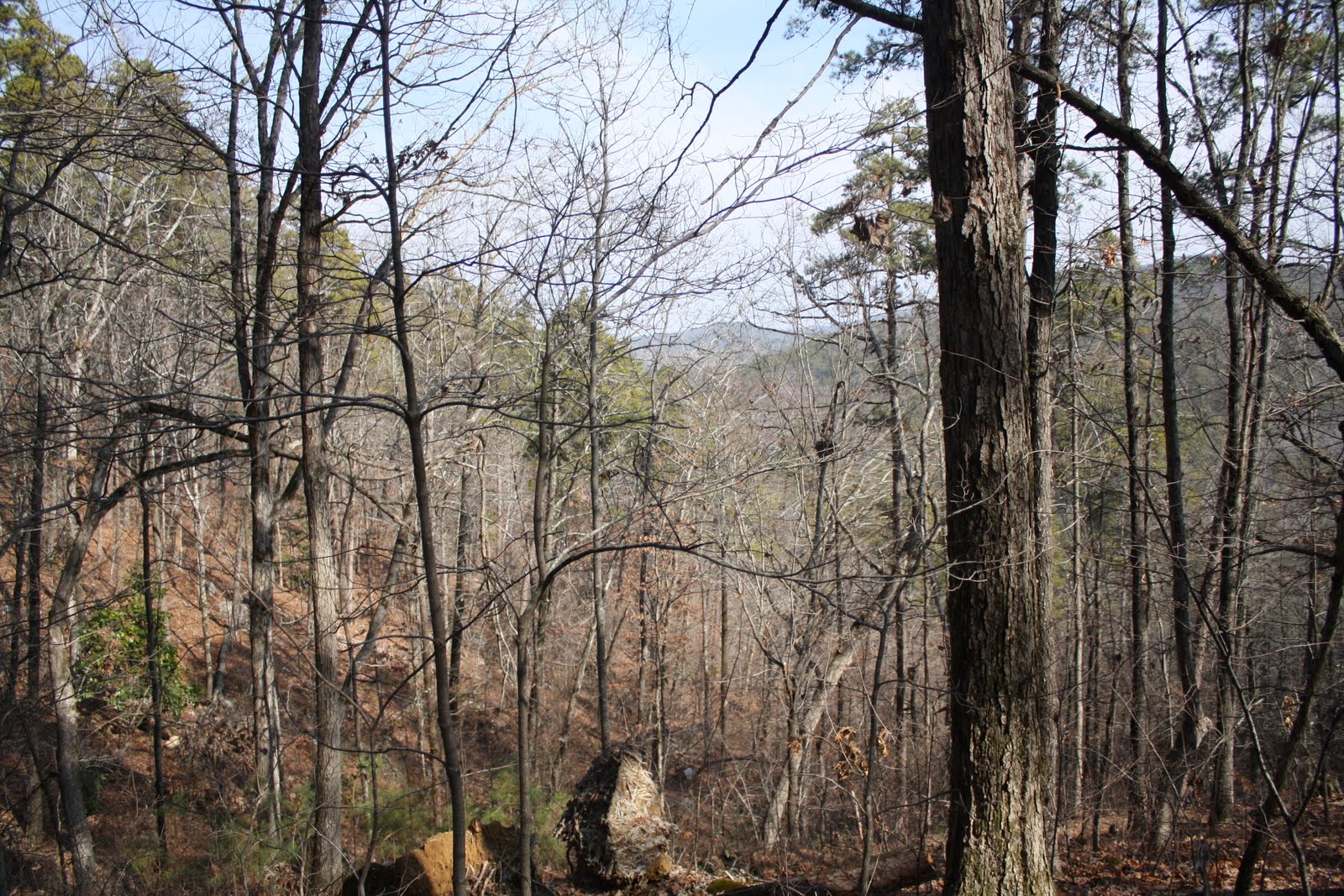
We had left Little Red at the pavilion on top and followed Andy's trail all the way down twice and back up twice for at least five miles: Hot Springs Mountain Trail to Gulpha Gorge Trail to Goat Rock Overlook Trail to Goat Rock Trail to Upper Dogwood Trail to Lower Dogwood Trail to Floral Trail to Honeysuckle Trail to Hot Springs Mountain Trail to Peak Trail and back to Little Red at 1,060 feet.

I'm certainly glad he had a map.
"That was a good workout," he said, climbing up the last rise to the parking lot. "That was easily five miles, a lot more than I ever figured we would do today. And look, the sun is out bright and full, and even with the haze it's blue sky." But down below us a fog drifted in the valley.
"I imagine the Valley of Vapors is hazy pretty much always," I said.
But from Central Avenue, where the vapors rise from 47 seeps and reservoirs, the sky looked like an azure blanket. My how healthful living has changed, I thought. Most people came to Hot Springs to relax and loll in the hot mineral water at the base of Hot Springs Mountain. We hiked about eight miles around the top of it.

Vapor Trails or Vapor Tales

With visibility about 400 feet, we drove north on Louisiana Route #3 toward Arkansas, the only one of the 50 states we had never visited.
"Since this is our final state, you need to stop at the entry sign. Rain or no rain, we need to get a picture of this one," I insisted, as we left Bossiers, Louisiana. The difference, apparent from the moment we crossed the state line, lowered Arkansas in my estimation. Culverts full of garbage lined both sides of the road and tumbledown shacks still housed people.
"I certainly wouldn't want to pull over here," said Andy. The roadside clay, red mush rutted with tire tracks, had no shoulder. "Little Red would be stuck for sure," he added.
Farther north rolling farmland supported herds of cows. "This is the economic recovery project," said Andy. "There was a sign." One side of Route #29 had a paved shoulder.
Both weather and economic condition improved as we drove north. Around Hope, Arkansas, at 39 degrees, black Angus bulls grazed peacefully at farms near the road. "They look like breeding bulls," said Andy. A school bus marked Community Punishment Detail parked by an intersection near Route #278. Several men in orange jump suits, vests and wool caps ran across to the bus before the light changed. They left orange bags by the road.
"There must have been an awful lot of garbage here, judging by the number of bags," said Andy. Trash bags dotted both sides every couple hundred feet for the next two miles.
"From the looks of the garbage they missed, I think they had better get a few more work gangs out at a few more locations," I said.
The sun popped through thick grey clouds around Prescott. We headed north and blue breaks opened up. "It's going to be colder here," said Andy, "but at least it's trying to clear." Pines and hardwoods lined the right-of-way on Interstate #30. We could see replanted pine forest beyond on one side and pasture on the other. Clouds moved back in around Arkadelphia, and Hot Springs, still socked in, recorded 43 degrees.
In spite of the early afternoon threat of rain or maybe because of it, we toured the Fordyce Bathhouse, now part of Hot Springs National Park. Renovated to look like it did in its heyday, the early 1900's, the Fordyce reopened in 1989 as the Visitor Center and museum. It tells the story of "The American Spa," when Hot Springs rivaled spas in Europe and local facilities modeled themselves after those of Greece and Rome. In 1915, reviews proclaimed the Fordyce Bathhouse the best in Hot Springs. The others on Bathhouse Row included Superior, Hale, Maurice, Quapaw, Ozark, Lanar and Buckstaff. Only Buckstaff, in continuous operation since 1912, still provides traditional therapeutic bathing.
The history of Hot Springs extends back to prehistoric times. Pottery and tools dated at 10,000 years old have been found in the region, and documents show American Indians, particularly Caddo and Quapaw, bathed in the Hot Springs in the 1700's. The records of Hernando DeSoto in 1541, indicate he came here to the "hot lakes," and in 1804, then President Thomas Jefferson sent an expedition led by George Hunter and William Dunbar to explore the newly acquired springs, purchased as part of the Louisiana Purchase from France.
In 1832, the federal government took an unprecedented step of setting aside four sections of land here, the first U.S. reservation to preserve a natural resource. The first bath houses were crude canvas and lumber tents stretched over individual springs or reservoirs, but by 1875, with the railroad, people came by the thousands to private bath houses ranging from simple to luxurious. The clientele was cosmopolitan, from Al Capone to baseball players Dizzy and Daffy Dean. Majestic Bathhouse attendant Jim Lemons said, "Al Capone was a good tipper." Even Jesse James came to Hot Springs in 1874, but he came to rob the customers. "I'm trying to imagine my parents or your parents coming here to bathe for a vacation," said Andy. "It wouldn't have happened, but I guess a spa vacation was the in thing for years."
We walked through the three floors of Fordyce Bathhouse, now part of the national park: the men's and women's dressing rooms; the men's and women's courtyards; the rooms for steam baths and sitz baths, chiropody, hydrotherapy, massage and Zander mechano-therapy; separated bathing rooms and cooling rooms with marble statues and benches; roof gardens and lounges and state rooms; the massage room and beauty parlor; the gymnasium, billiards room and a music room with a baby grand piano; and the Hubbard Tub area for therapy and healing.
Then we headed outside, where at least 47 hot springs surfaced. The Grand Promenade stretched half a mile in both directions above Central Avenue, and Hot Springs Creek flowed underneath.
"Did you read the display about the age of the water?" asked Andy, as we stopped to test the temperature. "It's 143 degrees all right." He pulled his hand out quickly.
"4,000 years old and underground all that time," I answered, testing it out for myself. "I'll just never understand how carbon dating can test the age of water."
From our reading, we learned that water coming to the surface fell as precipitation 4,000 years ago at the top of Hot Springs Mountain. It percolated down about a foot a year, heated as it descended deep into the earth, maybe 8,000 feet down, over thousands of years. Then, because of the pressure of more water coming down, it rose rapidly at the base of Hot Springs Mountain as Hot Springs Creek, about 700,000 gallons a day at 143 degrees Fahrenheit.
"Scientifically, that's fascinating," I said. "I wonder if science motivated the government involvement back in 1832, or if the lure was all economic and financial."
A few tourists milled about in the early evening. "If I were homeless, I'd choose this as a place to stay," I said. Temperatures had dropped into the high 30's, but steam rose from the springs.
"Why?" asked Andy. "You can't go into the water, because it's too hot."
"But the mist nearby is warm. Didn't you feel it?"
"Sue, the park closes at 10 p.m., and probably so no one can sleep at the springs."
"But it's right on Central Avenue--or under Central Avenue--as the folder said. It reminds me of the subway grates in New York City," I babbled.
"And police probably patrol this beat after 10 p.m."
"Oh, so I guess I don't want to be homeless in the Valley of the Vapors. It must have been something to come here with tons of money in the spa heyday."