Pages

Sunday, October 31, 2010

Reprieve from the Rain


Halloween morning we settled into the booth at Baldini's Sports Bar Casino in Sparks, Nevada, for complete breakfast -- two for the price of one at $4.99. The middle-aged waitress, dressed in a short skirted witch's garb with buck teeth fangs, took our orders. "You can't beat that for the price," said Andy. "You couldn't cook it at home for that."
When the waitress returned, I asked her about the teeth.
"Well," she hissed, "I glued them in this morning, so I know now what it feels like to wear dentures."
"Dentures," I said to Andy when she left. "I wonder how many people here wear dentures."
He looked around at the restaurant, now crowded with people at 8:00 a.m. on Sunday morning. "You're right," he answered. "I think we are the youngest ones here."
Another elderly couple hobbled in, the woman with a cane, the man greeting friends at other tables. "They must all be locals," said Andy. "I almost feel like we're at... a convalescent home."
We headed toward Pyramid Lake. Overhead white feathery cirrus clouds outlined the horizon in pastel shades of blue and grey blue. Every bend around the lake brought a new scene, more breath-taking than the last. Climbing to the top of several ridges gave us different perspectives as well.
When we stopped on lonely Route #447 to take a picture of the mountains, a Paiute Indian man and his two young sons stopped their truck to make sure we were okay. Their concern was genuine.
"I didn't plan to come this far," said Andy, as we approached the Black Rock Desert, "but I'm glad we did. The scenery is incredible, and I know for sure there is one place I don't want to live -- Gerlach -- and that's ever!" It wasn't until later that we learned more than 51,000 groupies descended on this town two months ago and on the playa of Black Rock Desert for the Burning Man festival or that the cost of coming here for the "experiment in community," as it was described, was $360. per person. In Reno News and Review, Burning Man was voted "the best place to run around naked for this area." I guess we won't fit in very well. Good thing, since Gerlach is the end of the earth.

Saturday, October 30, 2010

Finding the Sun

"This is where the book starts," I explained to Andy as he exited the highway in Weed, CA. "Steinbeck opened Of Mice and Men by having Lennie and George escape from a ranch in Weed." We drove around the outskirts of town, looking for a "Welcome to Weed" population sign.
"I think Weed has seen better days," Andy said, "and I don't see any Steinbeck references."
"Right!" I laughed. "Steinbeck's Weed references implied vigilante justice against his main characters. Not so complimentary!"
We stopped on Main Street for a picture as the rain started.
Little Red leaks. There is no doubt about it. Well, my door frame, at least.
"This shouldn't last long," said Andy as we turned south on Route #89 around Mount Shasta. Sheets of rain spread across the windshield, but my right side was spared this time. "So far, so good," I told Andy. But most rainy days I sit holding tissues to the window frame to avoid being dripped on. Thank goodness for the Gettysburg College seat cushion or I would be sitting in dampness too.
"I think we'll probably put 20,000 miles on Little Red before we get back," said Andy, as he checked the odometer.
"Let's hope it's not all in the rain," I suggested.
Along Route #44 in Susanville the heavy black clouds piled up against each other.
"That looks like snow," I thought out loud. "The blue is up there... somewhere. We saw it a few minutes ago." Every so often the trees opened up, revealing huge expanses of dry fields. "Fifty-eight hundred seventy-two feet," I read from the GPS.
"I had no idea we were that high," said Andy, "but it explains the patches of snow on the side. They must have plowed a couple days ago."
In Susanville, a large town of 17,400 for this part of the world, brilliant blue cracks of sky peeked through the menacing cumulus cloud wads and layers. It looked like a giant plate of Cool Whip with deep blue drizzles. But as we drove underneath it, I said, "Nope. It's not Cool Whip any more. It looks dirty gray now."
But skies improved. By the time we got to Sparks, Nevada, only the surrounding peaks harbored puffy white clouds.
"I'm glad now that we came here," said Andy.
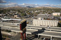
A pleasant clerk assigned us to room 1667 on the 16th floor of John Ascuaga's Nugget Casino in Sparks.
"This place is starving," said Andy. "It's Saturday night, and there is no one here." Across the street the Silver Club was boarded up, all two blocks worth of classy hotel and casino. The Nugget monopolized the business of Sparks, such as it was. "I read somewhere that Indian casinos affected Sparks and Reno more than anywhere else in the country," said Andy.
If that is true, we saw the evidence. We benefited as well--low rates on a Saturday night for a top floor room with a spectacular view.

Friday, October 29, 2010

Below and Above


On the road by 7:20 a.m., we headed to Oregon Caves. The road snaked along the Smith River, reputed to be the cleanest free-flowing river in the U.S. and the last major free-flowing river in the West. Here, the trees were still at peak color and clouds of mist hugged the valley.
Marisol led our 90-minute tour of Oregon Caves National Monument. "It's nice to have only nine people instead of the usual 16," she told us as she identified formations in the marble. "I can spend more time telling history and geology and pointing out interesting stories when I don't have to wait for so many to catch up."
Oregon Caves is one of only 5% of all the caves in the world comprised of marble, limestone that was put under great heat and pressure from magma deep in the earth. One column formation called "Giant Column" is estimated at 500,000 years old, and two sets of jaguar bones found inside the cave were carbon dated at 40,000 years. Marisol had interesting history to relate as well, like the explorer professor who dropped his lantern down one of the deep pits and decided to retrieve it in the dark. That was when she demonstrated total darkness for our tour group. It was a fascinating way to spend a morning.
Little Red climbed to 4,324 feet at Siskiyou Pass as we entered California. "There is probably snow at 5,000 feet," said Andy, "and the Shasta River is still moving fast." No sooner had he mentioned it than we saw Mount Shasta in the distance, snow-draped and sparkling in the bright sun. Other nearby peaks showed evidence of recent early winter storms as well. "I'd like to drive a little farther today," said Andy, "since we still have a few good hours of light."
"But the towns within 50 miles have limited resources for tourists," I argued. "Why don't we just stay here in Yreka and check out the local hot spots."
"Deal," he agreed.

Thursday, October 28, 2010

Decision Made

A man walked by our motel room this morning, hands in his pockets, rain pelting down on his wet hair. "They just seem to ignore it like it doesn't bother them," said Andy.
I knew he meant the weather. But for Oregonians, what else are they going to do? It rains all winter. No one carries an umbrella or wears a poncho. But I guess the wind precludes the usefulness of such foul weather necessities.
We headed out to Cape Sebastian Overlook. Through the fog we could almost see the grey ocean. I closed my eyes and pretended it wasn't raining.
"This is one of the nicest parts of the coast, and it looks like we'll have rain all day," moaned Andy.
Unfortunately, I had to agree. "Today I need my plastic bag," I told Andy. I pulled the shopping bag out of the camera case and poked the camera lens through the small hole I had worked in the bottom of the bag. "This should do it," I told him. "It's a trick I learned at yearbook photography camp to shoot digital in the rain."
"What gets me," he said, looking out the driver side window at the steady downpour, "is that there are guys outside cutting down lumber in all of this."
We sat at the overlook, and the rain came down harder.
"No, we can't even see the coast," I complained.
"Well, we are getting closer to November 1, and that is the true beginning of the winter rainy season," he said.
We drove as far as Brookings with stops at probably ten overlooks and waysides. Sometimes we sat looking out to sea; other times we read silently for a few minutes. All the time we watched the sky for a break. After coffee at McDonalds, Andy said, "Let's find a place to stay for the rest of today. We'll do laundry and bunk for the night with the hope it clears tomorrow or just stops raining. I'll even be happy with grey skies! If it clears, we'll head to Crescent City; if it doesn't, we'll go inland to Reno."
Decision made.

Wednesday, October 27, 2010

Where You Can See Forever


"It's cold out there," said Andy, settling into the fuzzy bucket seat of Little Red. "My ears are numb."
"And my nose... and fingers from holding the camera," I added. We had walked several overlook trails at Simpson Reef of Cape Arago, watching the seals and listening to California and Stellar sea lions communicate. We picked out the males, barking at their harems that were lolling on the rocks as the tide washed in.
"Those tiny rocks are all part of the National Wildlife Refuge," said Andy. "It protects nesting areas of birds as well."
We walked a loop trail of cliff, cliff steps and beach at Oregon Coast National Wildlife Refuges in Bandon. One of the memorial benches said, "From here you can see forever." I looked out over the endless expanse of saltwater. The tide was just coming in, and waves broke on the rocky islands offshore, flooding into the estuaries. A prime viewing area for migrating birds in September and migrating grey whales in December, the overlooks offered us spectacular views of the roiling ocean and the rugged coastline... uninhabited, relentless.
Rain moved in near Cape Blanco Lighthouse, the oldest standing lighthouse on the Oregon coast. Even the geese and seagulls struggled against the wind. Walking in the dip between hills, it was all I could do to hold the camera steady.
"There's no taking away from it," said Andy. "The Oregon coast is spectacular, rain or shine, and the Oregonians have been smart enough to protect so much of it."
In the 1870's, this area was the home of the Hughes family, now buried at the top of the hill in a pioneer cemetery. The wind in a few solitary trees whispered low. "No wonder this is a place to stay," I thought out loud. From there they can see forever.

Tuesday, October 26, 2010

Let the Sun Shine


At 6:15 a.m. when I woke up, the sky brightened. "It's not raining," I told Andy, "and the parking lot looks dry." Not 15 minutes later, I heard a tapping on the window. "Andy," I nudged him, "that's sleet, I think."
He looked out. "It's hail now," he observed. But by the time we finished our coffee, the thunderheads cleared, leaving deep blue sky, accentuated by billowing cumulus clouds.
"Maybe this is our day," said Andy.
"Don't hold your breath," I warned.
First, we pulled into Seal Rock for photos in the sun to contrast with the ones from yesterday.
We stopped at Waldport Bridge where fishermen in the early morning were casting the fish guts out of their boat for seagulls.
At Smelt Sands the seagulls, intent on opening some oyster shells, played tag with the breaking waves on the offshore rocks.
Cape Perpetua Scenic Area, the highest point on the Oregon coast at more than 800 feet above sea level, challenged the passing grey clouds. But the bright sun burned off any rain.
"It's noon," I told Andy, "and we haven't even covered ten miles of scenic vistas from yesterday. That's a reflection on the weather and the Oregon coastline."
"ELK." I read the sign as we drove south. "Next seven miles. Now why would elk cross here?" I asked Andy. "They have ocean with crashing waves on one side and thick woods on the other. Nothing to eat or drink. Oh yeah, salt. I bet they lick the rocks."
Around Florence the coastline changes to dunes--mile after mile of stabilized sand covered with grasses or exposed, blowing particles. Oregon Dunes National Recreation Area protects the extensive beach and offers challenges for off road vehicles. Here they call them OHVs. For us, it offered extensive photo opportunities, several short hikes and sun until it set around 6:15.
"We lucked out," said Andy.
He was absolutely right. The wet roads ahead in North Bend provided the proof.

Monday, October 25, 2010

Weather on the Coast

"I think we're going to get a little rain," said Andy. "We need it; it's been a couple minutes."
Moments later, Andy rested his eyes, while I held Kleenex against the door molding where it leaked on my right shoulder and watched the sheets of water splay across the windshield. Soon the car was steamed up, and we could barely see the state workers outside as they continued to cut and clear brush at Governor Patterson Memorial Beachside. When the tree was down and in pieces, one middle-aged worker systematically carried piece by piece, branch by branch to the edge of the wayside and tossed them over onto the beach and into the surf. It struck me as so useless, with a campground nearby and driftwood already clogging so many of the inlets. We sat in the car, watching him work. He disregarded the downpour and continued his labors.
"I know one thing about the weather here," said Andy. "You've got to use the decent weather when you have it, because you don't know what the next half hour is going to bring."

Return to the Coast

"When it clears, it's really pretty," said Andy as the sun popped out. The metal roof of a barn sparkled and horses, draped in wet blankets, grazed contentedly along Route #20 as we headed back toward the coast. A lumber truck zipped past, sending splats of water from the puddles against our windshield. Deep green blanketed the hills of the coastal range with interspersed patterns of lighter ferns, yellow aspen and gold maple. A few puffy white clouds dotted the blue overhead. "We should just about get to Newport when the next rain wave comes in," said Andy.
"Poetic justice," I told him. "I just composed descriptions about the sunny day."

Cape Foulweather, named by Captain James Cook in 1778 when he couldn't even land, lived up to its name this morning. But sun broke through momentarily at Yaquina Bay Lighthouse, built in 1871. "I'd move in right now," Andy told the gift shop volunteer.
"You and a very long list of others, and you'd be at the bottom of the list," she answered. In the early 1870's, Yaquina Bay was a choice appointment for Charles and Sarah Peirce and their nine children, West Point friends of Ulysses S. Grant.
A young couple stood looking out to sea at Ona Beach, their fishing poles propped against a boulder. "I've lived here all my life, and I've never seen this before," said the young man. It was nearing high tide. The waves broke and washed into a tidal inlet, flooding the beach above the treeline. "We got caught by a big one just a few minutes ago." Just then a small black spot appeared in the surf. Just as quickly it bobbed out of sight. "That's a seal out fishing," said the man. "No use staying here. He's getting all the salmon that head for this inlet."

Sunday, October 24, 2010

Waves and Pelts


"It comes in waves," said the ranger at Fort Vancouver National Historic Reserve. "I'm actually from Vermont, and this weather is nothing like the Vermont where I grew up."

Sheets of rain pelted on the window of the visitor center as we entered the theater for the film about the Hudson Bay Company, the hub of an extensive fur trading network that utilized a geographic range from Russian Alaska to Mexican California and from the Rocky Mountains to the Hawaiian Islands. The fort area, on the north bank of the Columbia River in Vancouver, Washington, was the region's first military post. Later it housed Pearson Airfield and still later Kaiser Shipyard.
When we stepped out after the half-hour movie, the sun glittered off the droplets on fence rails and rose petals in the English formal gardens. That hour reprieve gave us enough time to walk the grounds of old Fort Vancouver, built in 1824 to protect the growing fur trade and the settlers who pushed west in waves to seek land and fortune.
A volunteer blacksmith explained how the employees of HBC forged more than 10,000 beaver traps, the major product, and how the town adjoining the fort was a melting pot of 25 American Indian tribes, Irish, French Canadians, English, Americans and Hawaiians. A company town, each group had its own street, but life on this far western frontier was surprisingly cultured.
Then the heavy clouds rolled in, and rain pelted again. "Waves," I told Andy. "That's what the ranger said."
Later in the day we stopped at the Korean Veterans Memorial in Wilsonville, browsed in the stores of the Outlet Mall in Woodburn, and walked through the gardens at the Oregon Capitol Building in downtown Salem. All day waves of clouds rolled by, and alternately we dashed between downpours, regarded rainbows and strolled in the sun.

Saturday, October 23, 2010

Cruising the Willamette

"I know lumber rules, but the clear cutting here makes me sick," I told Andy as we again drove past sections of forest that had been leveled.
"But those areas have been replanted," he pointed out.
"It still looks terrible, and it will be years before the trees grow back."
"Better here where they grow fast though," he argued. "I'm not for it either, but there are two sides. I read this morning that a judge ruled that the Oregon Forest Service is not managing the lumber companies correctly. Too much erosion is going into the streams, and it is affecting the salmon production. I guess they will be clamping down."
With four days of rain predicted for the coastline and dangerous winds expected tonight, we headed inland to Salem, with stops for short walks at Van Duzer Forest Wayside, Fort Yamhill State Park, a historic site area, and Baskett Slough.
"I think there is a ferry near here," commented Andy as we headed toward the city.
"Wheatland Ferry is on the map, and the sign said turn left toward Willamette River," I told him.
Sure enough. The car ferry carried nine vehicles at a time on an electrified cable across the river. I read the sign: passengers, free; bicycles, free; motorcycles, $1.00; cars $2.00. Larger vehicles cost more. "But that's not exactly the way we want to go," I said.
"That's okay," he responded, parking the car. "I'm taking you on a cruise. I spare no cost. Over and back, a romantic trip across the Willamette."

Friday, October 22, 2010

Caught on Film

"For a little state population-wise, Oregon does an amazing job with its parks and waysides," said Andy as we walked along Newport Beach just before dark. The tide was out and several couples walked dogs and played fetch with rubber balls and sticks.
Prepared for miserable weather, we decided not to travel too far from the spectacular ocean backdrop. But instead of rain this morning, we woke to blue skies and sunshine. So today was a time to retrace our travels, catch the morning rays and revisit the overlooks of yesterday from Neskowin Beach to the Devil's Punchbowl.
At North Fogarty Creek Andy skimmed the information board and headed toward the water. I stopped on the sand to snap photos. "The tide is going out," he called from the basalt island rock extension just offshore. The information board warned about sneak waves, driftwood logs, submerged rocks and rising tides.
I looked up. He stood half way up the rock outcropping, maybe 15 feet above the water, grinning and waving. I snapped another picture.
Just then a series of waves crashed behind the island, swelling high and sending spray every direction. Andy shrugged his shoulders. Picking his way down the rocks, he was ready to start back on the narrow isthmus between rock and beach. But now there was no isthmus.
"Take off your shoes," I yelled over the roar of the water.
He held up his hands and looked around for a way back. He was marooned on the island.
Cupping my hands, I called again, "Just take off your shoes!"

Instead, he waited through four or five waves. With each one the water filled in a little more. With the ebb after the fifth breaker, he dashed across the partially submerged sand bar.
"Low tide, huh?" I teased. His pants showed a high water mark around the ankles and his shoes squished and bubbled with each step.
"It was, I swear," he insisted. "In Tillamook this morning it was high because the whole bay was filled in. I should have just waited a little longer."
"Yeah, right," I said. "And I got a picture!"

Thursday, October 21, 2010

Playing the Odds


Today we outran the rain.
"If weather reports are correct and the storm is moving in for at least five days, we are going to make the most of today," said Andy this morning. "The Oregon coast is spectacular, and we should try to get as many pictures in the sun as possible. I just hope it clears."
Our first stop was Astoria Column, a 125-foot decorated pillar built in 1926, that artistically marks the milestones in history. We paid our $1.00 parking fee and climbed the 164 steps to the top. In spite of a heavy cloud cover, sun rays broke through, and the world stretched beneath us.
"There's a patch of blue sky over there," Andy pointed out as we arrived at Fort Clatsop. Named for the local American Indians who inhabited the region in the early 1800's, the winter fortification of Lewis and Clark on the Netul River offered a glimpse into history. The 33 explorers arrived in dugout canoes, chose the site for availability of food, clothing and building materials and constructed a log fort guarded by a single cannon. For four months they endured the misery of constant rain. We studied the museum displays, visited the reconstructed fort and walked the trails; our blue sky mini-patch soon disappeared.
Thirty-mile per hour winds gusted at Cannon Beach as we checked out the volcanic sea stacks and traipsed back through the sand.
The Tillamook Cheese Factory and Blue Heron Cheese and Wine Shop offered samples for tasting, as well as tours. "Just a little shopping?" I begged. Most visitors ate ice cream and carried bags of goods.
"No, you cannot buy any gifts," ordered Andy. "How in the world will we fit them in the car?"
And so we headed for the shore and 50-miles of lighthouses, overlooks and short trails. One step ahead of the rain, we battled winds that increased to 50-miles per hour and watched the clouds billow in off the water. But it never rained, not until evening. The weather forecasters were right, and our pictures provide the evidence.