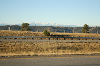

The Bighorn Mountains around Red Lodge were covered with snow as we drove by this morning, but we left the snow behind by heading north. Go figure.
 On Route 89, toward White Sulphur Springs, we noticed many trucks pulled out along the road into ranch field turnouts.
"What do you suppose they are doing?" I asked Andy.
"Hunters," he responded. "They are out for deer. If you look across that field, you can see two of them in the distance."
I spotted the fluorescent orange jackets immediately.
"I didn't know hunting was allowed on Sunday, but I guess Montana laws are different from back home. And I'm not a hunter," he said.
 We passed an SUV with two gutted deer on the roof. "I don't feel too bad," I told him, and yet every time we had passed a huge animal transport, I had squinted to see if cows or horses were traveling to market. Each time my stomach did flip flops.
 "No, it doesn't bother me either," he agreed. "It's being used for good purposes and not wasted... so much better than roadkill. And just think about the hundreds of dollars of damage the deer have done around our house."
We crossed Little Belt Mountains; the highest elevation on the road was 7,417 feet. There wasn't any snow, but people outside mending roofs and fixing mailbox posts wore heavy sweatshirts and hats.
By the time we reached the Lewis and Clark National Forest and stopped at Memorial Falls of Belt Creek along Kings Hill National Scenic Byway, we walked the mile-long trail to two waterfalls in shirt sleeves. Pink cliffs of Neihart quartzite, the hardest sedimentary rock, contrasted with the rushing water and glistened in the sun.
 "The room isn't ready, and I chose not to stay in a hotel downtown on the first floor," said Andy once we had arrived in Great Falls. "We are going to drive on up to Fort Benton and explore. See if you can find it on the map." The extra mileage meant today was our longest drive yet: 357 miles for a total of 4,363 miles.
We walked the trail to the overlook at Sluice Boxes Primitive State Park; hiked across the old Missouri River bridge in downtown Old Fort Benton; strolled along the river at the Upper Missouri River Breaks National Monument; walked the main street of Fort Benton, reputed to be the wildest single block of the Old West; and photographed the Montana Memorial to Lewis and Clark, where the two explorers chose the South Fork of the Missouri River and consequently saved the expedition. Reading the signs, we learned that the crew preferred the North Fork, which would have taken them into the Rockies, and they could not have returned before winter. It seems likely that the entire expedition could have perished, based on one unlucky decision. Instead, Lewis and Clark lucked out.
Again, Andy and I marveled about the twists of history we learn through travel.
No comments:
Post a Comment