AUTUMN SHOWERS
September 2015
The sun came in and out behind huge banks of cumulus clouds at 8:30 a.m. when we left the motel in Torrey, Utah.
“Are you anywhere near the flooding?”
questioned Drew warily, when we talked to him on the phone this morning.
 |
| Outside of Torrey, Utah, the sandstone formations look like giant castles in stone. |
“Yes, but don’t worry,” we
promised. “We don’t drive into dry
washes, and we don’t hike specially approved backcountry trails.”
But the storm at Lake Powell just
confirmed the immense and sudden power of nature.
Traveling at this time of year has its
advantages. Even though motels in small
towns have no vacancy, there are fewer people at the pullouts and almost no
children. Many of the travelers are
European tourists—polite and interested.
 |
| Even the dark clay of Factory Butte off Route #24 looks beautiful on a sunny morning. |
We stopped along Route #24 between Cainesville
and Hanksville for a picture of Factory Butte.
“We can walk out a little ways so the pictures don’t show electric
wires,” suggested Andy. “Just follow me,
and I’ll show you where to step.”
I tried.
He stepped on the clumps of weeds, but mud still stuck in big clumps to
our shoes.
A little farther on a section of land
had been set aside for all-terrain (ATV) and off-highway (OHV) vehicles. There we were able to drive and photograph
without getting stuck in the mud. In the
other direction the higher peaks of the Henry Mountains were buried under white
clouds.
“Up there, it’s snowing,” said Andy.
“The news predicted snow above 8,500 feet. Those peaks will be white tomorrow.”
 |
| Clouds that threaten rain pile up near Lila Canyon. |
Down here it was a pleasant 75 degrees
but very windy.
We turned off the main road temporarily
at Lila Canyon. Five miles in was a
mine. “It’s probably coal,” said Andy.
“Power plants out here still use coal, because it’s a cheap fuel and it’s
available.”
On the fringe of the rain, the
temperature read 71 degrees. Three
pronghorn antelope dashed near the road by dark hills, that were devoid of any
vegetation. We wondered if the "dark" was coal.
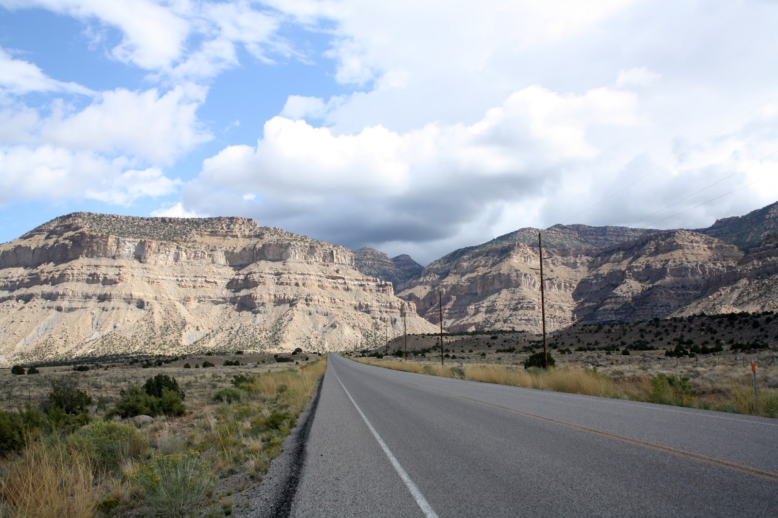
We stopped at a rest area outside of
Price, Utah for pictures of the Book Cliffs.
“We’re going to get some rain,” said Andy. The dark clouds piled up overhead. The highest close point, Patmos Head at 9,841
feet, was still in the sunlight, but farther east and north Bruin Point (10,285
feet) and Mt. Bartles (10,047 feet) were pretty much cloud covered.
There were no trees at all for the 30
miles into Price. “We went up in
elevation, so it has to be really arid here,” said Andy.
We had the oil changed in Price and then
headed north a bit to check out the countryside.
Helper, an old mining town, was
dying. “The miners probably were
immigrants, not Mormons, so the Mormon Church didn’t bail out the town when the
mines ran low,” said Andy. That made
sense.
 |
| Price Canyon Recreation Area in the mountains at more than 8,000 feet offers camping and picnicking for visitors. |
“We’re headed up in elevation again,”
said Andy, but it wasn’t enough of a rise to account for that much temperature
drop.
“Utah’s pretty empty,” said Andy, as we drove
back west toward Route #6.
“Empty and chilly,” I agreed, jumping
back into the car after two pictures. It
was 62 degrees when we reached the turn to head back to Price.
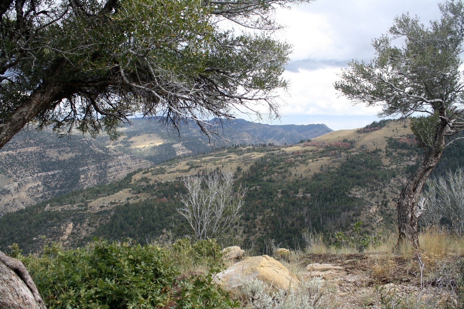
On the way back we detoured at a sign to
Mount Castle Country for views of the Price Canyon Recreation Area. It was labeled “bear country,” and the oak
trees were starting to change. If the
weather clears, we can hike it tomorrow.
 |
| Labeled "bear country," the Price Canyon Recreation Area covers rugged terrain in the high mountains. |
After checking into the motel, we headed
back out to explore some more. In every
direction around Price, rain clouds extended to the ground. In some places the streaks were just drizzle;
in others, a black sheet covered sky to ground.
We drove a huge circle outside the city
and washed off the car. For some miles
on Route #123 we saw a rainbow, then a double rainbow, before it disappeared
and rained a little harder. By the time
we reached the end of Route #123, near the power plant that was 24 miles from
Price, temperatures had dropped to 51 degrees, and huge puddles covered the
road.
It was time to call it a day and hope
for clear skies tomorrow.
No comments:
Post a Comment