RETIREMENT TRIP #7
Among the Giants
This morning we breezed through the California Inspection Station at
the State line without even a blink. The
guard took one glance, smiled and waved us on.
Andy never even came to a complete stop with the little black Ford
Fiesta. Maybe it’s our advanced age or
the Utah license plates. But then again
we didn’t even have a piece of fruit in the car to declare.
A sign said the fire danger in Crescent City was high. That was hard to
believe since fog blanketed the city. We
saw the low-lying sheet of white from way down the road as we drove south. There seemed no rhyme or reason for it—no
mountain or river—but Crescent City is on the bay. Maybe that’s the explanation. A glance at the map confirmed the idea. The city and surrounding area actually extend
out into the ocean as a large jut surrounded on three sides by water. It was just morning fog not yet burned off at
10 a.m.
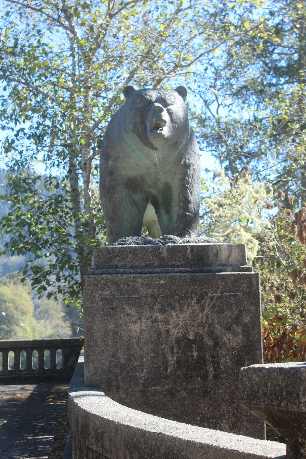 |
| Two weathered, concrete bears growl at visitors to the entrance to what remains of the old Klamath River Bridge. |
We stopped at the site of the old Klamath River Bridge, where for 40
years it had spanned the Klamath River near its mouth. At Christmas in 1964, the area experienced 24
inches of warm rain in less than a week.
It melted the snow pack and carried down redwoods, which piled up
against the bridge. The pressure became
so great that the logs and raging river took out the whole center span. Displaced citizens of Klamath watched in
horror and amazement. When they rebuilt
Klamath, they located the town farther upstream out of harm’s way. The concrete bears mark all that is left of
the old city and its lovely bridge.
California Highway Department gets a grade of F. They worked diligently on one-lane sections
of Route #101, but when we got off the highway just south of Klamath, there was
no sign that the Coastal Drive was not accessible. It was clearly labeled on the roadmap. About five miles in at High Bluff, the road
ended.
We turned around to take Alder Camp Cutoff. Two miles later that turned to dirt and the connection to Coastal Trail Road said one-way. We headed seven miles back to Route #101. Five miles south we tried the other entrance to the Newton B. Drury Scenic Parkway. Two miles in, the south branch was barred and the north end turned to dirt a mile later. We knew California highways were in bad shape, but not even to put up a sign? Guess money is tight all over!
 |
| The magnificent redwoods tower to the heavens. |
We turned around to take Alder Camp Cutoff. Two miles later that turned to dirt and the connection to Coastal Trail Road said one-way. We headed seven miles back to Route #101. Five miles south we tried the other entrance to the Newton B. Drury Scenic Parkway. Two miles in, the south branch was barred and the north end turned to dirt a mile later. We knew California highways were in bad shape, but not even to put up a sign? Guess money is tight all over!
We tried the southern entrance to the Drury Parkway at Prairie Creek
State Park. That too was closed off a
couple miles in, right after the campground.
Foiled again! There weren’t even
any elk grazing in all the prairie fields.
Guess we lose!
Ironically, following the Coast wasn’t an option since the fog bank
still clung to the coastline at noon.
But we were able to drive to the Lady Bird Johnson Memorial Grove. There we hiked the mile-long Lady Bird
Johnson Grove Nature Trail and read all the information about the Redwoods.
Redwood forests once blanketed the Pacific Coast from southern Oregon to Big Sur, California.
Redwood forests once blanketed the Pacific Coast from southern Oregon to Big Sur, California.
Intense logging from 1850 through the present reduced the redwood
forests to a fraction of their original expanse until today less than four
percent of the old-growth redwood forests remain.
Sempervirens is the
scientific species name for coastal redwoods.
It means “everlasting.” Most
trees in this grove preserved by Lady Bird Johnson are 600-800 years old.
The redwood tiny, one-inch cone produces thousands of seeds, but the
tree more successfully regenerates through massive clusters of bud material
called root collar burls, which lie dormant beneath the soil until the tree is
stressed by low rainfall or intense fire.
Then the sleeping sprouts awake.
Wind is the greatest gardener.
Quiet summer breezes give way to powerful gusts of winter storms that
can snap the highest branches.
Occasional wildfires clear dense ground cover, giving new seedlings an
opportunity to grow. The thick
insulating bark of the redwood lacks the volatile resins found in pines, firs
and spruce, and its sap is largely water. This combination slows combustion while the
surrounding vegetation burns vigorously.
Fires can burn repeatedly through cracks in the bark into the heartwood,
but it leaves the outside growing layers intact. As the heartwood decays, it leaves hollow
shelters for wildlife. So fire creates
instead of destroying.
Colonial seafarers and early American adventurers cursed the omnipresent
rain and fog of northern California.
Andy and I just held our breaths, hoping it would go away. A discomfort to some, the mild, wet climate
of the North Coast ensures the survival of redwoods. Wet winters soak the region under 60-70
inches of rain. Summer produces little
rain, but temperatures rarely exceed 80 degrees.
 |
| Dangerous waves crash off the coast by the Thomas H. Kuchel Visitor Center. |
 |
| The beach at Kuchel Visitor Center, beautiful and deserted, warns of extreme danger from sneaker waves. |
 |
| The Trinidad Memorial Lighthouse, surrounded by flowers, memorialized those lost at sea. |
By the 1960’s aboriginal redwood forests that had stood for millennia
had vanished in less than a century. The
realization that old-growth forests were disappearing so rapidly led to the
establishment of three redwood state parks in the 1920’s and to Redwoods
National Park in1968.
 |
| From the lighthouse gardens, the California Coast stretches in magnificence for miles. |
The denuding of hillsides around Klamath contributed to the extreme
flooding in 1964. Maybe that helped to
spur park creation and redwood preservation.
Regardless, at Redwood Creek in 1969, Presidents Nixon and Johnson
joined Governor Reagan in dedicating a 300-arcre grove to Lady Bird Johnson and
her campaign to preserve America’s natural beauty.
Days and years are not adequate to comprehend the ancient
redwoods. Twenty generations have passed
since the tallest trees first started to grow in northern California soil. Twenty more generations will come and go
before the seedlings of today will fall to give life to new generations of
redwoods. Thank goodness for those who
have the foresight to preserve and care for such treasures.
At Redwood Creek Overlook, the downstream tract had not been
logged. Trees, averaging 200-1,500 years
old, grew 200-300 feet in height. Now
protected, this area won’t be logged, and the upstream neighboring tract is
being reforested with logging roads contoured and new trees planted.
 |
| Views from the memorial lighthouse point are amazing. |
There was beach access at the Thomas H. Kuchel Visitor Center and the
fog had cleared out by 2:30 p.m. But
one sign warned of extreme fire danger on land and another warned of deadly
surf. I guess you can’t win at this
spot! Four people had been caught and
died here in sneaker waves on the beach since 2004. The waves were certainly bigger than those in
Oregon, and the wind had picked up.
Still, it was beautiful and exciting.
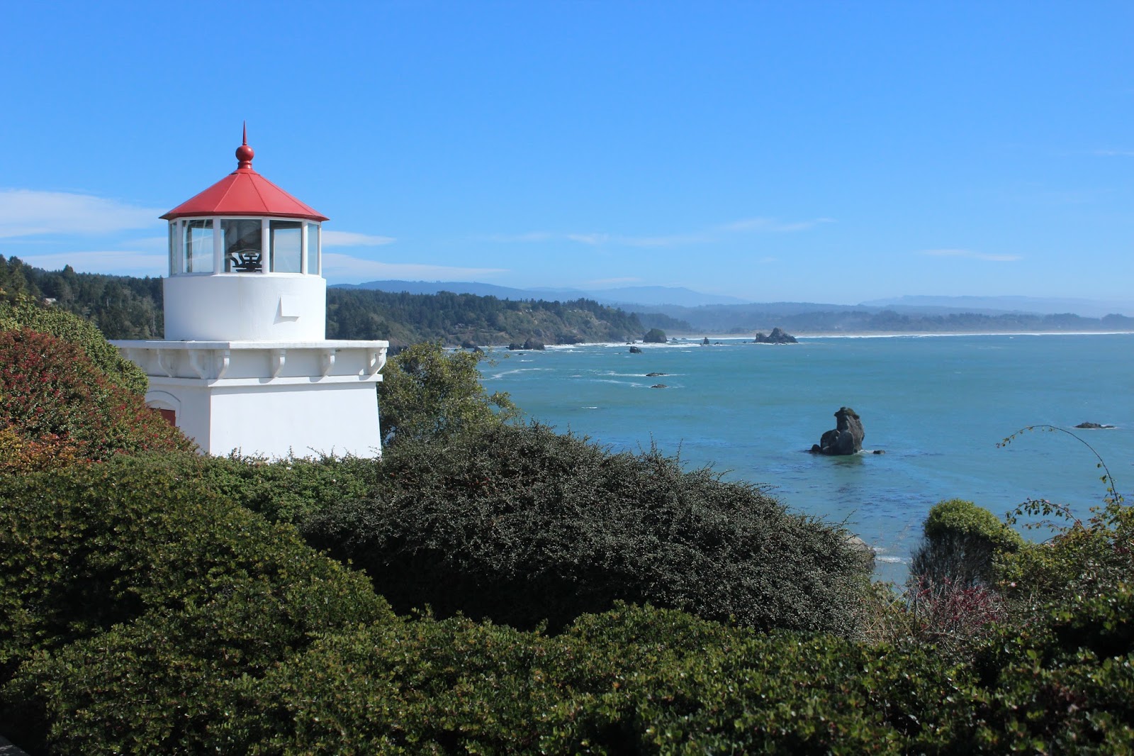
Trinidad Memorial Lighthouse in Trinidad, California honored those who
died at sea. In spite of reconstruction
of surrounding walkways, the gardens on the cliff ridge were spectacular and
the view was breathtaking.
A one-mile loop trail led up the cliff to Trinidad Lighthouse, still in
operation by the Coast Guard. The trail
wound around the cliff through rows of thick hedges, past a large stone cross
and up to the summit where a university weather station monitored air
quality. We never found the
lighthouse. Back down at the car, Andy
checked another map. We had missed
seeing the lighthouse by one turn at the top, but it was a challenging
hike. And since it is still Coast Guard
operational, there are no tours anyway.
We hadn’t missed a thing!
 |
| Even though we never saw the lighthouse, the views from the trail are spectacular. |
 |
| A concrete cross marks the end of the trail for sailors lost at sea. |
 |
| From the same lookout as the picture above, the zoom lens gives a totally different picture of the same scenery. |
No comments:
Post a Comment