RETIREMENT TRIP #7
The Changing World of Nature
“Today you can tell fall is in the air here,” said Andy, coming in from
checking the car. He wanted to be sure
the patched tire was holding.
“Fall is definitely coming,” said the owner and desk clerk at Antlers
Motel when I checked out. “There’s a certain
nip today, and it isn’t the usual morning cooling off.”
A mist hung over Lake Almanor as we drove away from Chester. It was almost imperceptible, but it portended
moisture. The seasons are changing. We headed east toward Susanville.
Huge ranches extended as far as we could see on both sides of the road
in between stands of pine. There were
thousands of cows grazing on the browning natural grass. It wasn’t overgrazed, but the number of
animals was huge beyond estimation—little dark dots as far as we could see in
every direction.
 |
| Grazing land looks marginal along Route #395, the highway from Canada to Mexico. |
“Just outside of Susanville we pick up Route #395,” said Andy. “That road goes from the Canadian border all
the way to Mexico.”
“Stop at the Susanville sign,” I reminded him. “I want a picture of MY town!”
By 9:00 a.m. a bright sun warmed the land and thoughts of fall slipped
away. Just then, we noticed a
V-formation of geese flying overhead. I
guess they got the message too. They
were headed south.
I wanted a picture of the Susanville sign. I had mentioned it more than once
before. But Andy couldn’t stop coming
down the two-mile 6%-grade hill into town.
“We can get it going out of town,” I suggested, but he ended up on the
wrong road, and we found ourselves in Johnsonville on a country byway. Oh well!
Outside of Johnsonville the terrain leveled off with mountains in the
distance. Andy had said we’d notice a progressive
dryness as we headed east. He was right. One more big down and everything was
semi-arid. Now the buttes were covered
with sage and grass. Fire danger was
high. They get some rain from the looks
of the grass interspersed with volcanic lava, but the land is thirsty and
moisture is still some weeks away.
 |
| Pivot systems of irrigation allow ranchers to grow hay for winter feed. |
 |
| Cattle by the thousands graze east of Altures, California. |
And then we came to Likely, population 99. There was even a one-pump gas station, a
general store, a small school house, the Most Likely Café that didn’t look open
and a guy flying a Confederate flag. Unlikely
I want to live in Likely!
Far in the distance in the South Warner Wilderness Area, we could see a
cloud of smoke. It was probably a grass
fire that was being allowed to burn. It
wouldn’t damage much here unless it reached the Modoc National Forest farther
up the mountains.
Modoc National Wildlife Refuge is on the fly-way for migrating
birds. We stopped for a few minutes to
check out the population. A small V of
Canada geese landed in the shallow water.
I read that grains are planted to offer a nutritional food source for the
migrating fowl, and besides the geese, we saw two herons and lots of
mallards. I watched a deer move slowly
through the marshy water. Andy didn’t
see it, but a sign said pronghorn antelope frequent the area. It was probably a pronghorn.
On the other side of Altures, the ranches seemed more profitable.
Pivot irrigation systems meant water was available and we saw fields of
beef cattle by the hundreds and storage shelters stacked with hay bales. Here ranching was a profitable livelihood,
but the abandoned homes along the road showed the “little guy” was being
swallowed up and pushed out.
 |
| Goose Lake is little more than a puddle. |
 |
| Andy stands at the end of what was the boat dock at Goose Bay State Recreation Area. |
“Here it is all about the water,” said Andy, “and not even just the
water but cheap water.”
Goose Lake on the California-Oregon border is just about bone dry. Whoever is using the water for irrigation has
sucked it all. It’s mile after mile of
dry mud flats and grass with a few salt patches. The sad part is that loss of the lake also
means a drop in the water table. This
valley, probably once rich and fertile, is being devastated. No more lake.
We turned in at Goose Lake State Recreation Area. The flier said, “Goose Lake State Recreation
Area is a green and shady destination of wildlife and wildlife watchers. Its grassy expanse also makes it an inviting
place to camp and find boating access.”
Some ad! Not only was there no
boat launch, there also was no water for miles.
Cows grazed everywhere on the dry, yellow grass. Maybe a huge rainfall would recreate a
shallow lake, but for now Goose Lake is no more.
The Abert Rim is one of the highest and longest exposed scarps in North
America, rising 2,000 feet above the valley floor and continuing for nearly 33
miles.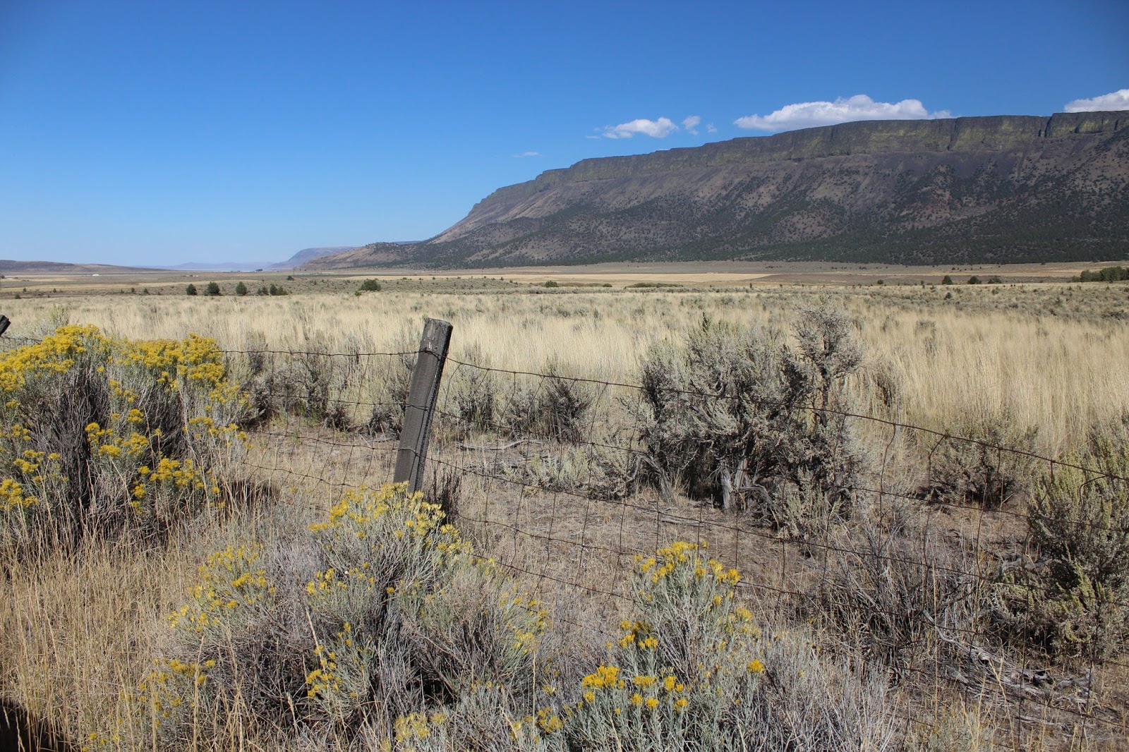 |
| The Abert Rim, a scarp, stands 2,000 feet above the valley floor. |
 |
| In a dry land, the escarpment captures water and filters it down to salty lakes. |
We were intrigued by the green
lichens growing high up on the side. It’s
also one of the most prominent and visible fault scarps in the country. More cataclysmic changes may be in store for
southeastern Oregon than the drying up of lakes like Abert at the base of the
scarp. Mount St. Helens is evidence of
that.
 |
| Bright green lichens grow high up on the edge of the ridge |
Millions of years ago a blanket of lava several thousand feet thick
covered southeastern Oregon. Then
continental plates shifted. The Abert Escarpment
is actually the face of a tilted fault block.
Finally, 20,000 years ago during the Ice Age, rain and runoff carved
away at the ranges to form lakes in the valleys in between the plates. It’s still “high country.” The town of Lakeview at the southern end is
4,800 feet in elevation.
Lake Abert looked completely dry with white salt flats until we drove a
little farther north.
“The literature said it was totally dry,” said Andy, “so they must have
gotten some rain last year.”
Globs of salt floated near the edge and the “beach” was lined with
white brine. We could smell it too, even
inside the car with windows closed.
 |
| What remains of Lake Abert trickles down from the Escarpment. |
Brine shrimp live here, so the area attracts sea birds. I read the informative sign. It explained that 10,000 years ago Lake Abert
was part of a 460-square mile basin of water known as Lake Chewaukan. As the climate warmed, mineral salts that had
been dilute in this ancient sea concentrated in what was left of the smaller
lakes.
 |
| Marsh plants on the edge of the lake and brine shrimp attract shorebirds and waterfowl. |
Now millions of brine shrimp in
the salty water attract shore birds and waterfowl. The shrimp can withstand below zero
temperatures and can live with 98% of their moisture gone. They may produce hundreds of eggs in their
two-month lifespan. Eggs take about two days to hatch. Their actual adult size is about 5/8 inch. It’s no wonder birds come here for easy
eating.
The freshwater streams that feed Lake Abert are vital for land-dwelling
wildlife. Big Horn sheep live on the
adjoining escarpment.
We stopped again, marveling about the salt-tolerant grass that was
growing along the margin.
 |
| All the remains of most of Lake Abert is a vast salt flat. |
 |
| Salt flats spread for miles where a healthy lake once existed. |
 |
| Basalt rocks tumble from the hillside onto the salt flats. |
Farther out the strip of blue water shimmered. In the sun it was 90 degrees, and there was nothing to block the sun. Only the deepest part still had some water. The northern area was solid white salt flats. A few birds swooped overhead, and Andy watched some wading in the shallows. There wasn’t much water, but salt-tolerant marsh grass survived.
 |
| With a close-up of the basalt rocks, the water reflects the opposite shore. |
Around one bend a herd of cows munched on the grass. “They must have water troughs,” said Andy. “They
couldn’t be drinking from the lake.” At
least the grass is being utilized in a practical manner.
 |
| Little is left of Lake Abert. |
What a different world! And this
is Oregon. It’s NOT green.
Going back toward town, we saw that the salt flats looked grey in the
sun instead of white.
And there was
still a flow from the scarp in a center stream.
 |
| As Oregon changes, environmental care becomes all the more crucial. |
There will no longer be a Lake Abert at the foot of the Abert Escarpment.
No comments:
Post a Comment